


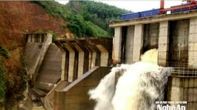
The regional and temporal drought mapping system will support monitoring and early warning of water shortages across the country.
According to Nguyen Minh Khuyen, Deputy Director of the Department of Water Resources Management ( Ministry of Agriculture and Environment ), the 2023 Law on Water Resources has marked a turning point in Vietnam's thinking on water resources management. That is, shifting from passive response to proactive coordination; from relying on senses to making decisions based on data and technology.
One of the major orientations of the law is to promote the application of science and technology, digital transformation in monitoring, forecasting, and comprehensive management of water resources. Accordingly, the Ministry has developed a map of drought, water shortage, and water source scenarios synchronously applying modern digital transformation technologies.
The above system is built on the basis of Big Data and digital modeling technology. Input data types include: Meteorological data (rainfall, temperature, humidity); hydrological data (flow, river water level, water storage in reservoirs); data on exploitation, use, and water demand of each industry and region; hydrogeological data (groundwater level by aquifer).
In the context of increasingly complex and unpredictable climate change, extreme heat tends to increase, causing drought and water shortage, affecting production. The drought mapping system by region and time will support monitoring and early warning of water shortages across the country.
In particular, the "early identification" system not only helps to clearly identify areas affected by drought; but also integrates water resource scenarios, acting as an important strategic analysis tool, thereby supporting water resource management and effective response planning.
The application of digital models allows all data to be integrated into a centralized management system, allowing for quick updates, synchronization and retrieval. The system also builds and applies a combination of seasonal rainfall forecasting numerical models to forecast rainfall for the next 6 months to provide information for scenarios.
To build the drought map, the research unit also applied hydrological models to forecast the flow and water level in reservoirs. Using methods and algorithms to analyze drought trends, assess the risk of water shortage by region and sub-region. Based on the simulation results, the regions are divided into mild, moderate and severe levels of water shortage.
On the GIS platform, drought maps are designed. Drought areas are visually represented on digital maps, helping users easily identify affected areas, severity and developments over time.
According to Mr. Khuyen, research and practical implementation such as drought mapping systems and real-time water resource scenarios are not only relevant, but also strategic tools for effective management.
"They allow us to read the state of water resources in the near future, thereby anticipating risks for early adjustment and remote management. This is a fundamental step to ensure water security, sustainable development of agriculture , urban areas and energy in a risky climate environment," Mr. Khuyen shared.
However, Mr. Khuyen also noted that in the long term, the system needs to be closely connected with remote sensing satellite data, global climate forecast models and IoT sensor systems in the field, to improve the accuracy and timeliness of information.
TC
Source: https://baochinhphu.vn/ung-dung-cong-nghe-so-xay-dung-ban-do-han-han-102250516164425301.htm

![[Photo] People eagerly lined up to receive special publications of Nhan Dan Newspaper](https://vphoto.vietnam.vn/thumb/1200x675/vietnam/resource/IMAGE/2025/8/30/53437c4c70834dacab351b96e943ec5c)


Comment (0)