
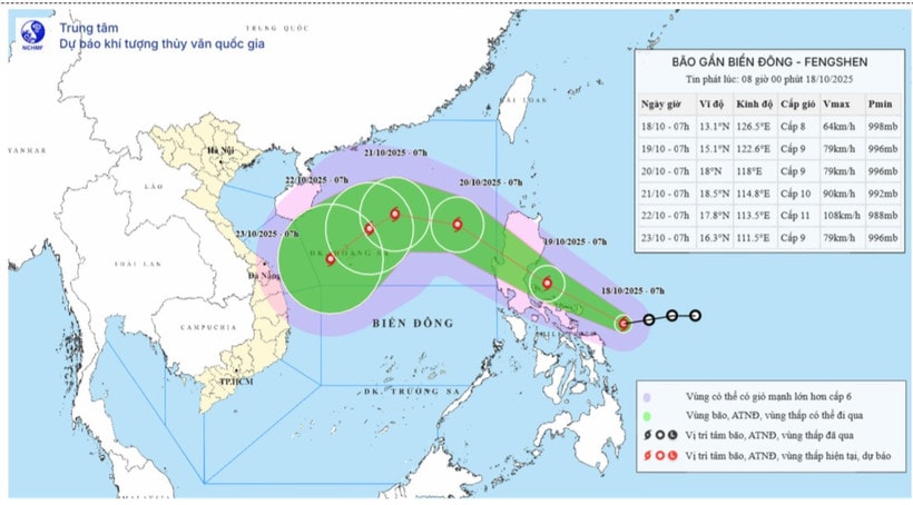
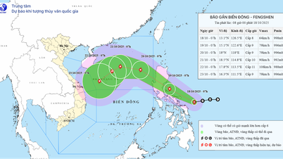
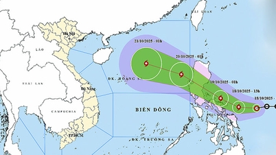
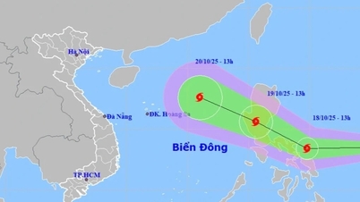
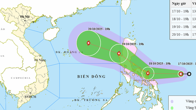
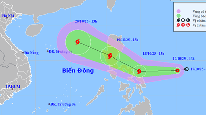
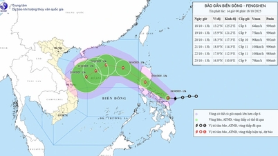
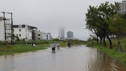
At 7:00 a.m., the eye of the storm was at about 13.1 degrees north latitude, 126.5 degrees east longitude, in the sea east of the central Philippines.
The strongest wind near the storm center is level 8 (62 - 74km/h), gusting to level 10. Moving west at a speed of about 20km/h.
Storm forecast (in the next 24 to 72 hours) is as follows:
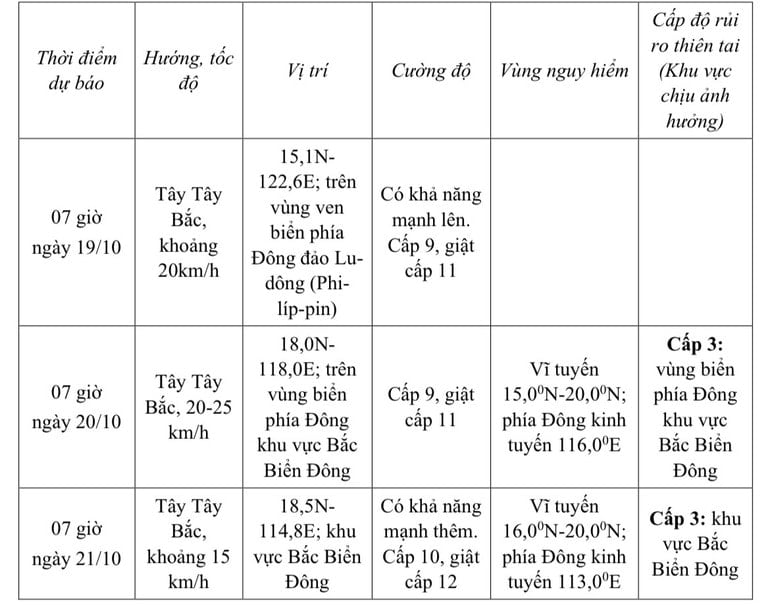
Storm warning for the next 72 to 120 hours, the storm will move mainly in a southwest direction, about 10km per hour and is likely to strengthen.
From October 19, the sea area east of the northern East Sea will have winds gradually increasing to level 6-7; near the storm center, winds will be level 8-9, gusting to level 11, waves 2.5-5m high. The sea will be very rough.
Warning: Between October 20 and 22, the northern East Sea area (including Hoang Sa special zone) is likely to be affected by strong winds of level 10-11, gusting to level 13.
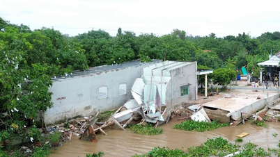
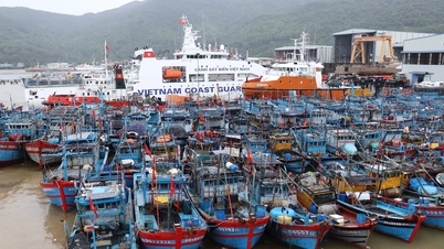
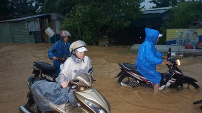
Ships and boats operating in the above mentioned dangerous areas are likely to be affected by storms, whirlwinds, strong winds and large waves.
Source: https://baodanang.vn/ap-thap-nhiet-doi-manh-len-thanh-bao-gan-bien-dong-3306651.html
![[Photo] Collecting waste, sowing green seeds](https://vphoto.vietnam.vn/thumb/1200x675/vietnam/resource/IMAGE/2025/10/18/1760786475497_ndo_br_1-jpg.webp)
![[Photo] Closing ceremony of the 18th Congress of Hanoi Party Committee](https://vphoto.vietnam.vn/thumb/1200x675/vietnam/resource/IMAGE/2025/10/17/1760704850107_ndo_br_1-jpg.webp)
![[Photo] General Secretary To Lam attends the 95th Anniversary of the Party Central Office's Traditional Day](https://vphoto.vietnam.vn/thumb/1200x675/vietnam/resource/IMAGE/2025/10/18/1760784671836_a1-bnd-4476-1940-jpg.webp)


Comment (0)