
At 7:00 p.m. on October 4, the center of the storm was at about 18.7 degrees North latitude; 114.3 degrees East longitude, in the North East Sea, about 380 km East Southeast of Hainan Island (China). The strongest wind near the center of the storm was level 12 (118-133 km/h), gusting to level 15. Moving in the West Northwest direction, speed about 25 km/h.
Forecast, by 7am on October 5, the storm will be in the northwest sea of the North East Sea, about 500km East Southeast of Quang Ninh with strong winds of level 12-13, gusts of level 16; moving in the West Northwest direction at a speed of 20-25km/h. The affected area is the northwest sea of the North East Sea, the eastern sea of the North Gulf of Tonkin. Disaster risk level 3.
At 7:00 p.m. on October 5, the storm was on the eastern coast of the Northern Gulf of Tonkin, about 190 km southeast of Quang Ninh with strong winds of level 11-12, gusts of level 15; moving in the West Northwest direction at a speed of 20-25 km/h. The affected area is the northwest sea area of the Northern East Sea, the Northern Gulf of Tonkin.
At 7:00 a.m. on October 6, the storm was in the area between Quang Ninh province (Vietnam) and Guangxi province (China) with winds of level 8-9, gusts of level 12; moving in the West Northwest direction at a speed of about 20 km/h. The affected area is the northern sea of Bac Bo Gulf, the coastal mainland area from Quang Ninh to Hung Yen ... Natural disaster risk level 3.
At 7:00 p.m. on October 6, the storm in the northern mountainous region of the North with winds below level 6 weakened into a low pressure area; moving in the West Northwest direction at a speed of about 20km/h.
Due to the impact of the storm, the North East Sea area has strong winds of level 8-10, the area near the storm's eye has winds of level 11-13, gusts of level 15-16, waves 4-6m high, the area near the storm's eye is 6-8m, the sea is very rough (extremely destructive, extremely strong waves. Sinking large tonnage ships).
From the afternoon of October 5, the sea area east of the Northern Gulf of Tonkin (including Bach Long Vi special zone) has winds gradually increasing to level 6-7, then increasing to level 8-9. From the evening of October 5, the northern Gulf of Tonkin area (including Bach Long Vi special zone, Van Don, Co To, Cat Hai and Hon Dau island) has winds gradually increasing to level 8-9, waves 2-4m high, the area near the storm center has winds of level 10-11, gusts of level 14, waves 3-5m high, rough seas (very dangerous for ships).
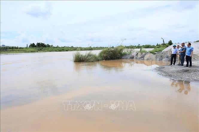
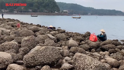
Coastal areas and islands in Quang Ninh - Hai Phong provinces will have storm surges of 0.4-0.6m. Beware of flooding in low-lying coastal areas and river mouths due to surges and big waves from the afternoon and evening of October 5.
Warning, the weather at sea and in coastal areas during the storm is extremely dangerous, unsafe for any vehicle or structure operating in the danger zone such as: cruise ships, passenger ships, transport ships, cages, rafts, aquaculture areas, dykes, embankments, coastal routes. Vehicles are highly likely to capsize, be destroyed; be flooded due to strong winds, big waves and rising sea levels.
On land, from the night of October 5, on land in coastal areas from Quang Ninh to Hung Yen, winds will gradually increase to level 6-7, near the storm center, level 8-9, gusting to level 10-11. (Winds can break tree branches, blow off roofs, causing damage to houses. It is impossible to go against the wind). Inland areas in the Northeast, winds will be strong at level 4-5, in some places level 6, gusting to level 7-8.
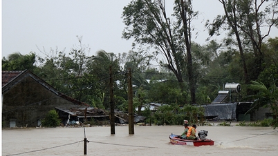
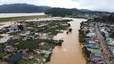
From the night of October 5 to the end of the night of October 7, in the mountainous and midland areas of the North, there will be heavy rain, with average rainfall of 150-250mm, and locally very heavy rain over 400mm. Warning of the risk of heavy rain (>150mm/3 hours); in the Northern Delta and Thanh Hoa, there will be moderate to heavy rain with average rainfall of 70-150mm, and locally very heavy rain over 200mm.
Hanoi area: Less likely to be affected by storms. It is forecasted that from early morning on October 6 to the end of October 7, there will be moderate to heavy rain, with average rainfall of 70-120mm, and locally over 150mm.
Due to the influence of the wide storm circulation, it is necessary to guard against the risk of thunderstorms, tornadoes and strong gusts of wind both before and during the storm's landfall.
Along with that, the National Center for Hydro-Meteorological Forecasting said that from 7:40 p.m. on October 4 to 0:40 a.m. on October 5, the areas of Quang Tri, Gia Lai and Lam Dong provinces will continue to have rain. There is a risk of flash floods on small rivers and streams, and landslides on steep slopes in the above provinces.
Specifically, the rainfall is generally from 15-40mm, in some places over 80mm, there is a risk of flash floods on small rivers and streams, landslides on steep slopes in many communes/wards: Dakrong; A Doi, Huong Phung, Khe Sanh, Lao Bao, Lia, Ta Rut, Tan Lap (Quang Tri province); An Hoa, An Toan, An Tuong, Ayun, Bau Can, Binh Hiep, Canh Lien, Canh Vinh, Chu Krey, Chu Prong, Dak Po, Dak Somei, Dak Song, Duc Co, Gao, Hoi Son, Hra, Ia Krel, Ia Pia, Ia RSai, Ia Tul, Kong Chro, Phu My Nam, Son Lang, Sro, Uar, Van Canh, Van Duc, Vinh Thanh, Vinh Thinh (Gia Lai province); Ham Thanh; Bac Ruong, Bao Lam 4, Cat Tien, Da Huoai 2, Da Huoai 3, Da Teh, Da Teh 3, Dak Sak, Dak Song, Dam Rong 2, Duc An, Duc Lap, Duc Linh, Hai Ninh, Nam Ban Lam Ha, Nam Ha Lam Ha, Nam Thanh, Nghi Duc, Bac Gia Nghia, Quang Son, Quang Tan, Suoi Kiet, Ta Dung, Tanh Linh, Thuan An, Truong Xuan, Tuy Duc (Lam Dong province)
Warning level of natural disaster risk due to flash floods, landslides, land subsidence due to heavy rain or level 1 flow.
Flash floods and landslides can have very negative impacts on the environment, threaten people's lives; cause local traffic congestion, and affect the process of transportation.
movement of vehicles; destruction of civil and economic works, causing damage to production and socio-economic activities.
The hydrometeorological agency recommends that local authorities pay attention to reviewing bottlenecks and vulnerable locations in the area to have prevention and response measures.
From 3:00 p.m. to 6:00 p.m. on October 4, the provinces of Quang Tri, Gia Lai and Lam Dong had moderate to heavy rain such as: Dakrong Hydropower Plant 68.8mm (Quang Tri); Buon Nung Chu Drang 46.6mm (Gia Lai); My Thanh 85.8mm (Lam Dong);...
Soil moisture models show that some areas in the above provinces are near saturation (over 85%) or have reached saturation.
Source: https://baotintuc.vn/van-de-quan-tam/bao-so-11-tien-nhanh-vao-vinh-bac-bo-canh-bao-nuoc-dang-va-gio-giat-manh-20251004210741611.htm


Comment (0)