
The 39.5 km long Lo River flowing through the communes of Vinh Loi, Thuong Am, Cap Tien, Dong Tho, Quyet Thang, Van Son, Hong Lac, Truong Sinh (Son Duong) is the main source of water supply for production for the entire agricultural land area of 8 communes along the river, and is also the drainage axis when heavy rain occurs. However, in recent years, due to many reasons, the riverbank has continuously eroded, many places have eroded close to the dike, deforming the river section, causing loss of production land, threatening the safety of residential areas if floods occur. In order to protect the embankment, water environment, and prevent encroachment, the province has placed markers and reinforced the dike.
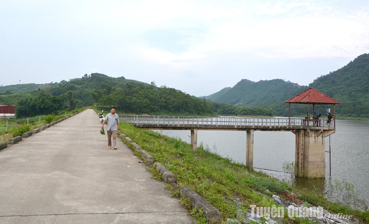
Hoang Khai irrigation reservoir dam (Yen Son) is reinforced to protect the environment and aquatic ecosystem in the lake area.
Mr. Nguyen Son Han, an officer of the Vinh Loi Commune Irrigation Management Board, said: He was very happy when the province included the Lo River section flowing through the commune in the list of areas that must establish a protection corridor and invest in reinforcing the dike. According to Mr. Han, by marking the boundary and forming the corridor, organizations and individuals have more responsibility in protecting the riverbanks, preventing encroachment and dumping of garbage into the river, causing river pollution.
Gam River section through Luc Hanh, Phuc Ninh, Xuan Van, Tan Long communes (Yen Son) has also been marked with a protection corridor to preserve and develop the aquatic ecosystem, natural animals and plants along the water source; prevent and combat activities that risk polluting and degrading water sources, ensure the stability of the banks and prevent and combat encroachment on land along the water source. Comrade Trieu Van Ly, Vice Chairman of Xuan Van Commune People's Committee, said: In addition to marking the protection corridor of the river, the commune requires households living along the river to sign a commitment to maintain hygiene and not to dump household waste into the riverbank, causing environmental pollution and river water sources.
Besides the achieved results, in some localities, a part of the population is not aware of protecting and complying with the law on water resources, which is threatening the security and safety of water resources.
Comrade Cao Xuan Huy, Head of Technical Department, Rural Clean Water Center, Department of Agriculture and Environment said: Currently, in the communes of Tho Binh, Binh An, Minh Quang, Thuong Lam (Lam Binh); Yen Hoa commune (Na Hang); Ninh Lai commune (Son Duong), some people arbitrarily encroach on water pipes, cultivate, and raise livestock in the water source area of the centralized water project managed by the unit. According to Mr. Huy, the encroachment causes water loss, affects the water supply capacity of the project, and in the long term will have a negative impact on the security and safety of water resources in the area.
According to the report of the Department of Agriculture and Environment, in terms of surface water resources, the density of rivers and streams in the province is relatively high, about 0.9 km/km2, with 3 rivers flowing through: Lo River, Gam River and Pho Day River. Regarding groundwater, it is possible to exploit about 4.2 million m3/day in river basins. The density of rivers is high, however, the terrain of the province is steep, the water reserves are not much, moreover, the impact of climate change is negatively affecting the current water reserves.
Comrade Vu Viet Hung, Head of the Department of Geology, Minerals and Water Resources, Department of Agriculture and Environment said: According to the Department's review results, the whole province has 138 river and stream sections that must establish protection corridors, of which the most is Chiem Hoa district with 34 river and stream sections; Lam Binh and Yen Son districts each have 27 sections; Son Duong district has 26 sections. The remaining are Ham Yen, Na Hang districts, and Tuyen Quang city.
Along with determining boundaries, setting up markers, and establishing protection corridors, the Department also conducts investigations, verifications, and water environment monitoring on river and stream sections to monitor water resource developments.
Head of the Department of Geology, Minerals and Water Resources, Department of Agriculture and Environment Vu Viet Hung said: Regulations on establishing protection corridors for river and stream sections are extremely necessary but not enough without the cooperation of organizations, individuals, households, especially the communities living around the area. Because in fact, some river and stream sections are currently polluted due to the awareness of the communities living in that area. Therefore, each person and community needs to raise awareness and responsibility in preserving and protecting rivers and streams, protecting the landscape and living environment of ourselves.
Source: https://baotuyenquang.com.vn/bao-ve-an-toan-an-ninh-nguon-nuoc-211678.html
![[Photo] Prime Minister Pham Minh Chinh meets with US business representatives](https://vphoto.vietnam.vn/thumb/1200x675/vietnam/resource/IMAGE/2025/5/13/5bf2bff8977041adab2baf9944e547b5)
![[Photo] President Luong Cuong attends the inauguration of the international container port in Hai Phong](https://vphoto.vietnam.vn/thumb/1200x675/vietnam/resource/IMAGE/2025/5/13/9544c01a03e241fdadb6f9708e1c0b65)

![[Photo] Prime Minister Pham Minh Chinh receives Ambassador of the French Republic to Vietnam Olivier Brochet](https://vphoto.vietnam.vn/thumb/1200x675/vietnam/resource/IMAGE/2025/5/13/f5441496fa4a456abf47c8c747d2fe92)


Comment (0)