

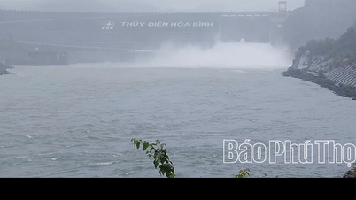
Chu River through Thieu Hoa commune. (Illustration photo).
According to Thanh Hoa Hydrometeorological Station, the water level on rivers is currently changing slowly and is 2-5.5m lower than level 1.
Water level at 1:00 p.m. on August 24 at some stations is as follows: On Chu River at Bai Thuong TV station is 14.04m below BĐ1 by 0.96m; at Xuan Khanh TV station is 5.1m below BĐ1 by 3.9m; on Ma River at Ly Nhan TV station is 4.41m below BĐ1 by 5.09m; at Giang TV station is 1.36m below BĐ1 by 2.64m; on Buoi River at Kim Tan TV station is 4.35m below BĐ1 by 5.65m.
From tonight (August 24) to August 28, there is a possibility of a flood with a flood amplitude of 3-6m on the rivers. The peak flood level of the upper Ma River, Buoi River, and Chu River is likely to rise to level BĐ1 - BĐ2, in some places above BĐ2; the downstream of the main rivers is likely to rise to level BĐ1; small rivers such as the Am River, Yen River, and Cau Chay River are likely to rise to level BĐ2 - BĐ3, in some places above BĐ3.
, Thiet Ong, Pu Nhi, Van Nho, Van Nho, Van Phu, Giao An, Ba Thuoc, Dien Lu, Thiet Ong, Pu Luong, Co Lung, Van Nho, Van Nho, Dien Quang, Bat Mot, Yen Nhan, Luong Son, Van Xuan, Thuong Xuan, Luan Thanh, Tan Thanh, Thang Loc, Xuan Chinh, Ngoc Lac, Thach Lap, Ngoc Lien, Nguyet An, Minh Son, Kien Tho.
High risk of flooding in areas along small rivers and streams such as Buoi River, Cau Chay River, Yen River, Hoat River and Bang River.
Flood disaster risk warning level: Level 1 - 2.
News Reporter Group
Source: https://baothanhhoa.vn/canh-bao-nguy-co-cao-ngap-lut-tai-khu-vuc-ven-song-suoi-nho-259270.htm


![[Photo] Dan Mountain Ginseng, a precious gift from nature to Kinh Bac land](/_next/image?url=https%3A%2F%2Fvphoto.vietnam.vn%2Fthumb%2F1200x675%2Fvietnam%2Fresource%2FIMAGE%2F2025%2F11%2F30%2F1764493588163_ndo_br_anh-longform-jpg.webp&w=3840&q=75)
![[E - Magazine] Journey of value creation - Connecting far and wide](https://vphoto.vietnam.vn/thumb/402x226/vietnam/resource/IMAGE/2025/11/25/1764042907045_e-magazine-hanh-w1200t0-di2547d199d2104747t12787l1-ts-30-nam-026.webp)


Comment (0)