
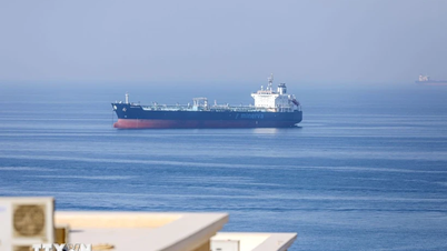
Many coastal areas have strong winds and high waves.
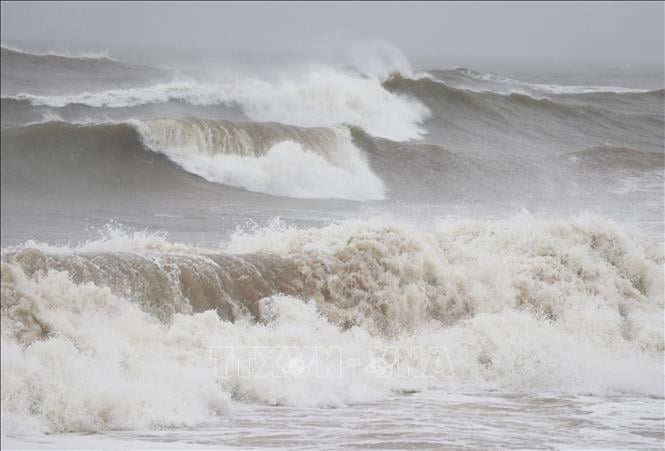
Illustration photo: VNA
Regarding the weather developments at sea, on the afternoon of May 28, Deputy Head of the Weather Forecast Department, National Center for Hydro-Meteorological Forecasting Vu Anh Tuan said that the low pressure trough with its axis at about 10-13 degrees North latitude connects with the low pressure area at 1:00 p.m. on May 28 located at about 11-13 degrees North latitude, 111-113 degrees East longitude. In the sea area from Binh Dinh to Khanh Hoa , the North East Sea area (including the sea area of Hoang Sa), the middle and South East Sea area (including the sea area of Truong Sa) have showers and thunderstorms.
It is forecasted that on the night of May 28 and May 29, the Gulf of Tonkin, the sea area from Binh Dinh to Ca Mau , Ca Mau to Kien Giang and the Gulf of Thailand, the North East Sea area (including Hoang Sa area), the middle and South East Sea area (including Truong Sa area) will have showers and thunderstorms, with the possibility of tornadoes, strong gusts of wind level 6-7 and waves over 2 meters high during thunderstorms.
All vessels operating in the above areas are at risk of being affected by tornadoes and strong gusts of wind.
According to the guidance of the Ministry of Agriculture and Environment , affected coastal provinces and cities must closely monitor warning bulletins, forecasts and developments of strong winds at sea; notify captains and owners of vehicles and vessels operating at sea to proactively prevent and have appropriate production plans, ensuring safety of people and property; maintain communication to promptly handle possible bad situations.
High tides in the Southeast coastal region
According to the National Center for Hydro-Meteorological Forecasting, the tide level on the eastern coast of the South is currently at a high level. The highest water level observed at Vung Tau station was 3.89 m at 3:00 a.m. on May 28.
It is forecasted that in the next 24 hours, high tides will tend to increase, the coastal areas of provinces and cities from Vung Tau to Ca Mau will have the highest water level of about 3.9-4.05 m, high water will appear about 2-6 hours and 10-12 hours every day, areas at risk of flooding due to high tides are low-lying coastal areas, riverbanks and areas outside the dike in the provinces from Vung Tau to Dong Ca Mau.
Warning: In the next 24-48 hours, water levels along the Southeast coast will continue to be high. The highest water level at Vung Tau station is forecasted to be around 4-4.05 m.
Hydrological experts note that high tides will slow down the flood drainage process on rivers in the Southeast. Low-lying coastal areas, riverbanks, and areas outside the dykes in the Southeast are likely to be flooded in the early morning and early afternoon. In addition, high tides during this period also increase saltwater intrusion in the fields.
To proactively respond and minimize damage caused by high tides causing flooding in the coming time, the Department of Dyke Management and Natural Disaster Prevention and Control under the Ministry of Agriculture and Environment recommends that affected provinces and cities closely monitor forecasts and warnings, and promptly provide information to authorities and people at all levels for proactive prevention.
Authorities inspect and review coastal residential areas, dykes, dams, low-lying areas, and areas at high risk of flooding to proactively organize the relocation and evacuation of people when situations arise; clear the flow, and promptly handle construction incidents from the first hour.
Provinces and cities are ready to deploy measures to drain water and protect production; reinforce and protect aquaculture ponds; harvest crops and upland plants that are ready for harvest; prevent and combat flooding in urban areas and low-lying areas, ensuring minimal damage; notify owners of water transport vehicles about flooding to proactively take measures to ensure safety for people, vehicles, equipment and works.
Northern region has some places with rain over 250 mm
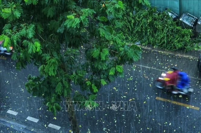
Illustration photo: Tuan Anh/VNA
Commenting on the rain situation, on the afternoon of May 28, Deputy Head of Weather Forecasting Department Vu Anh Tuan said that from the evening of May 28 to the early morning of May 30, the Northern region will have moderate rain, heavy rain, thunderstorms, and some places will have very heavy rain with common rainfall from 40-100 mm, locally over 250 mm.
From early morning of May 29 to early morning of May 30, the North Central region will have moderate rain, heavy rain, thunderstorms, and very heavy rain in some places with common rainfall of 30-70 mm, locally over 120 mm.
From the evening of May 28 to the night of May 29, the South Central, Central Highlands and Southern regions will have moderate rain, heavy rain and thunderstorms, some places will have very heavy rain with common rainfall of 30-60 mm, locally over 100 mm (heavy rain is concentrated in the afternoon and evening).
Warning of the risk of localized heavy rain of over 150 mm in 3 hours, with the possibility of tornadoes, lightning, hail and strong gusts of wind during thunderstorms. From May 30, heavy rain in the above areas will tend to decrease, with the possibility of tornadoes, lightning, hail and strong gusts of wind during thunderstorms.
Warning level 1 natural disaster risk due to heavy rain.
Heavy rains are likely to cause flooding in low-lying areas, urban and industrial areas; flash floods on small rivers and streams, landslides on steep slopes (real-time warning information on areas at risk of flash floods and landslides is provided online on the website of the Department of Hydrometeorology at: https://luquetsatlo.nchmf.gov.vn and in separate bulletins warning of flash floods and landslides).
Source: https://baobinhphuoc.com.vn/news/9/173334/de-phong-nhieu-hinh-thai-thoi-tiet-nguy-hiem-tren-dat-lien-va-tren-bien
![[Photo] Prime Minister Pham Minh Chinh receives leaders of Excelerate Energy Group](https://vphoto.vietnam.vn/thumb/1200x675/vietnam/resource/IMAGE/2025/5/29/c1fbe073230443d0a5aae0bc264d07fe)
![[Photo] Prime Minister Pham Minh Chinh attends the event "Digital transformation of the banking industry by 2025"](https://vphoto.vietnam.vn/thumb/1200x675/vietnam/resource/IMAGE/2025/5/29/0e34cc7261d74e26b7f87cadff763eae)


Comment (0)