
I. GEOGRAPHIC LOCATION:
Ninh Binh is a province located in the extreme South of the Northern Delta, 190 50' to 200 27' North latitude, 105032' to 106027' East longitude. The Tam Diep mountain range runs in the Northwest - Southeast direction, forming a natural boundary between Ninh Binh and Thanh Hoa provinces. The East and Northeast are surrounded by the Day River, bordering the two provinces of Ha Nam and Nam Dinh, the North borders Hoa Binh province, the South is the East Sea. National Highway 1A, National Highway 10 and the North-South railway run through the province.
 Ninh Binh City
II. TERRAIN
Ninh Binh terrain has 3 distinct regions:
*Flatlands
*Mountainous and semi-mountainous areas
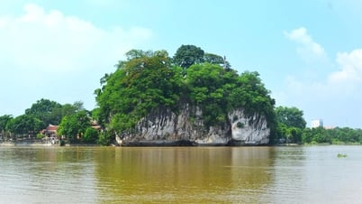
This area is located in the west and southwest of the province, including the southwest areas of Nho Quan district and Tam Diep city, the west of Gia Vien district, the southwest of Hoa Lu district and the southwest of Yen Mo district. The total area of this area is about 35,000 hectares, accounting for 24% of the province's natural area. The average altitude is from 90-120m. Especially the rocky mountain area has an altitude of over 200m.

*Coastal area
Ninh Binh has over 15km of coastline. This area belongs to the area of 4 coastal communes of Kim Son district: Kim Trung, Kim Hai, Kim Dong, Kim Tan, with an area of about 6,000 hectares, accounting for 4.2% of the province's natural area. The land here is still heavily saline due to new deposition, so it is in the process of being renovated, so it is mainly suitable for planting protective forests (mangroves, sedges), growing sedge, growing one rice crop and aquaculture.
III. CLIMATE
Ninh Binh has a tropical monsoon climate. The annual weather is divided into four distinct seasons: spring, summer, autumn and winter. The average annual temperature is about 23 degrees Celsius. The average number of sunshine hours per year is over 1,100 hours. The average annual rainfall is 1,800mm.
I. V. TRAFFIC
Ninh Binh is an important traffic junction from the North to the Central and South regions.
- Road: The province has National Highway 1A, National Highway 10, National Highway 12A, 12B, 59A. - Railway: The North-South railway running through Ninh Binh province is 19 km long with 4 stations (Ninh Binh, Cau Yen, Ghenh and Dong Giao) convenient for transporting passengers, goods and construction materials. - Waterway: Ninh Binh province has a very convenient waterway transport system due to many large rivers such as: Day River, Hoang Long River, Can River, Vac River, Van River, Lang River. In addition, there are large ports such as: Ninh Phuc Port, Ninh Binh Port, Kim Son, contributing significantly to the socio-economic development of the province.
V. RIVERS AND HYDROLOGY
The river system in Ninh Binh includes the Day River, Hoang Long River, Boi River, An River, Vac River, Lang River, Van Sang River, with a total length of 496 km, distributed widely throughout the province. The average density of rivers and streams is 0.5 km/km2, the rivers usually flow in the Northwest - Southeast direction to the East Sea.
VI. RESOURCES
1. Land resources The total natural land area of the province is 1,390 km2 with alluvial and feralitic soils. Water resources: Including surface water resources and groundwater resources.
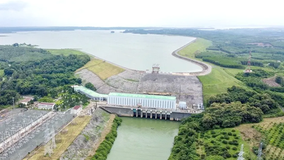
- Surface water resources: Quite abundant, favorable for irrigation, agricultural production development and water transport services. Ninh Binh has an average density of river and stream systems with a total length of main rivers of over 496km, covering an area of 3,401ha, density reaching 0.5km/km2. In addition, the province also has 21 large reservoirs, covering an area of 1,270ha, with a capacity of 14.5 million m3 of water, irrigation capacity for 4,438ha.
- Groundwater source: Groundwater in Ninh Binh is mainly in Nho Quan district and Tam Diep city. The total amount of underground water in Ria (Nho Quan) is 361,391m3/day. Tam Diep area is 112,183m3/day.
3. Forest resources.
Compared to the provinces in the Red River Delta, Ninh Binh is the province with the largest forest area with about 19,033 hectares, accounting for 23.5% of the region's forest area and 13.3% of the province's total natural area.
Natural forest: Total area is 13,633.2 ha, timber reserves are 1.1 million m3, mainly concentrated in Nho Quan district.
Cuc Phuong primeval forest is a typical tropical forest with diverse and rich flora and fauna.
Planted forests: Area reaches 5,387 hectares, concentrated in Nho Quan, Hoa Lu, Kim Son districts, Tam Diep city, with main crops being pine, acacia, eucalyptus, mangrove (reed and reed).
4. Marine resources
Ninh Binh's coastline is over 15km long with thousands of hectares of alluvial land. Cua Day is the largest estuary, with a fairly deep depth, ensuring convenient entry and exit for large ships with a capacity of thousands of tons. Ninh Binh's sea area has the potential for aquaculture, exploitation, and fishing of marine resources with an output of 2,000÷2,500 tons/year.
5. Mineral resources:
- Limestone resources: Limestone is the largest mineral resource of Ninh Binh. With quite large limestone mountain ranges, running from Hoa Binh, in the northwest - southeast direction, through Nho Quan, Gia Vien, Hoa Lu, Tam Diep city, Yen Mo, to the East Sea, more than 40 km long, an area of over 1,2000 hectares, reserves of tens of billions of cubic meters of limestone and tens of millions of tons of dolomite. This is a large source of raw materials for the production of cement and construction materials and some other chemicals.
- Clay resources: Scattered in low mountainous areas of Yen Son and Yen Binh communes (Tam Diep city), Gia Vien and Yen Mo districts, used to produce bricks, tiles and raw materials for the casting industry.
- Mineral water resources: Ninh Binh mineral water is of good quality, mainly concentrated in Cuc Phuong (Nho Quan) and Kenh Ga (Gia Vien) and can be exploited for daily life and tourism with large reserves. In particular, Kenh Ga mineral water is salty, often at a temperature of 53÷540C. Cuc Phuong mineral water has a high magnesium bicarbonate content, used for beverage and medicinal purposes.
- Peat resources: Small reserves, about 2 million tons, distributed in Gia Son, Son Ha (Nho Quan), Quang Son (Tam Diep city) communes, can be used to produce biofertilizers, serving agricultural production.
VII. TOURISM AND CULTURE POTENTIAL
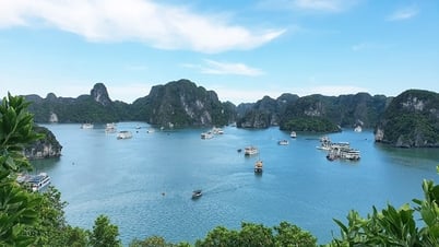
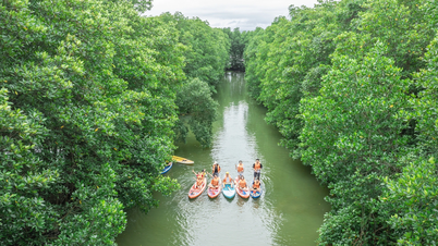
1. The province's tourism is relatively rich and diverse, especially with the Trang An Scenic Landscape Complex recognized by UNESCO as a World Cultural and Natural Heritage. There are many mountains, lakes, forests with famous cultural and historical relics, landscapes and landscapes such as Tam Coc - Bich Dong, Cuc Phuong National Park; Van Long Wetland Nature Reserve, Phat Diem Stone Church, Van Trinh Cave...

Bai Dinh Pagoda at night
2. Culture:
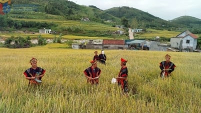
- Ninh Binh is located at the intersection of the Northwest, Red River Delta and North Central regions, where the Hoa Binh culture and Dong Son culture are influenced. This characteristic has created a relatively diverse culture with distinct characteristics compared to the provinces of the Red River Delta.
- Major festivals in Ninh Binh: Hoa Lu Ancient Capital Traditional Festival; Thai Vi Temple Festival; Bai Dinh Pagoda Festival; Bao Ban Festival...
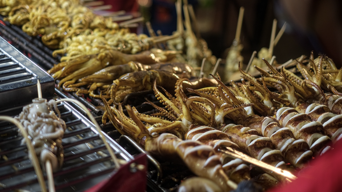
- Talking about the culinary culture of Ninh Binh, it is famous for its dishes: Goat stew from the Ancient Capital, Huong Mai burnt rice, Tong Truong perch, Gia Vien stuffed snails, Yen Mac spring rolls...
Ninh Binh Provincial Portal


![[Photo] President Luong Cuong works with Hung Yen and Thai Binh Provincial Party Committees on implementing Resolution of the 11th Central Conference, 13th tenure](https://vphoto.vietnam.vn/thumb/1200x675/vietnam/resource/IMAGE/2025/6/6/127b735d2761484d81dcee0d7725a25b)


![[Photo] General Secretary To Lam receives Korean Ambassador to Vietnam](https://vphoto.vietnam.vn/thumb/1200x675/vietnam/resource/IMAGE/2025/6/6/a0765b7543784cbcbfe4755b67d43ab4)


![[OCOP REVIEW] Tu Duyen Syrup - The essence of herbs from the mountains and forests of Nhu Thanh](https://vphoto.vietnam.vn/thumb/402x226/vietnam/resource/IMAGE/2025/6/5/58ca32fce4ec44039e444fbfae7e75ec)


Comment (0)