
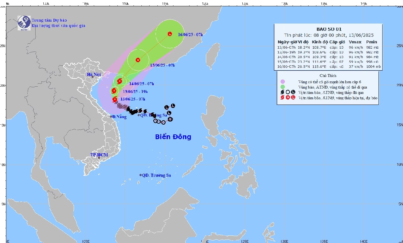
Forecast path of storm number 1.
At 7:00 a.m. on June 13, the center of storm No. 1 was at 18.2 degrees North latitude, 108.7 degrees East longitude, in the sea southwest of Hainan Island (China). The intensity was level 10 (89-102 km/h), gusting to level 13, moving in a North-Northwest direction, at a speed of about 10 km/h.
Forecast of storm developments in the next 24 to 72 hours as follows:
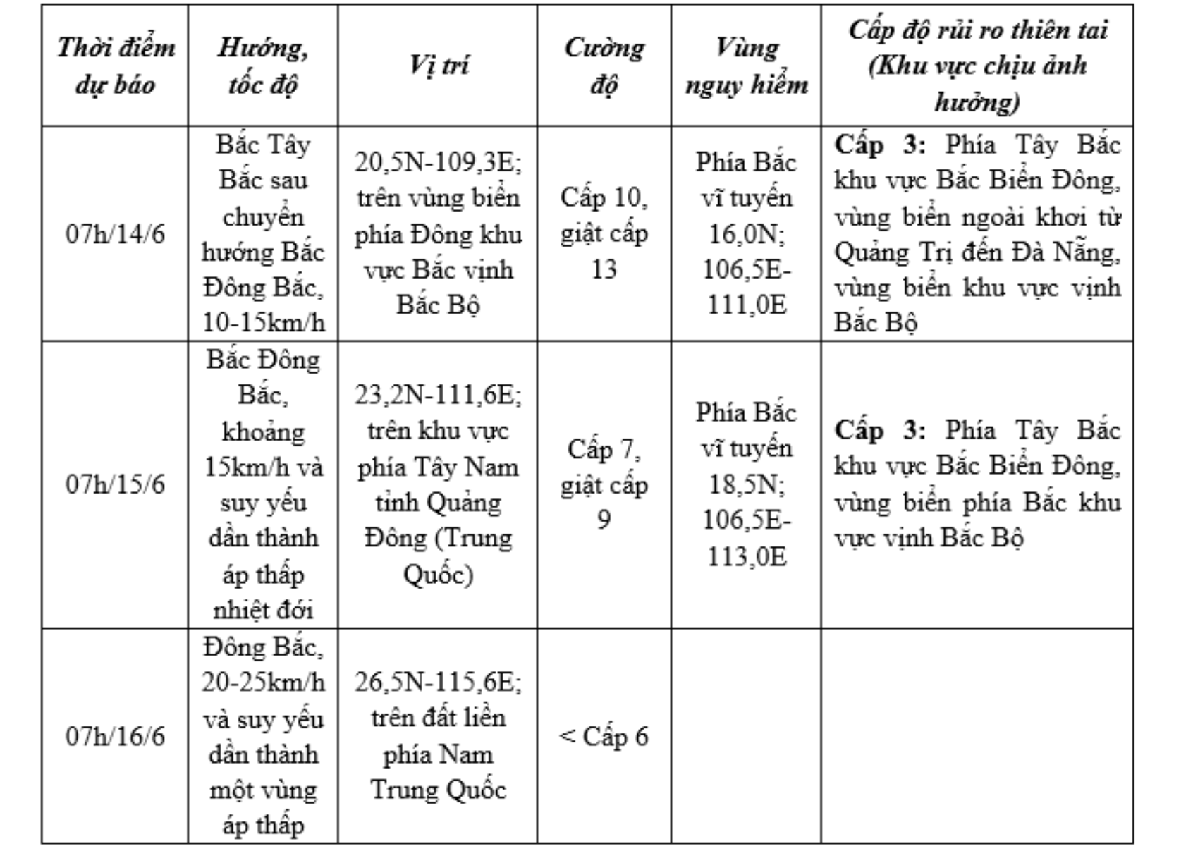
Forecast of storm impact:
Northwest of the East Sea and offshore Quang Tri - Da Nang, strong winds level 6-8, near the storm center level 9-10, gusting to level 13. Waves 3-5m high, near the storm center 4-6m. Very rough seas.
Tonkin Gulf strong wind level 6-7, near the storm center level 8-10, gust level 13. Waves 2-4m high, 3-5m in the East. Very rough seas.
Ships in danger zones are at risk of tornadoes, strong storms, and large waves.
In addition, areas from Hai Phong to Nghe An are warned of the risk of rising water and high tides (coastal waters). From Hai Phong to Nghe An, sea levels are rising abnormally.
Risk of flooding in low-lying coastal areas and river mouths from 5-7 p.m. on June 13 and 14.
On land, today (June 13), the area from Quang Binh to Hue will have heavy to very heavy rain with common rainfall of 50-120mm, some places over 250mm; the area of Southern Nghe An, Ha Tinh , from Da Nang to Quang Nam and Kon Tum will have moderate rain, heavy rain, locally very heavy rain and thunderstorms with common rainfall of 20-40mm, some places over 120mm.
Warning of the risk of flash floods, landslides in mountainous areas, and urban flooding in low-lying areas.
NDS (Source: National Center for Hydro-Meteorological Forecasting)
Source: https://baothanhhoa.vn/du-bao-ngay-15-6-bao-so-1-suy-yeu-thanh-ap-thap-nhiet-doi-251973.htm


Comment (0)