Kon Tum city is one of the dynamic economic zones of Kon Tum province in terms of trade, services, tourism, and processing industry.
Kon Tum Provincial People's Committee has just approved the Project to adjust the General Planning of Kon Tum City to 2040. The planning scope is the entire administrative boundary of Kon Tum City, including 21 administrative units (10 wards and 11 communes), with a natural area of 43,601.18 hectares.
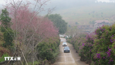
Kon Tum City is the provincial capital, the political - economic, cultural - social and scientific - technical center of Kon Tum province; is one of the dynamic economic regions of Kon Tum province in terms of trade, services, tourism, processing industry; is an important traffic hub of the Central region, the Central Highlands and international exchange; is an ecological urban area, imbued with the cultural, historical and ethnic identity of the Central Highlands; has an important defense and security position of the Northern Central Highlands.
By 2030, Kon Tum City's population will be about 306,000 people (including the converted population of about 38,000 people); of which: the inner-city population will be about 236,500 people (urbanization rate is about 77.29%), the suburban population will be about 69,500 people.
By 2040, Kon Tum City's population will be about 435,000 people (including the converted population of about 40,000 people); of which: the inner-city population will be about 360,000 people (urbanization rate is about 82.76%), the suburban population will be about 75,000 people.
Regarding land scale, by 2030, civil land will have an area of about 5,559.91 hectares, accounting for 12.75% of the total area of the city; non-civil land will have an area of about 5,550.85 hectares, accounting for 12.73% of the total area of the city; agricultural land and other functions will have an area of about 32,490.42 hectares, accounting for 74.52% of the total area of the city.
By 2040, civil land will have an area of about 6,750.68 hectares, accounting for 15.48% of the total area of the city; non-civil land will have an area of about 10,406.53 hectares, accounting for 23.87% of the total area of the city; agricultural land and other functions will have an area of about 26,443.97 hectares, accounting for 60.65% of the total area of the city.
It is expected that by 2040, the main economic and technical indicators of the urban area will reach: civil land of about 155.19 m2/person; new civil land of about 97.50 m2/person; residential land of about 101.22 m2/person; new residential land of about 40.39 m2/person; urban public service land of about 4.27 m2/person; urban public green land of about 11.20 m2/person.
Regarding development zoning, Kon Tum City takes the area along the Dak Bla River as the main landscape space axis, divided into 6 basic development zones including: Zone 1 - New development zone (new urban area in the North); Zone 2 - Existing central area (renovation, embellishment); Zone 3 - New development zone in the East; Zone 4 - New development zone (new urban area in the South); Zone 5 - Eastern rural area; Zone 6 - Western rural area.
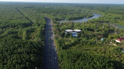
The inner city area is oriented to expand urban development space along both banks of the Dak Bla River (from Ho Chi Minh Road to the road and bridge connecting Ngok Bay - Dak Nang commune). Taking the Dak Bla River axis as the center to focus on investing in infrastructure construction, maximizing land fund and landscape along both banks of the river to form urban areas, commercial services - tourism and riverside green parks. Developing and expanding the city's urban space to the North (controlling to the intersection of Ho Chi Minh Road - the main road in the West of the city) and to the West (adjacent to the North - South Expressway in the West).
Suburban areas are organized in a cluster and point model on provincial and inter-commune roads.
Inheriting the orientation of the Project to adjust the General Planning of Kon Tum City, Kon Tum Province to 2030 approved by the Provincial People's Committee in Decision No. 1335/QD-UBND dated November 1, 2016 (referred to as the 2016 General Planning Project), developing Kon Tum City into a modern, vibrant and sustainable city following the model of "New Green City". The urban structure is multi-centered, based on a radial traffic system, 3 belts and green corridors along the Dak Bla River and streams.
The existing central area (Renovation and embellishment area) has an area of about 1,141.75 hectares, located in the wards of Quyet Thang, Quang Trung, Truong Chinh, Thang Loi, Thong Nhat, Duy Tan; is a place with high population density; arranges political - administrative centers at provincial and city levels and trade - service centers, tourism - sports complexes to create a multi-functional concentrated urban area; carry out renovation and upgrade of technical infrastructure systems of existing residential areas; adjust some functional areas to reconstruct and build new functions in accordance with the general orientation of the whole area.
The Northwest urban area has an area of about 1,959.42 hectares, belonging to the wards: Ngo May, Quang Trung and Vinh Quang commune. It is an urbanized village area, expanding the urban development of the city. The Northern urban area has an area of about 5,604.70 hectares, belonging to the wards: Ngo May, Duy Tan, Truong Chinh and Dak Cam commune; is the administrative center of the city, developing low-density residential areas combined with green parks, trade and services in the northern gateway area of the city; industrial clusters and land reserved for development of the city.
The Eastern urban expansion area has an area of about 581.94 hectares, located in the wards of Thang Loi, Truong Chinh and Dak Ro Wa commune; it is a low-density residential area and an ecological urban area combined with physical education and sports.
The Southern urban expansion area, including the New Development Area - the urban area on both sides of the Dak Bla River, has an area of about 5,218.02 hectares, belonging to the wards: Thong Nhat, Thang Loi and the communes: Dak Ro Wa, Chu Hreng; is the administrative center of the province, the new residential area along the Dak Bla River associated with the development of trade, services, tourism, and sports.
The Southern urban area has an area of about 2,185.26 hectares, belonging to the wards: Nguyen Trai, Le Loi and Tran Hung Dao. It is a residential area associated with industrial development, trade services and tourism.
Source


























































Comment (0)