
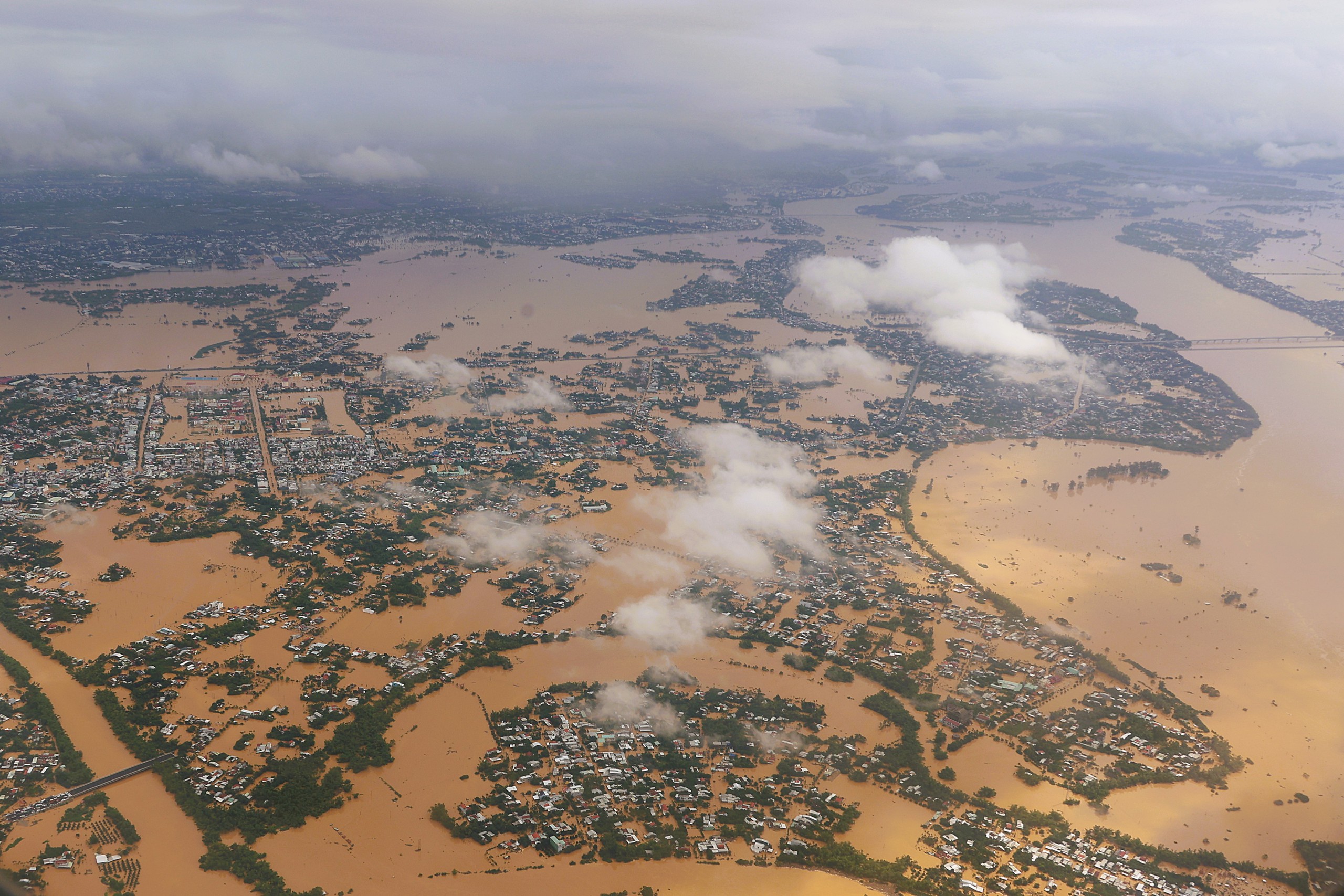
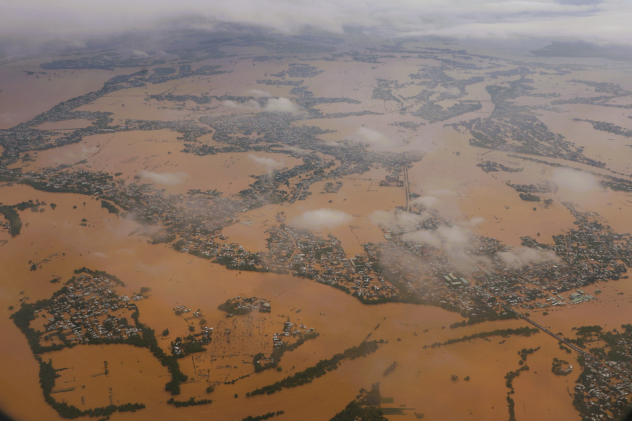
Panoramic view of Hoi An and Dien Ban, seen from a military plane
PHOTO: MAI THANH HAI
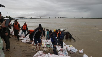
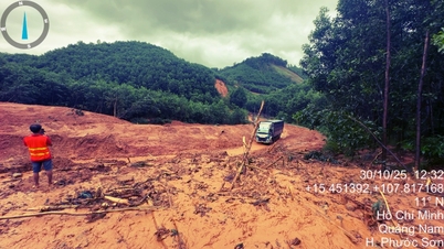
The historic flood in Hoi An has caused severe damage, with the first images of the flooded situation being recorded at noon on October 30. Thanh Nien reporters followed the military plane to interview and report on this emergency situation.
Da Nang City and surrounding areas were also severely affected. Follow the latest updates on the historic flooding in Hoi An to better understand the impact this natural disaster has had.
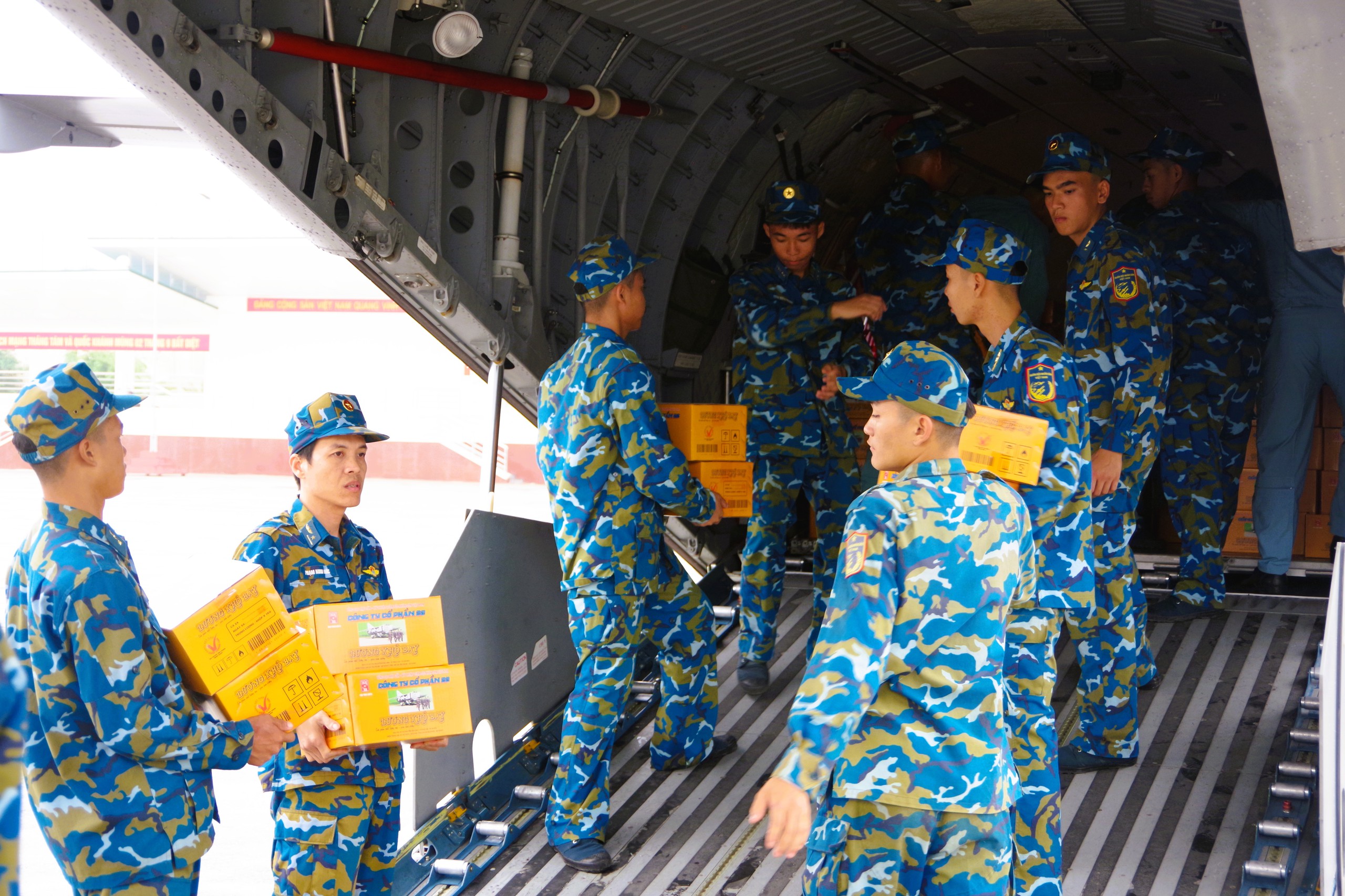
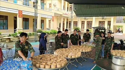
Officers and soldiers of the 918th Air Transport Brigade (Air Defense - Air Force) load dry rations onto Casa 295 aircraft, transferring them to Military Region 5.
PHOTO: MAI THANH HAI
Also this afternoon, Casa 295 aircraft number 8902 of the 918th Transport Air Brigade (Air Defense - Air Force, Ministry of National Defense ) transferred nearly 6 tons of dry food from Gia Lam military airport to Da Nang airport, handing it over to Military Region 5 to provide relief to areas severely affected by floods in Da Nang and Hue.
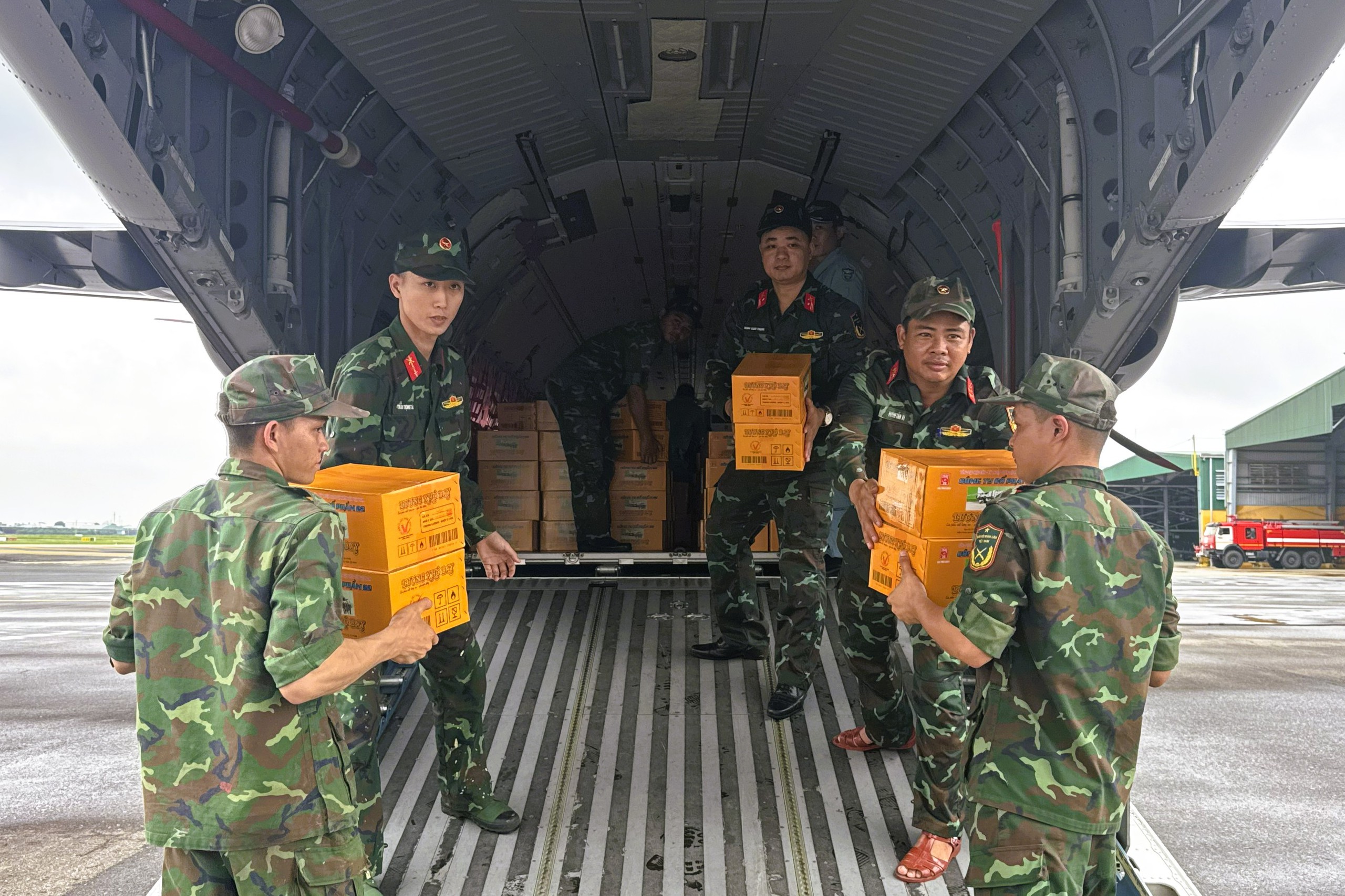
Troops of Military Region 5 received nearly 6 tons of dry food from air force transport planes to provide relief to isolated areas.
PHOTO: MAI THANH HAI
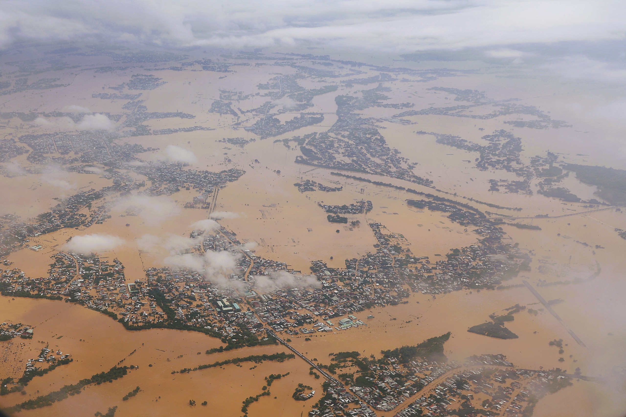
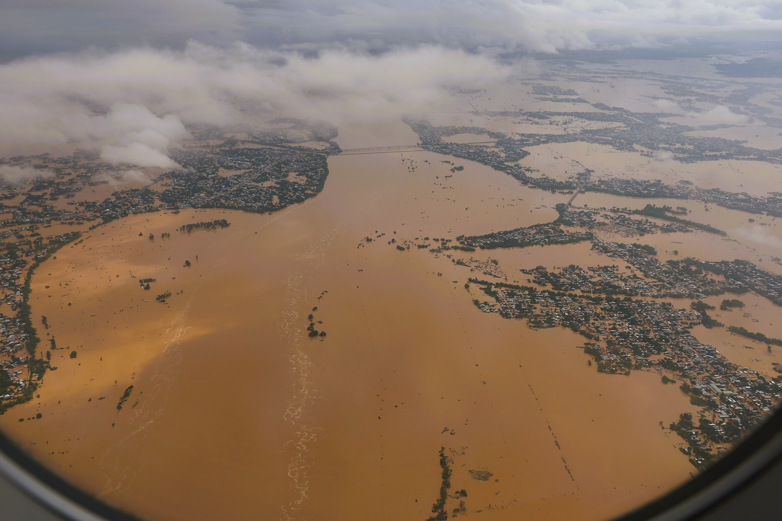
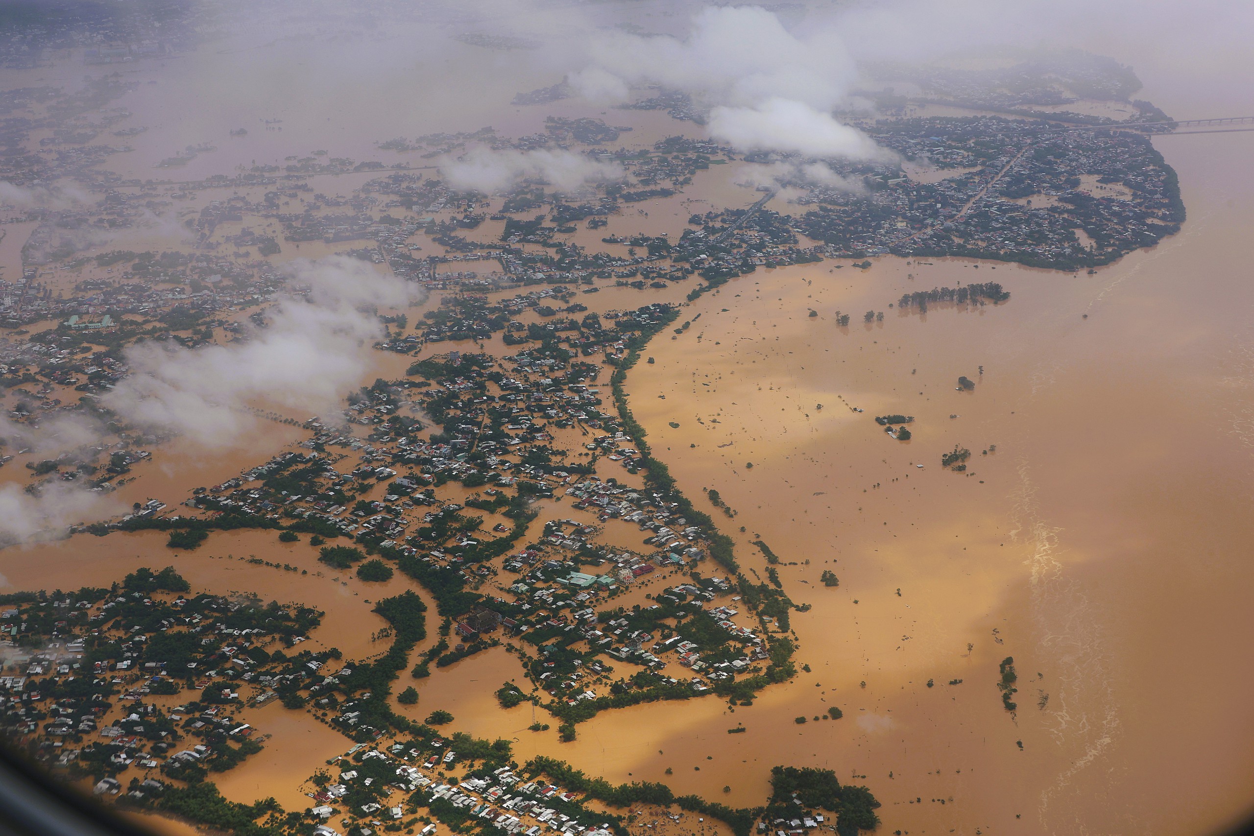
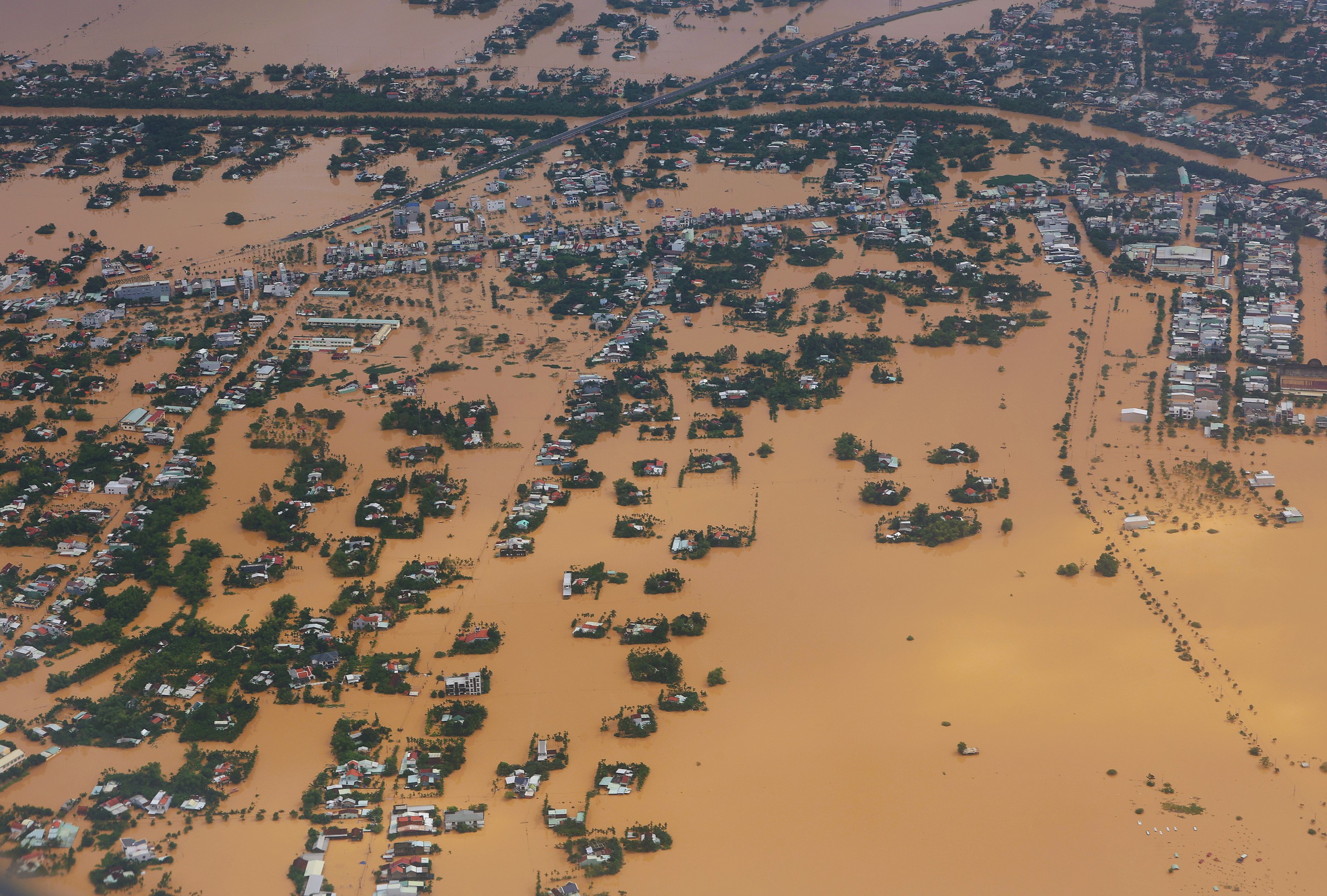
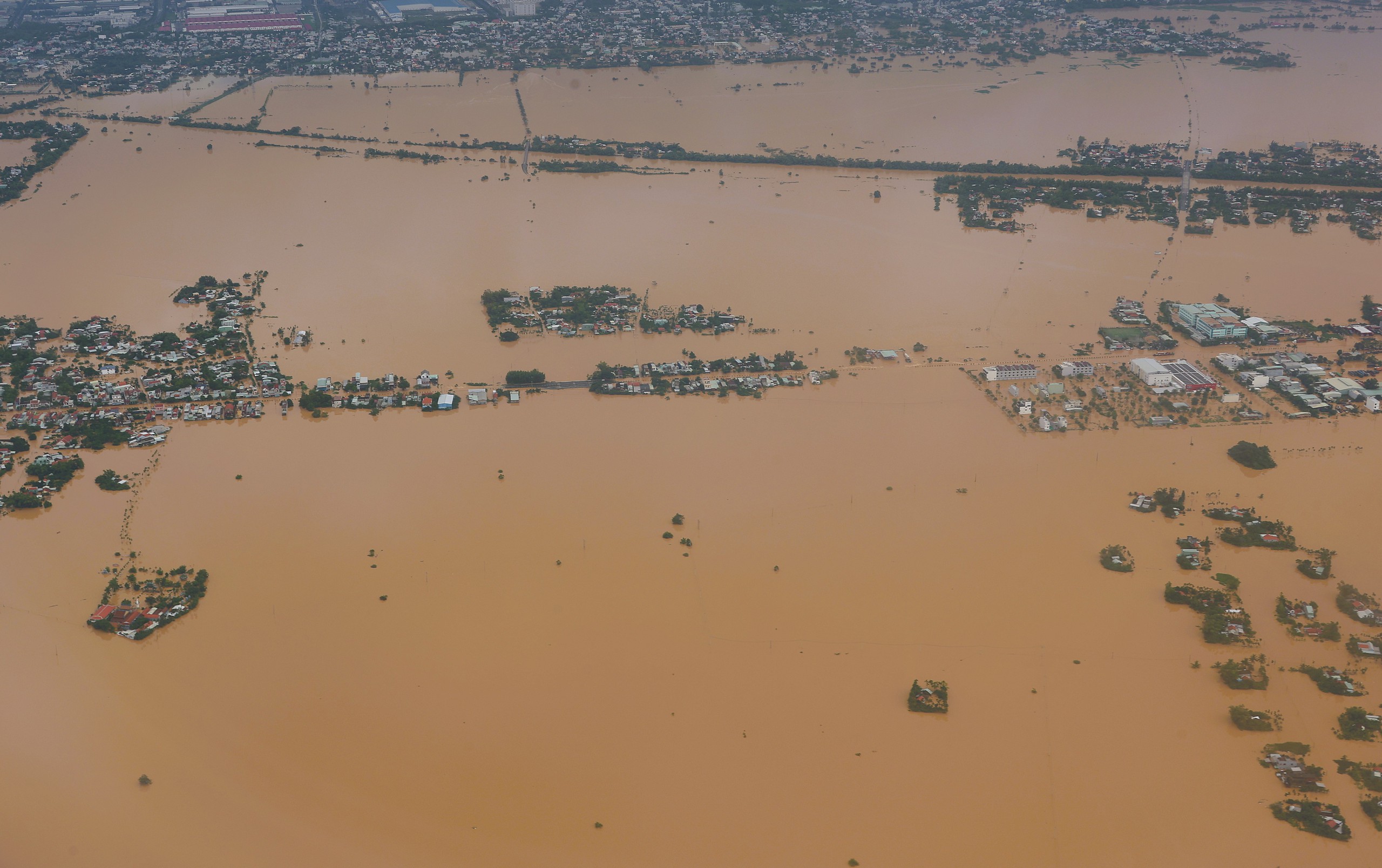
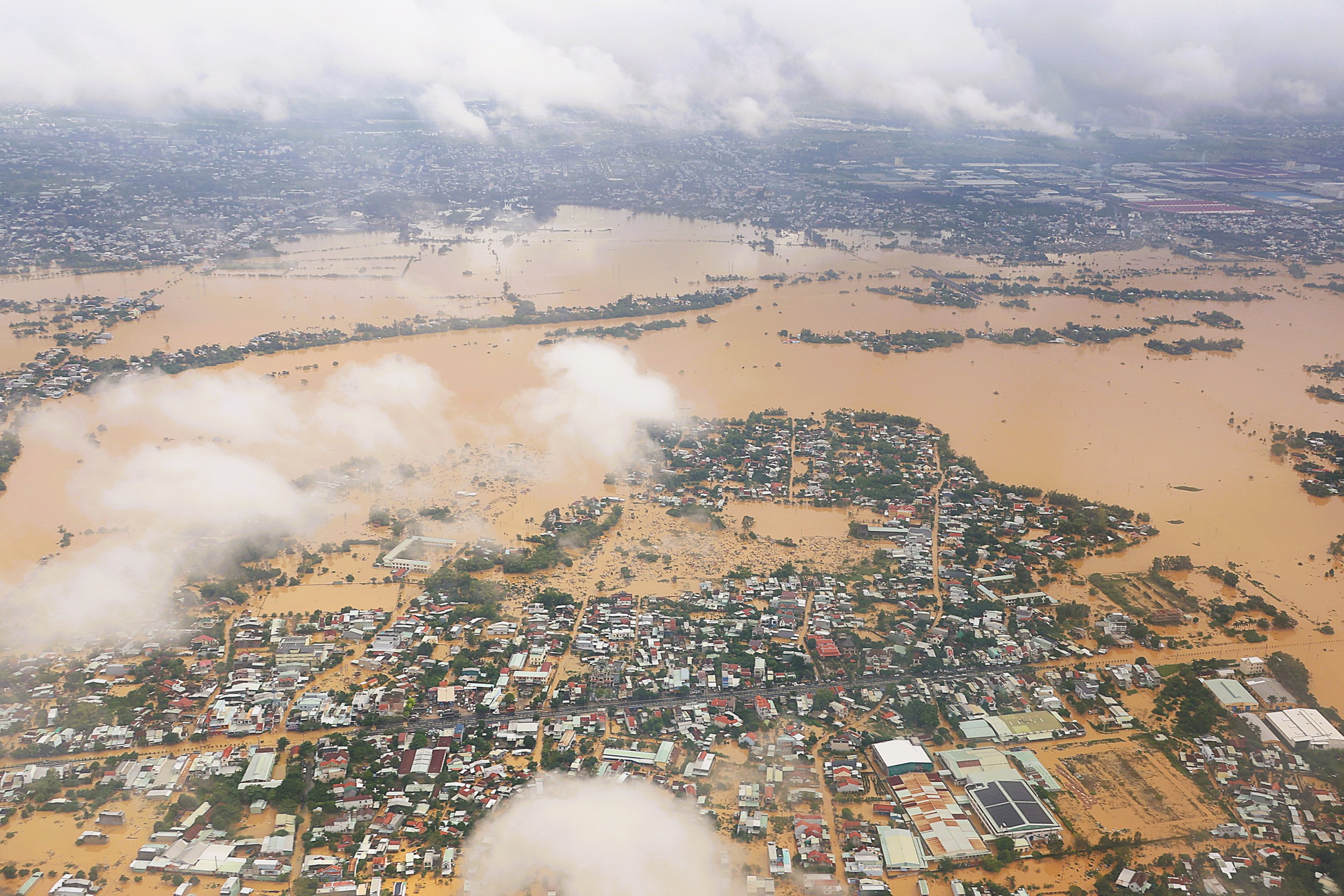
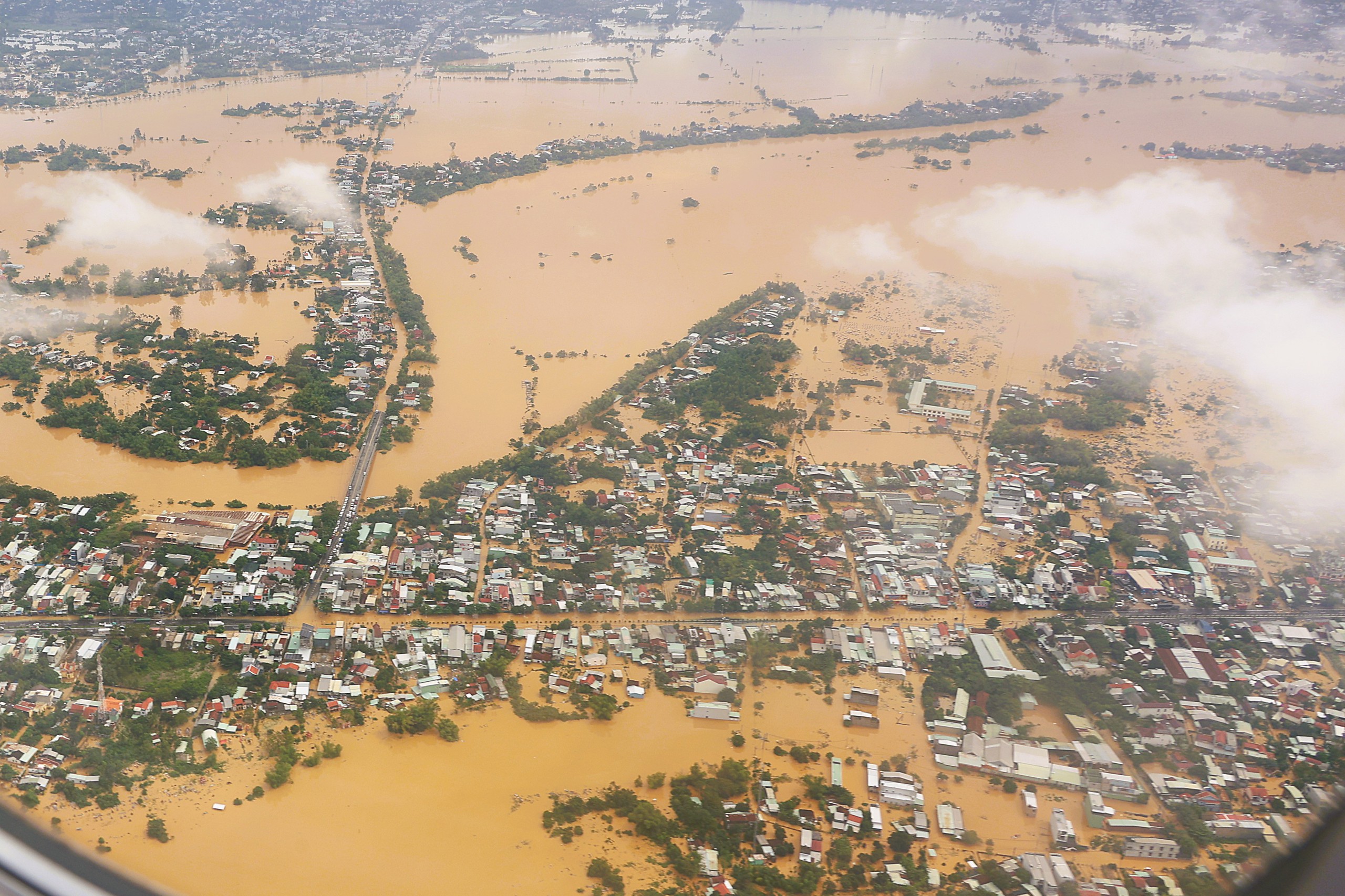
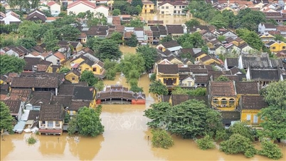
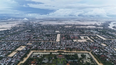
Some images of historic floods in Hoi An and Da Nang, recorded from military aircraft:
Dien Ban, seen from above
PHOTO: MAI THANH HAI
Residential areas surrounded by floodwaters
PHOTO: MAI THANH HAI
Muddy water from upstream
PHOTO: MAI THANH HAI
The Thu Bon River water level rose, submerging riverside houses.
PHOTO: MAI THANH HAI
Floodwaters rise in historic floods
PHOTO: MAI THANH HAI
Isolate residential areas
PHOTO: MAI THANH HAI
A flooded residential area
PHOTO: MAI THANH HAI
Area near the center of Da Nang
PHOTO: MAI THANH HAI
Update: Flood on Thu Bon River is receding slowly, still at alert level 3
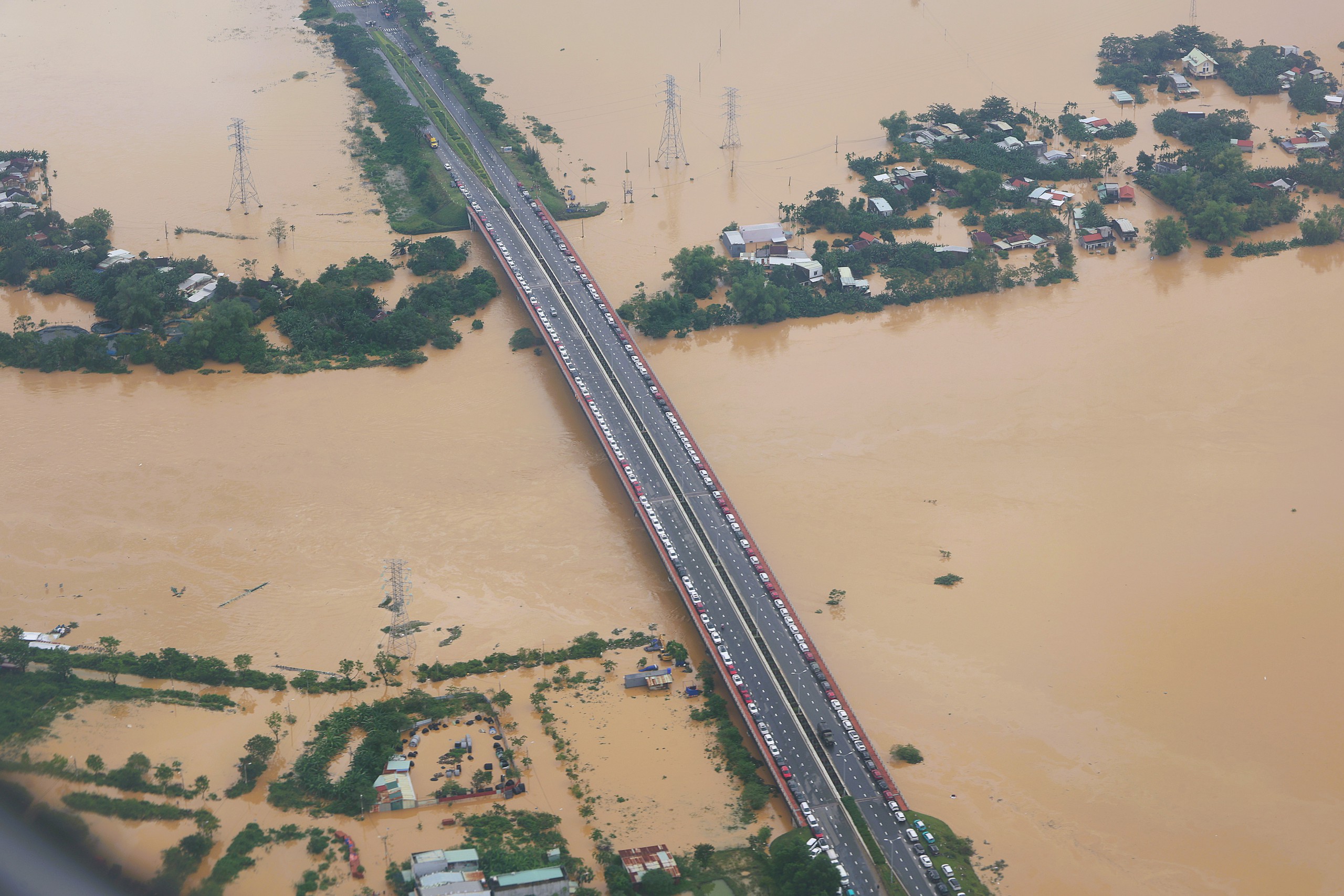
Water level rose, people brought cars onto the bridge to avoid flooding.
PHOTO: MAI THANH HAI
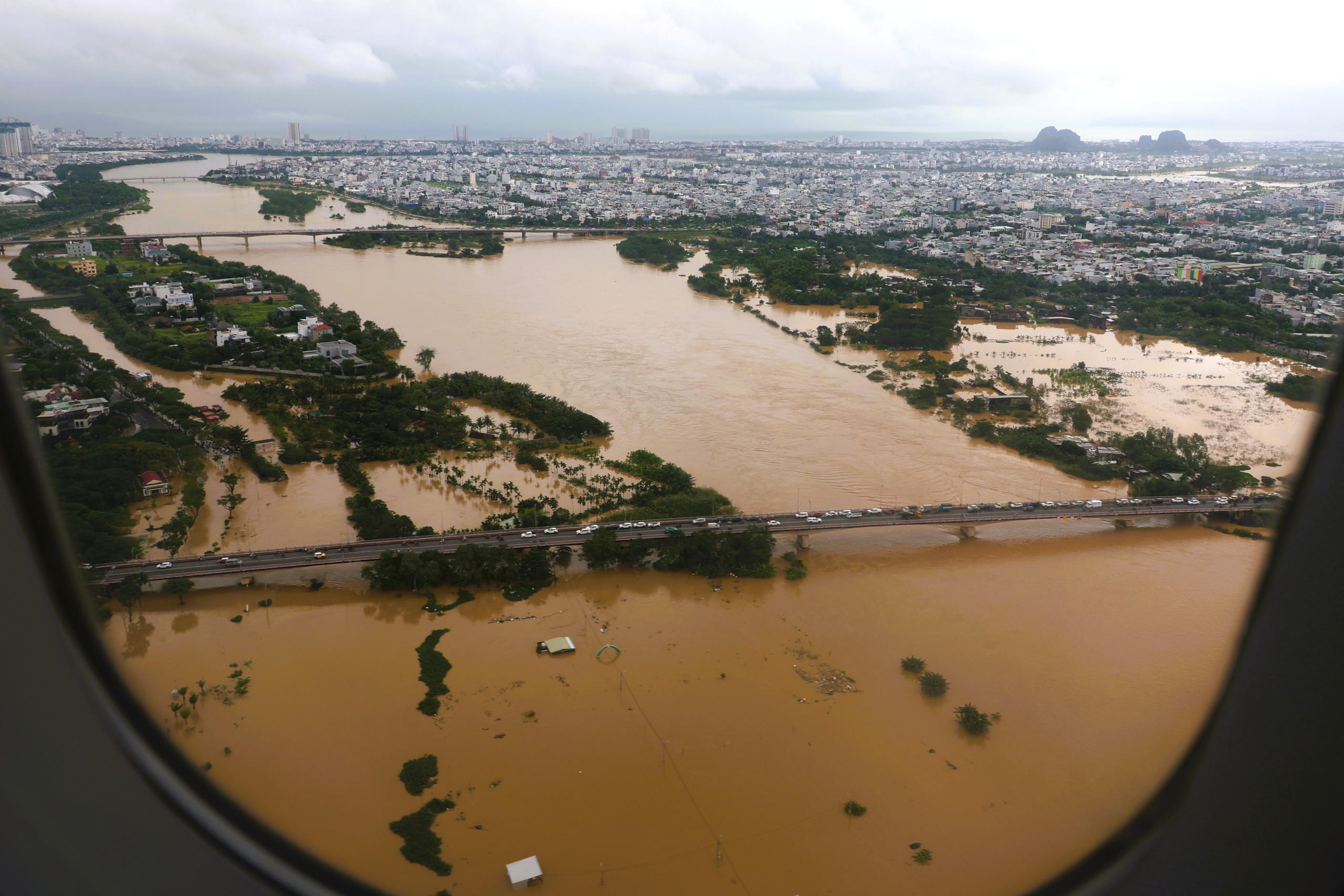
Flooding in central Da Nang
PHOTO: MAI THANH HAI
Thanhnien.vn
Source: https://thanhnien.vn/lu-lut-lich-su-o-hoi-an-nhin-tu-may-bay-quan-su-bo-quoc-phong-185251030115056355.htm
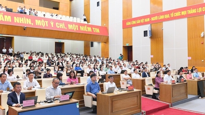
![[Photo] The Third Patriotic Emulation Congress of the Central Internal Affairs Commission](https://vphoto.vietnam.vn/thumb/1200x675/vietnam/resource/IMAGE/2025/10/30/1761831176178_dh-thi-dua-yeu-nuoc-5076-2710-jpg.webp)
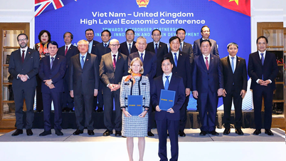
![[Photo] General Secretary To Lam attends the Vietnam-UK High-Level Economic Conference](https://vphoto.vietnam.vn/thumb/1200x675/vietnam/resource/IMAGE/2025/10/30/1761825773922_anh-1-3371-jpg.webp)


![[Photo] Prime Minister Pham Minh Chinh attends the 5th National Press Awards Ceremony on preventing and combating corruption, waste and negativity](https://vphoto.vietnam.vn/thumb/1200x675/vietnam/resource/IMAGE/2025/10/31/1761881588160_dsc-8359-jpg.webp)


Comment (0)