

Accordingly, the ENSO phenomenon (a global climate regulator) is maintaining a neutral state and is likely to last until the end of this year with a probability of 55%-90%. In neutral ENSO conditions, it means that weather patterns such as storms, tropical depressions, heavy rains or droughts will appear at levels equivalent to the multi-year average (TBNN), but still contain unpredictable local fluctuations.
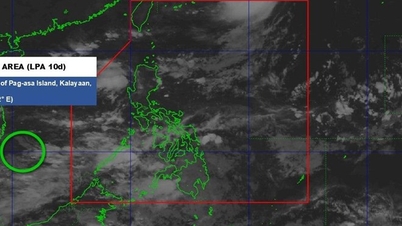
From July to September, there are forecasts for 6-7 storms and tropical depressions in the East Sea, of which about 3 are likely to directly affect the mainland. From October to December, there will continue to be 5 more storms, of which at least 2 may make landfall.
Heavy rains are forecast to increase sharply from July to November. The North, North Central, Central Highlands and South will experience many periods of moderate to heavy rains from July to September. The Central region, especially the Central Central and South Central regions, will be the focus of heavy rains in October and November, with rainfall exceeding the average of many years by about 10%-25%.
By December, rainfall in most areas tends to return to near average levels.
The Department of Hydrometeorology also said that the heat wave in the North and Central regions will last until about August before gradually decreasing when cold air begins to strengthen from October and gradually strengthens in November and December. Although the average temperature from July to the end of 2025 is estimated to be approximately the average of many years, the interaction between heat and cold air during the transition period can cause dangerous thunderstorms, tornadoes, lightning and hail, especially in October and November.
The heat returned after the storm passed.
On June 14 and 15 alone, the heat wave returned to the North and Central regions after Storm No. 1 dissipated in mainland China. In the North, the temperature recorded at 1 p.m. on June 15 was generally between 35 and 37 degrees Celsius, with some spots exceeding 37 degrees Celsius. Relative humidity dropped to only 55% and 65%.
The National Center for Hydro-Meteorological Forecasting warns that on June 16 and 17, the area from Thanh Hoa to Phu Yen will continue to experience heat waves, with some places experiencing severe heat waves with the highest temperature commonly ranging from 35-37 degrees Celsius, and some places above 38 degrees Celsius. The lowest relative humidity ranges from 55% to 60%. In the Northern region, local heat waves will continue, with some places exceeding 35 degrees Celsius. The meteorological agency recommends that people monitor to respond appropriately to this heat wave.
Source: https://www.sggp.org.vn/nang-nong-keo-dai-den-thang-8-mua-lon-don-ve-cuoi-nam-post799590.html
![[Photo] Opening of the World Cultural Festival in Hanoi](https://vphoto.vietnam.vn/thumb/1200x675/vietnam/resource/IMAGE/2025/10/10/1760113426728_ndo_br_lehoi-khaimac-jpg.webp)


![[Photo] Ho Chi Minh City is brilliant with flags and flowers on the eve of the 1st Party Congress, term 2025-2030](https://vphoto.vietnam.vn/thumb/1200x675/vietnam/resource/IMAGE/2025/10/10/1760102923219_ndo_br_thiet-ke-chua-co-ten-43-png.webp)

![[Photo] General Secretary attends the parade to celebrate the 80th anniversary of the founding of the Korean Workers' Party](https://vphoto.vietnam.vn/thumb/1200x675/vietnam/resource/IMAGE/2025/10/11/1760150039564_vna-potal-tong-bi-thu-du-le-duyet-binh-ky-niem-80-nam-thanh-lap-dang-lao-dong-trieu-tien-8331994-jpg.webp)


Comment (0)