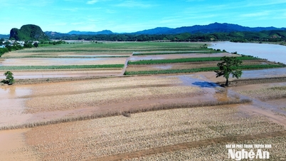
Admiring 5 century-old bridges across Lam River, connecting the 'vi and giam regions' of Nghe An - Ha Tinh
Lam River – one of the symbols of Nghe An, not only creates a beautiful landscape on both banks, but it is also the "natural boundary" between Nghe An and Ha Tinh provinces. The century-old bridges across Lam River are an important link, expanding the space for regional connectivity and promoting sustainable development of the two "vi and giam" localities.
Báo Nghệ An•25/04/2025
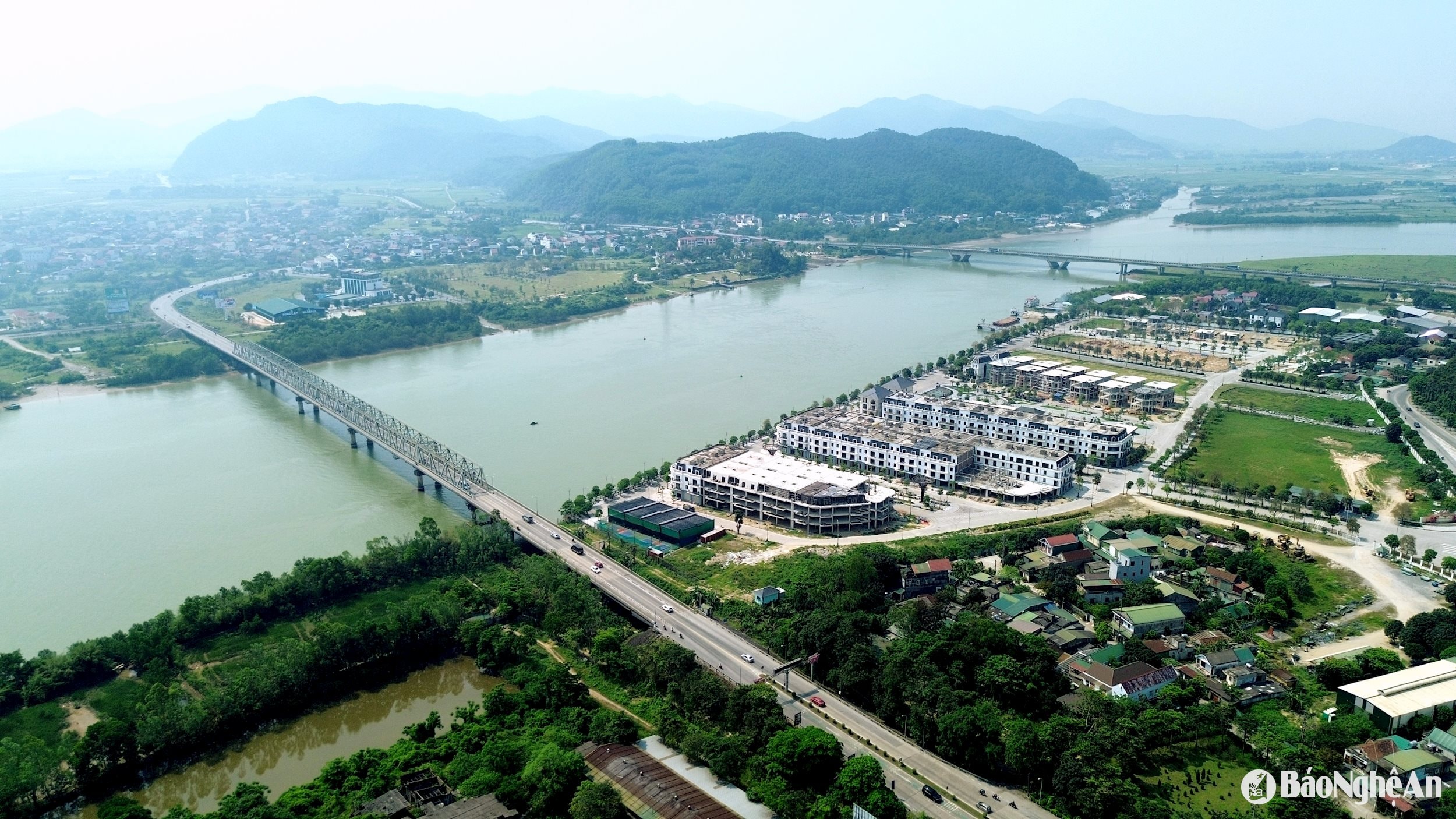
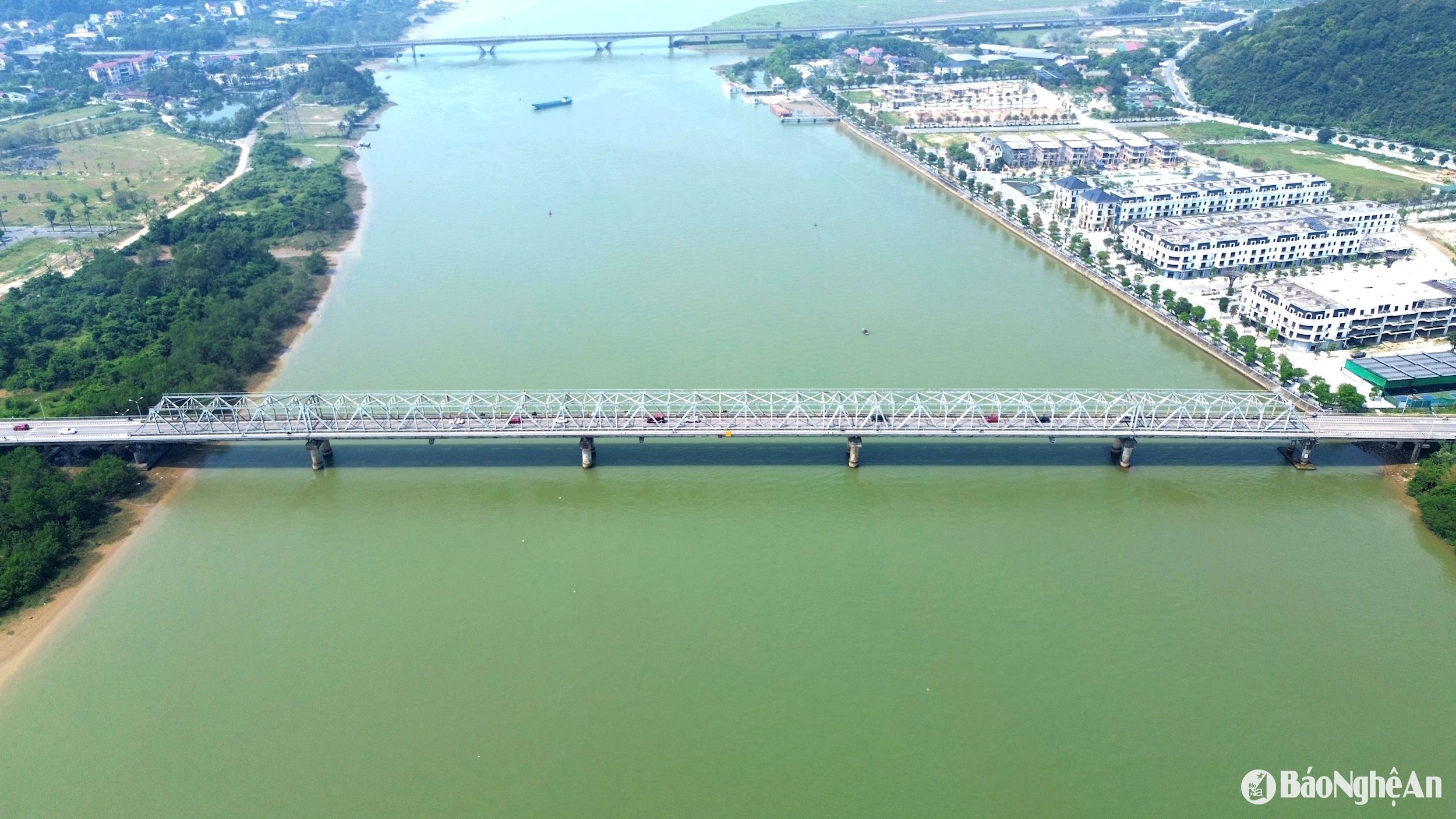
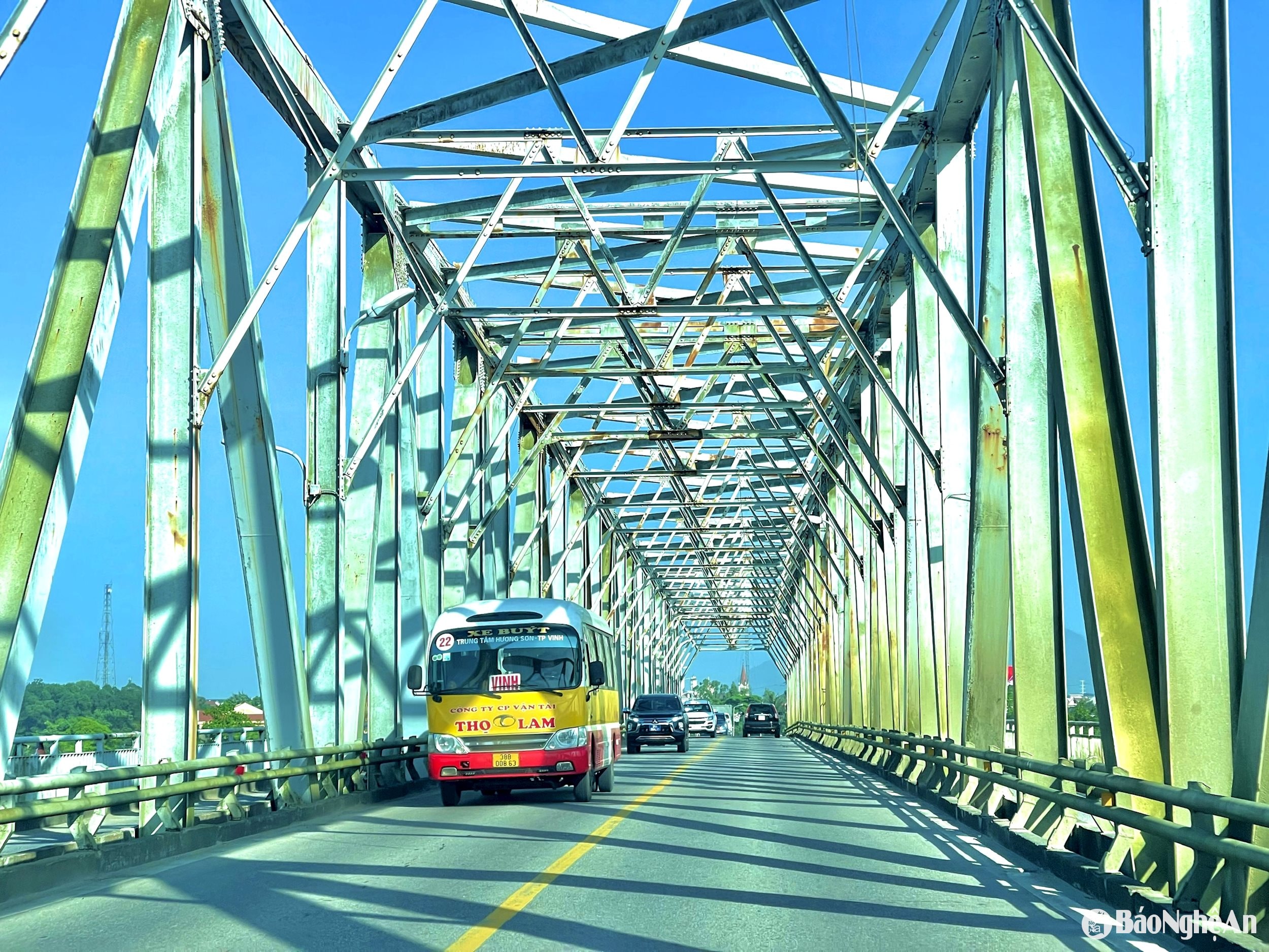
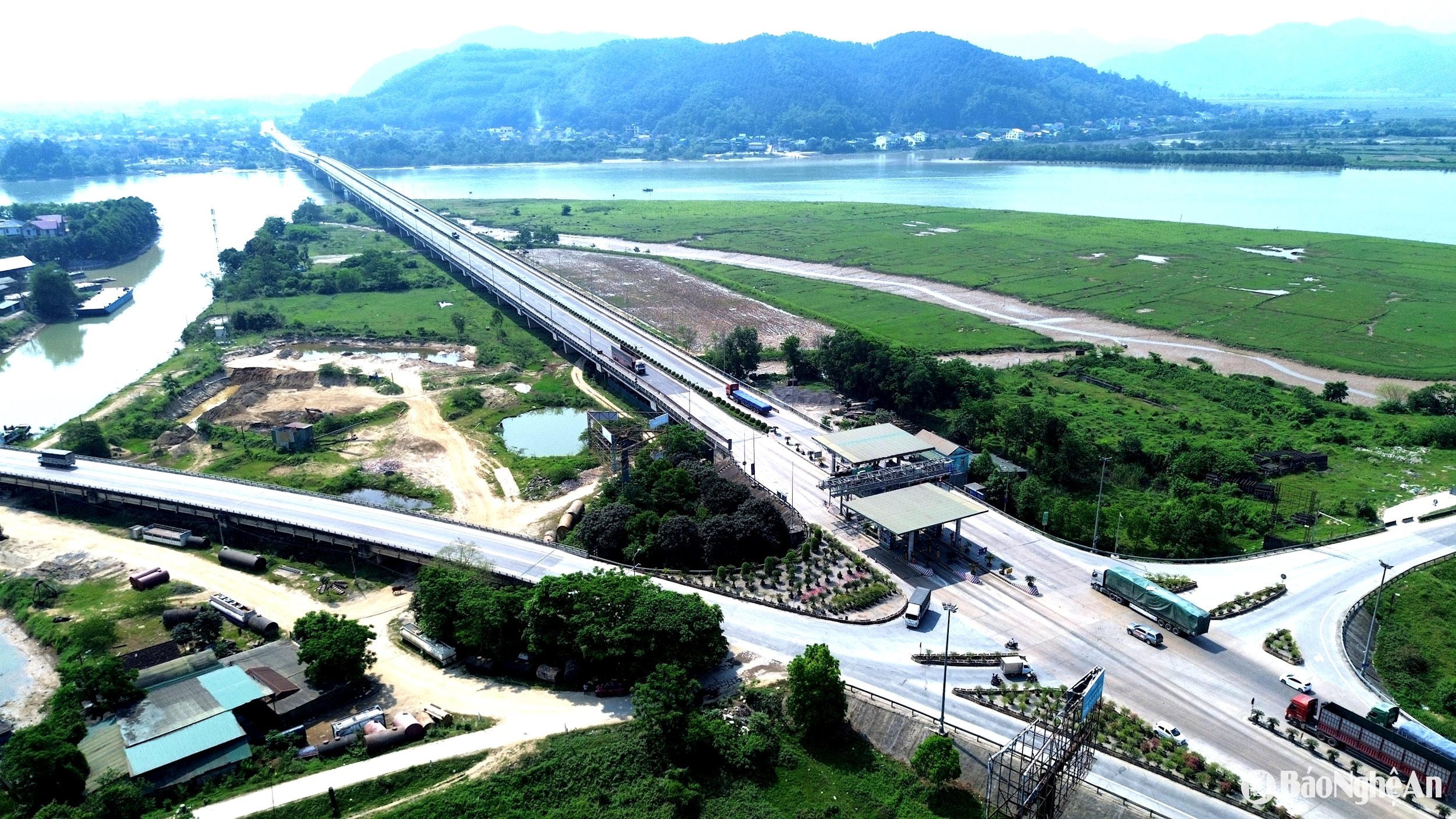
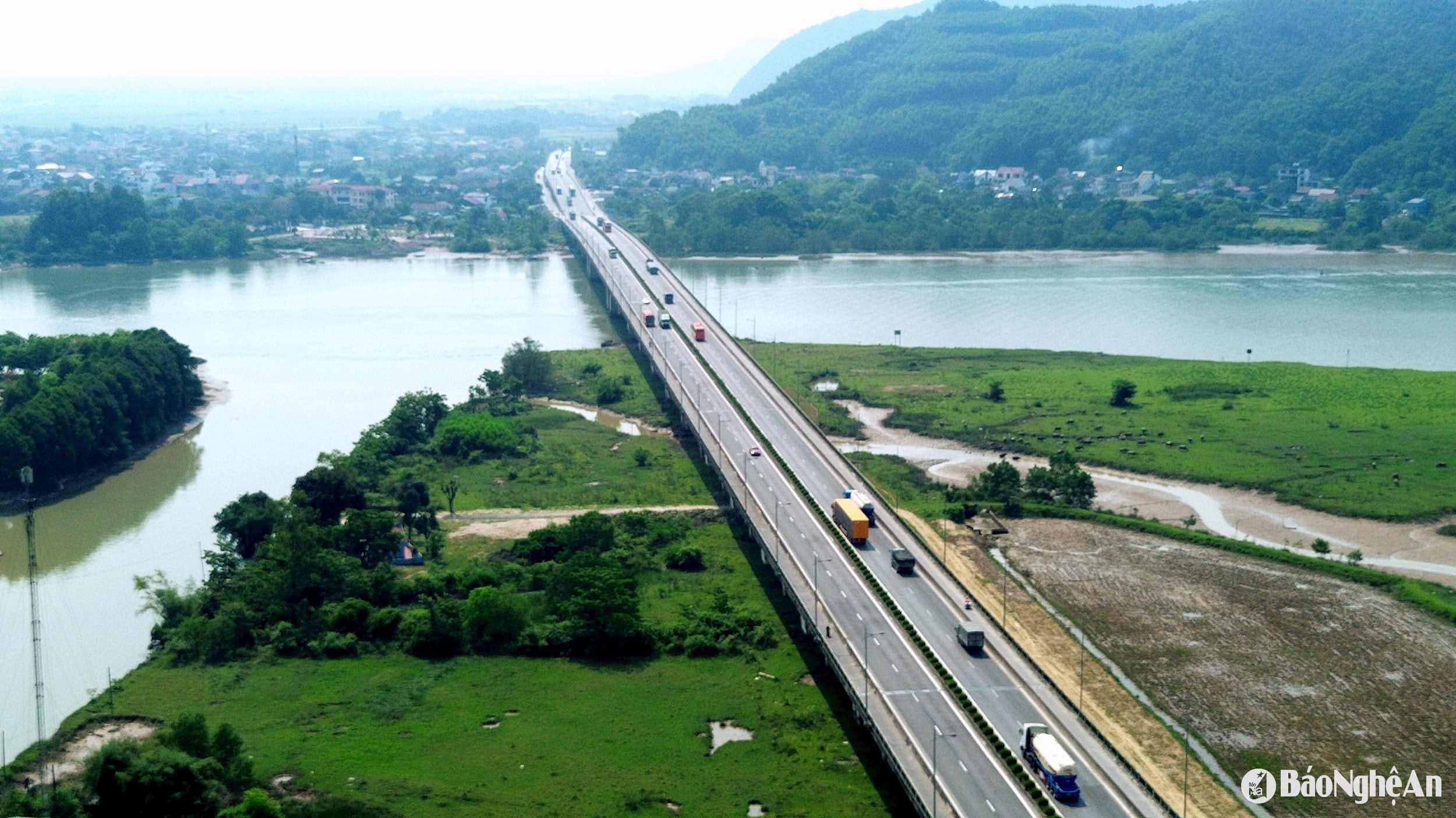
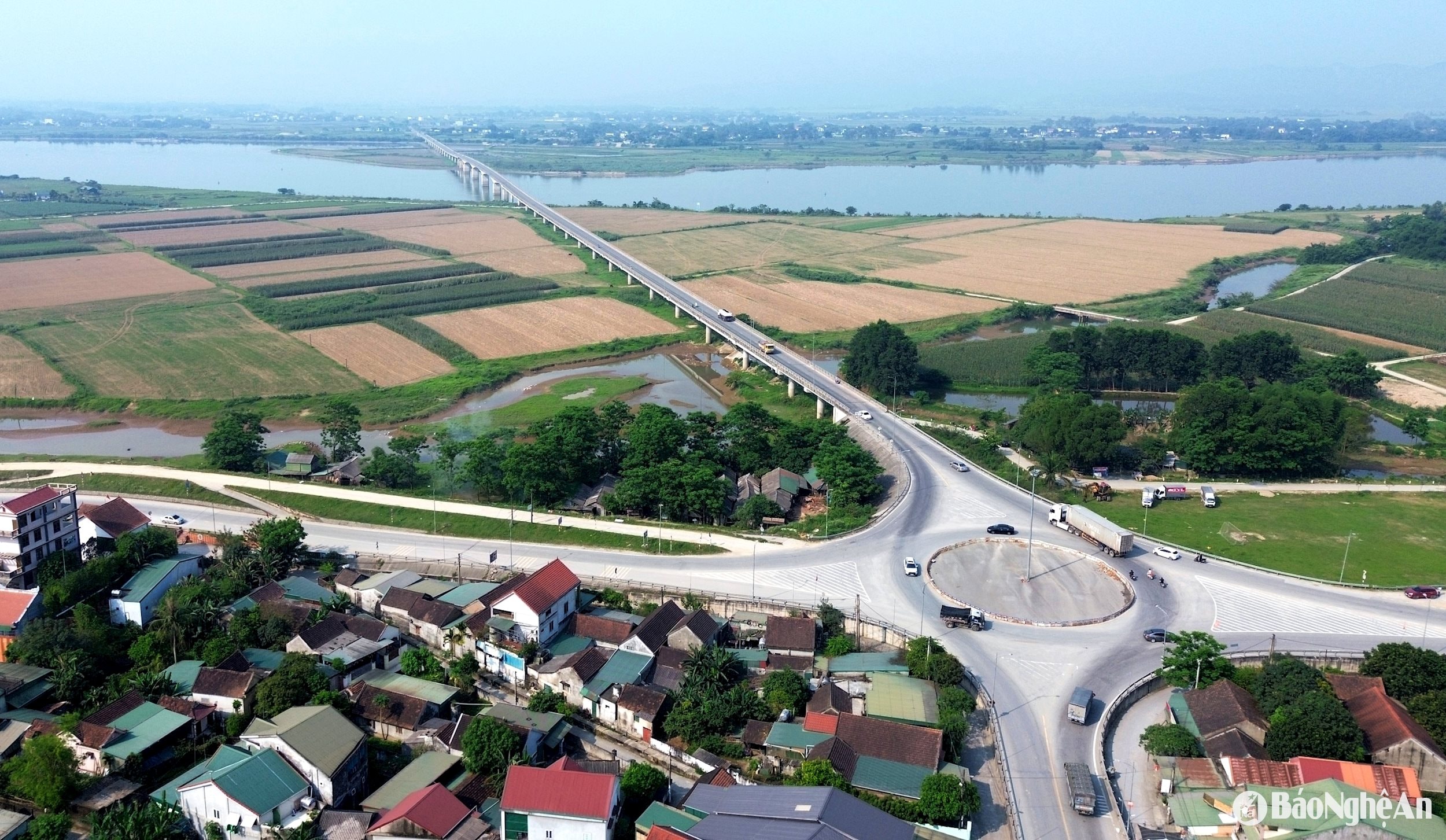
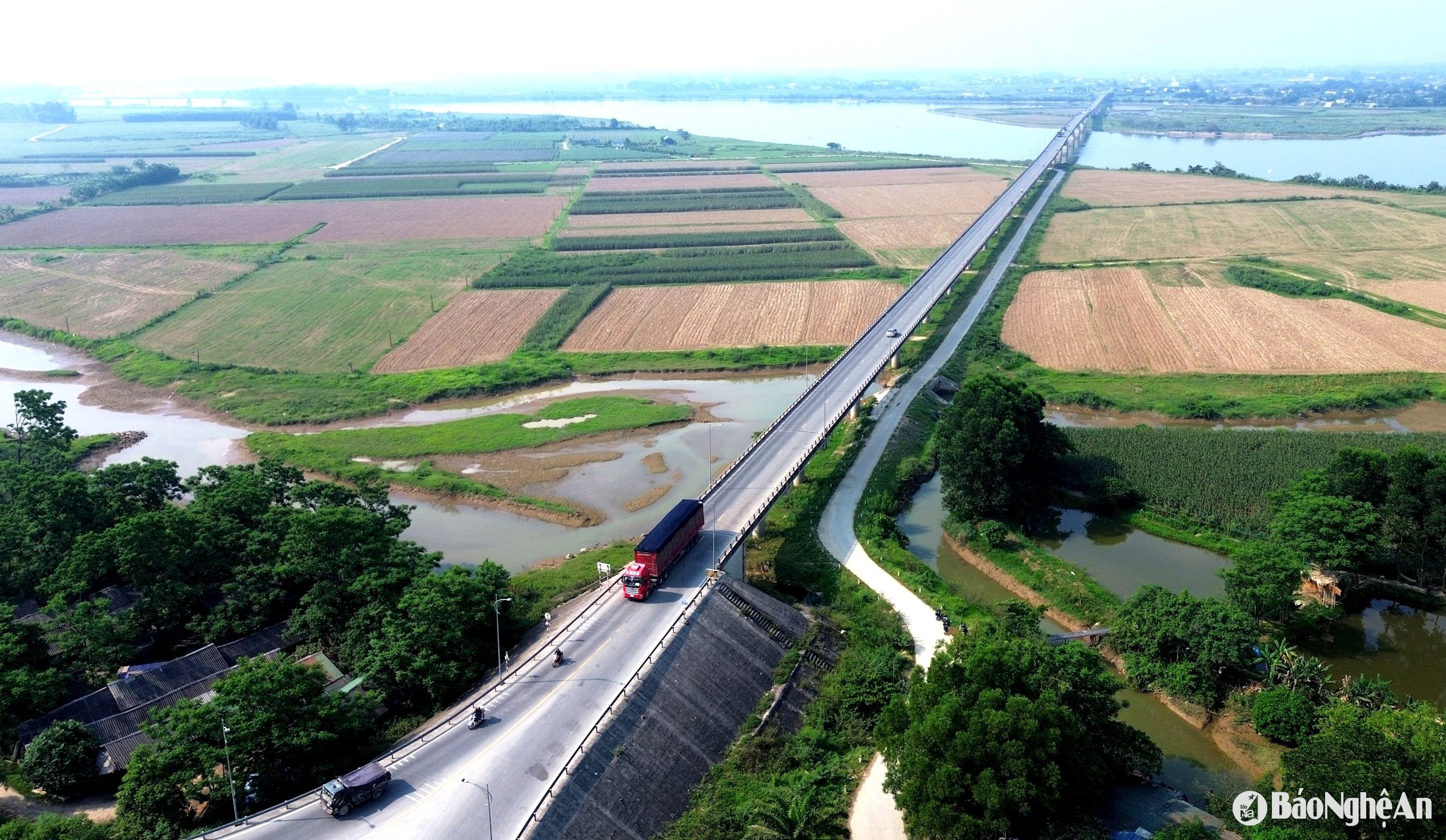
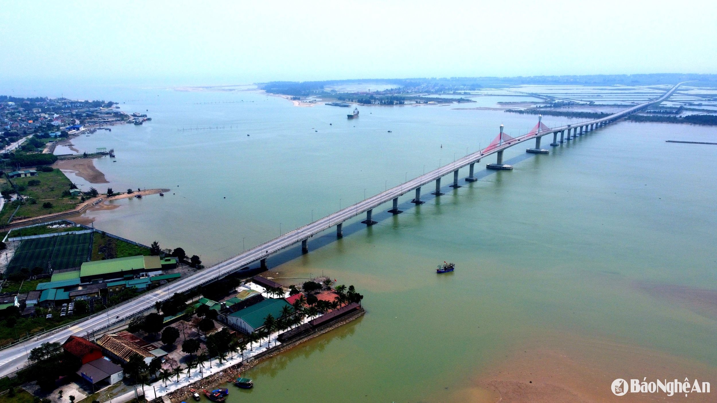
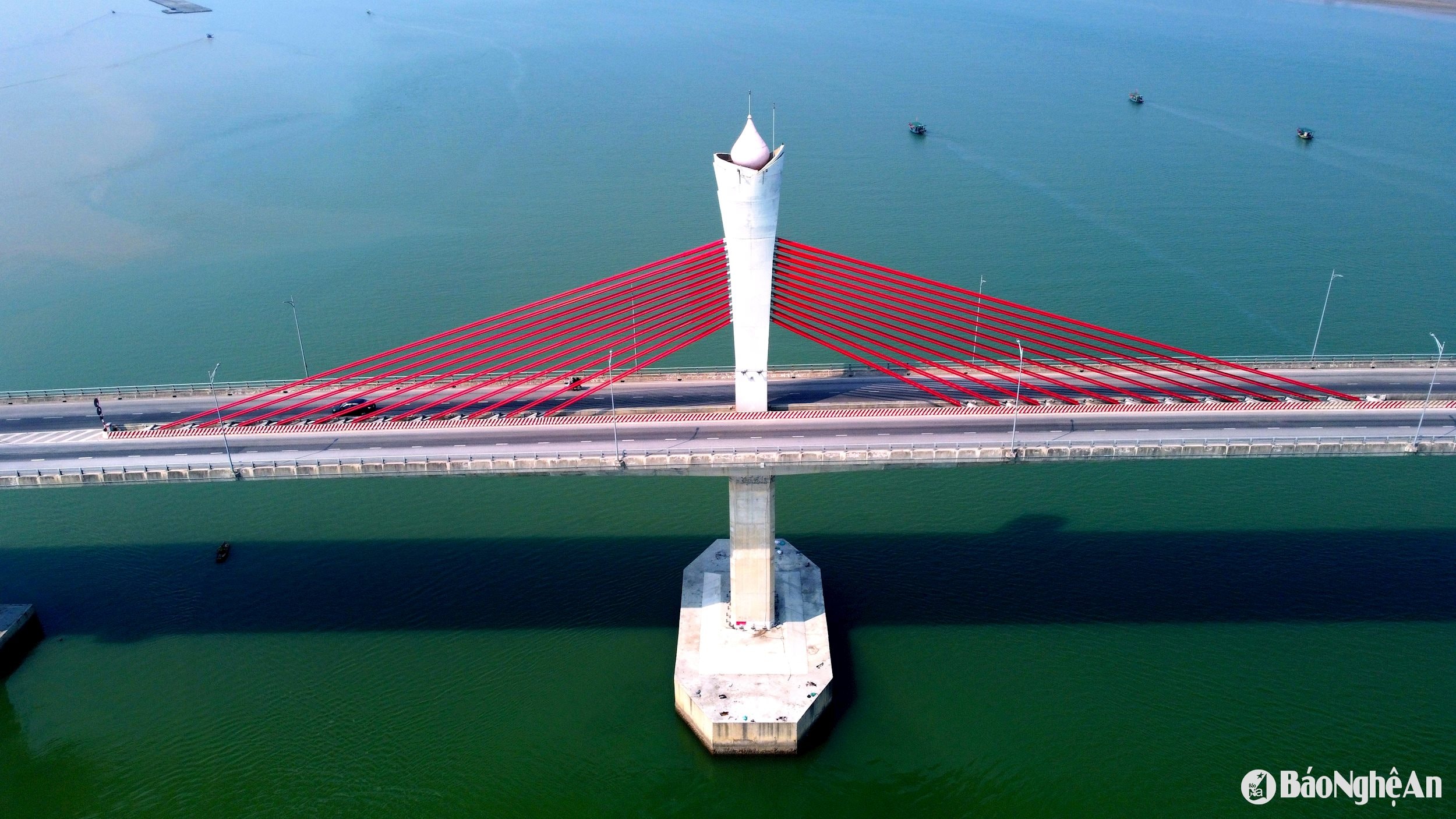
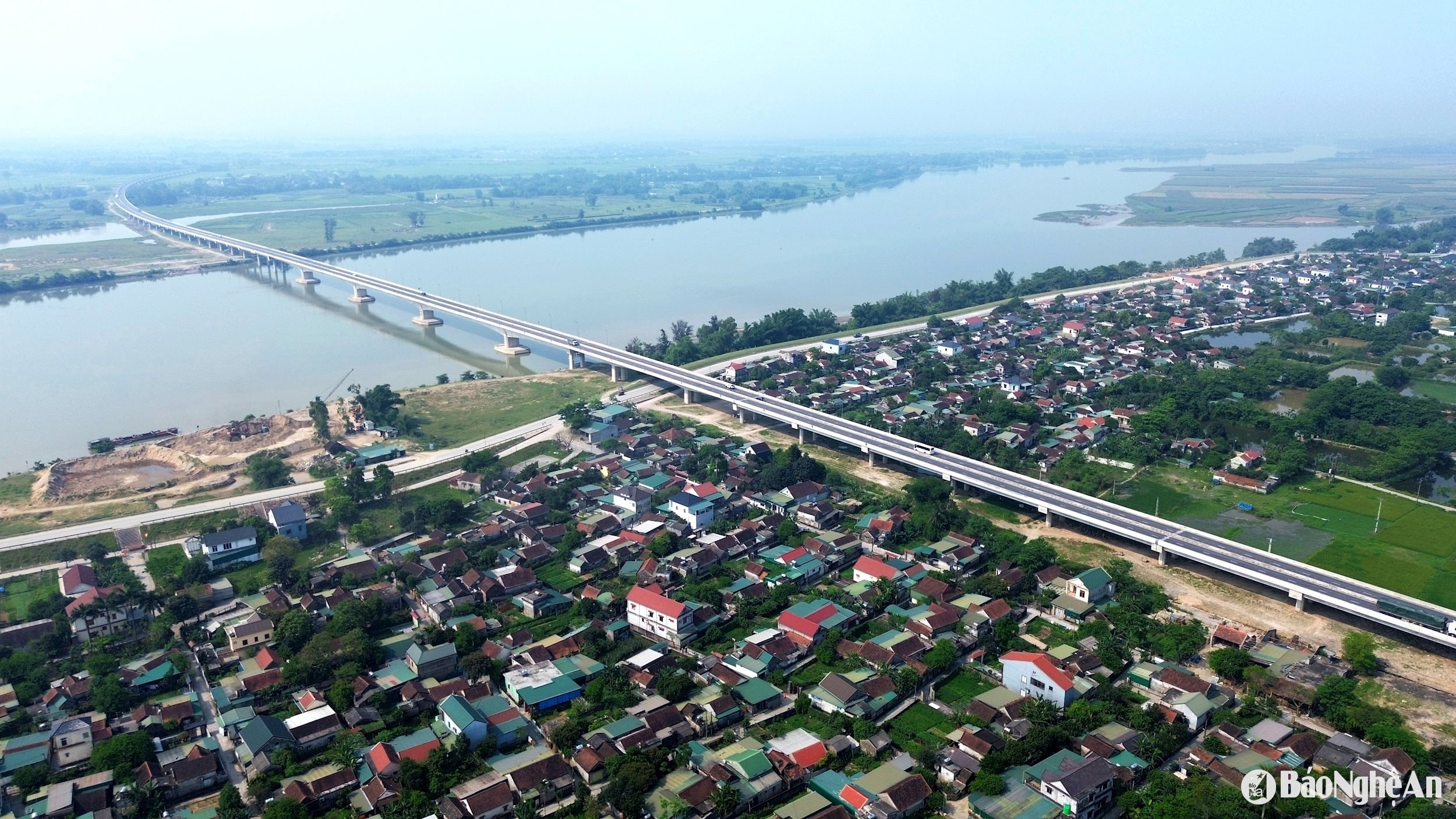
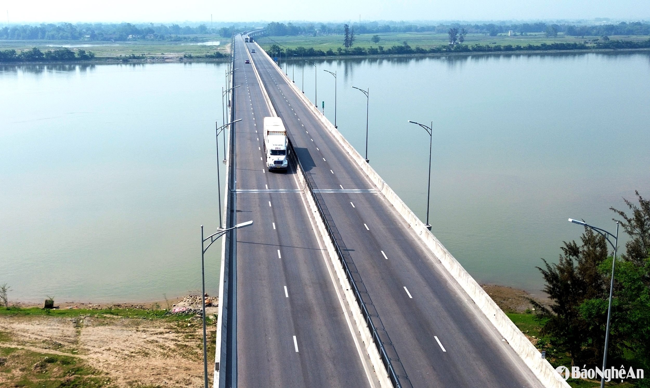
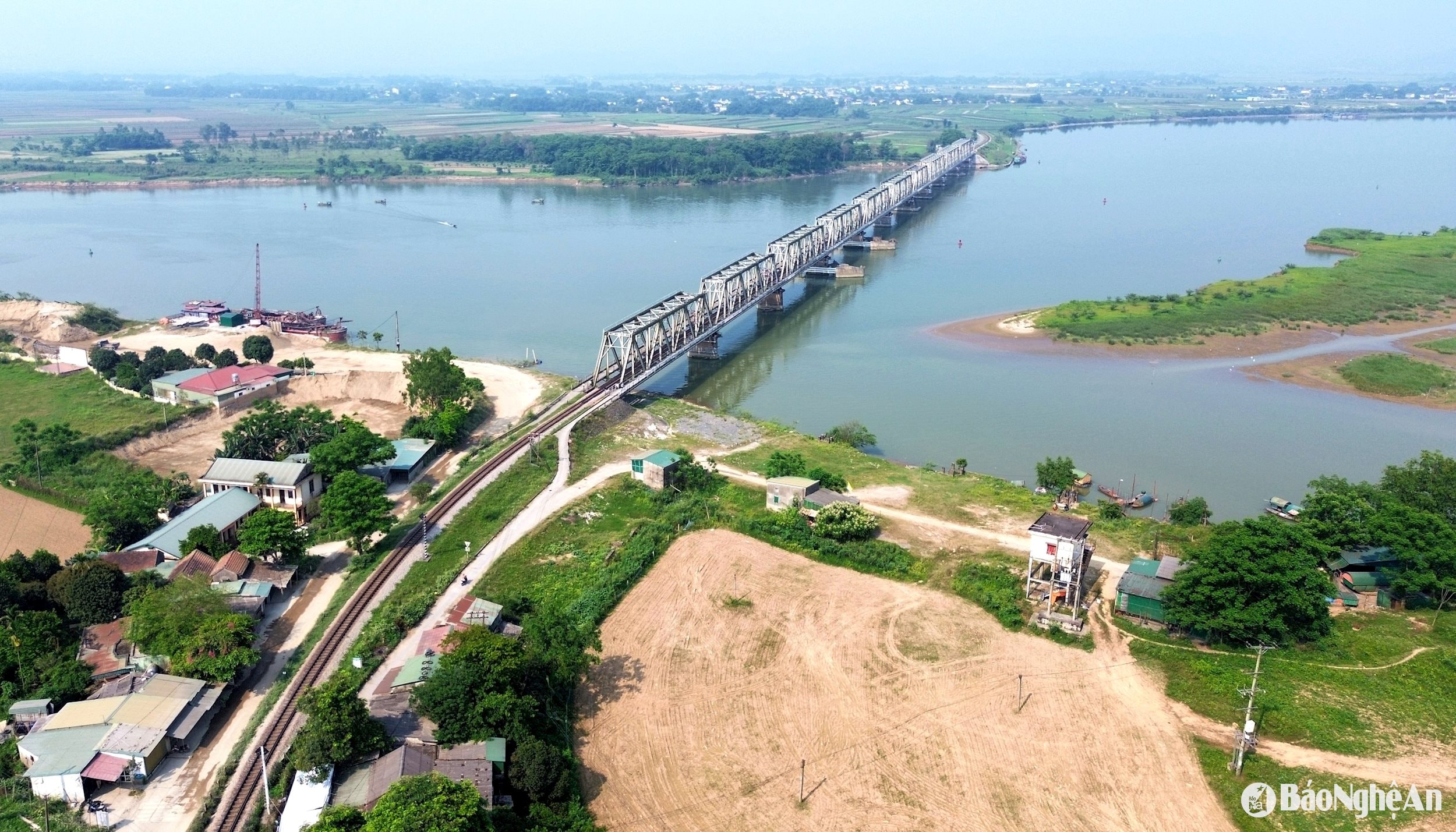
Clip: Xuan Hoang - Quang An In the memories of many generations of people on both banks of the Lam River, the ferry trips and wooden ferries in the Ben Thuy area used to be the main means of transportation. Ben Thuy 1 - Project of the century. Started in 1986, inaugurated in 1990, Ben Thuy I bridge is the first road bridge across the Lam River, connecting National Highway 1A, 630.5 m long, including 13 spans, connecting Vinh City with Xuan An town ( Ha Tinh ). Photo: Xuan Hoang Considered one of the key national projects in the early period of renovation, Ben Thuy 1 Bridge is a lever for socio -economic development in the North Central region. Photo: Xuan Hoang Traffic volume through Ben Thuy 1 Bridge continues to increase. Photo: Quang An Due to the high traffic volume, Ben Thuy 1 Bridge became overloaded. Therefore, in 2012, Ben Thuy 2 Bridge was put into use as a "powerful assistant", helping to divert traffic and reduce pressure on the old bridge. The bridge is 996 m long, 25 m wide, has 4 lanes for motor vehicles, 2 lanes for non-motorized vehicles, and a design speed of 80 km/h. Photo: Xuan Hoang Ben Thuy 2 Bridge is 996m long, 25m wide, has 4 lanes for motor vehicles, 2 lanes for non-motorized vehicles, and a design speed of 80 km/h. This is one of the modern bridges, with a permanent design of reinforced concrete and prestressed concrete. Photo: Quang An Yen Xuan Bridge – eliminating the status of an “oasis” in flood-prone areas, is one of the projects of special significance in ensuring traffic safety and overcoming isolation during the rainy season. Inaugurated in 2016, this bridge is 3.6km long, of which the main bridge is nearly 1.9km long and 9m wide. Photo: Quang An The majestic Yen Xuan Bridge spans the distance connecting the remote communes of Nam Dan district ( Nghe An ) with Duc Tho (Ha Tinh), contributing to eliminating the "oasis" situation during the rainy and flood season, creating convenience for people to travel and trade. Photo: Xuan Hoang Cua Hoi Bridge - an architectural highlight and coastal connection of Lam River estuary, started construction in 2019, inaugurated in March 2021; the bridge is 5.2km long with the main bridge section being 1.7km long, with an investment of nearly 1,000 billion VND. Cua Hoi Bridge helps complete the coastal route, creating conditions to promote the development of marine economy, tourism, trade and ensure national defense and security. This bridge connects National Highway 8B, National Highway 1, and at the same time reduces the load on the main national highway, connecting the North Central Coast region. Photo: Quang An The unique architectural highlight of Cua Hoi Bridge is the lotus-shaped bridge piers combined with a modern cable-stayed system. Photo: Quang An Hung Duc Bridge - connecting the North - South highway, is an important part of the Dien Chau - Bai Vot highway section. With a total length of nearly 4.1 km, including 90 spans, the Hung Duc bridge surface is 17.5 m wide. According to the Department of Transport - Nghe An Department of Construction, Hung Duc Bridge is the longest river crossing bridge on the current North - South highway; is an important traffic axis connecting the districts of Hung Nguyen, Nam Dan (Nghe An) and Duc Tho (Ha Tinh), promoting economic development along the highway. Photo: Xuan Hoang Hung Duc Bridge across Lam River on Dien Chau - Bai Vot Expressway was built by Hoa Hiep Company Limited, Cienco 4. Photo: Xuan Hoang The bridges across the Lam River are not simply transportation works but also symbols of the will to rise, of connection and development. Each bridge carries within it a historical story, a milestone of development and an expectation for the future. In the photo: Yen Xuan railway bridge across the Lam River was built during the French colonial period (on this side of the bridge is Hung Nguyen district, on the other side is Trung Phuc Cuong commune of Nam Dan district, later connecting with Ha Tinh). Photo: Quang An
 Báo Nghệ An•25/04/2025


![[Photo] Da Nang: Water gradually recedes, local authorities take advantage of the cleanup](https://vphoto.vietnam.vn/thumb/1200x675/vietnam/resource/IMAGE/2025/10/31/1761897188943_ndo_tr_2-jpg.webp)


![[Photo] Prime Minister Pham Minh Chinh attends the 5th National Press Awards Ceremony on preventing and combating corruption, waste and negativity](https://vphoto.vietnam.vn/thumb/1200x675/vietnam/resource/IMAGE/2025/10/31/1761881588160_dsc-8359-jpg.webp)


Comment (0)