
Mr. Pham Van Son - Deputy Director of the Center for Remote Sensing and Geological Hazards, Institute of Geosciences and Mineral Resources said that since 2012, the Ministry of Natural Resources and Environment has implemented the Project "Investigation, assessment and zoning of landslide risk warning in mountainous areas of Vietnam". Up to now, the Project has investigated and mapped to create a picture of landslide risk in 28/37 mountainous provinces.
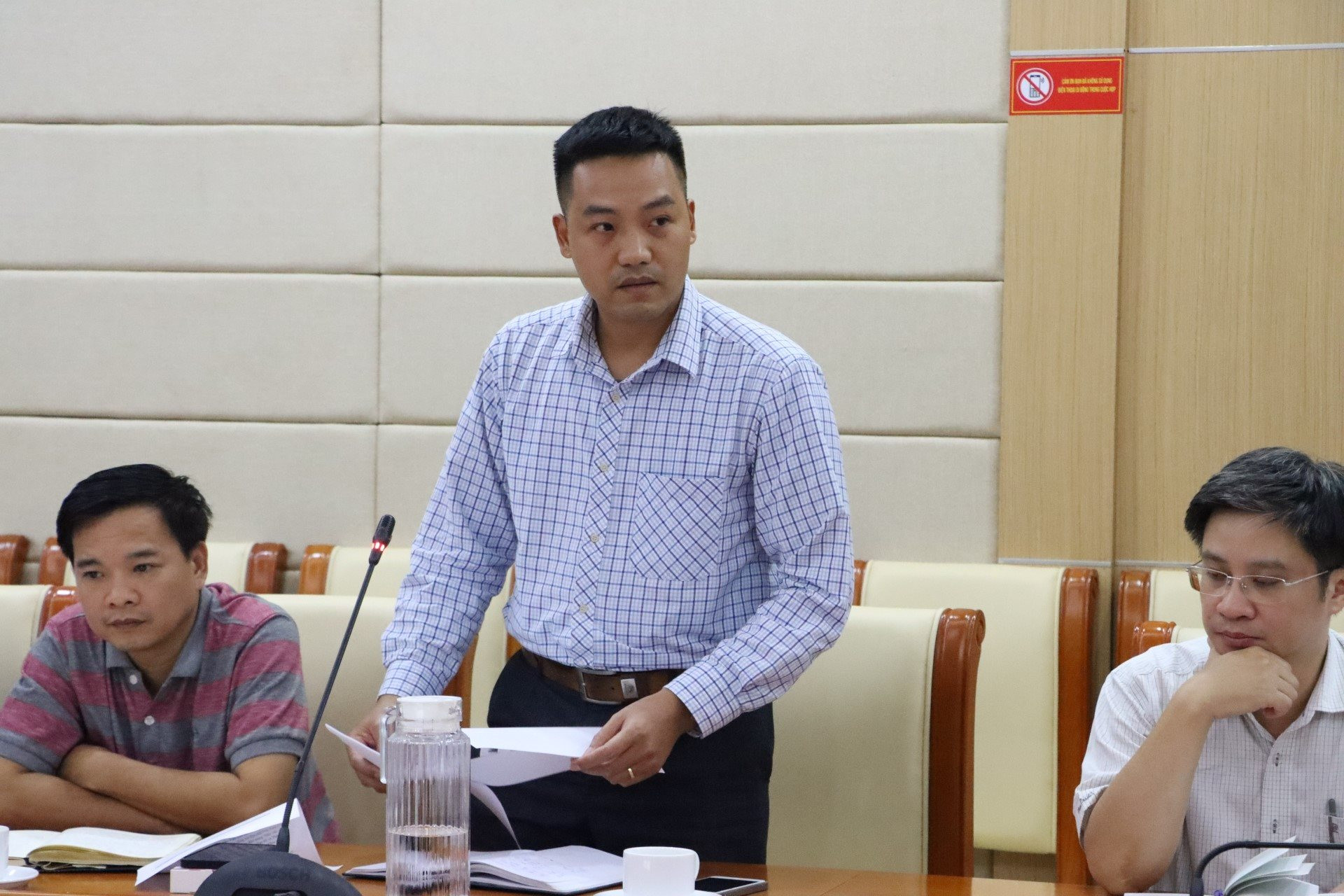
Reporter: After the particularly serious flash floods and landslides in Lai Chau, Lao Cai, Lang Son, Thanh Hoa, Quang Nam... causing great loss of life and property, in 2012, the Ministry of Natural Resources and Environment assigned the Institute of Geosciences and Mineral Resources to preside over and coordinate with many related units inside and outside the Ministry to develop and implement the project "Investigation, assessment and zoning of landslide risk warning in mountainous areas of Vietnam". At that time, what goals did scientists expect to achieve, sir?
Mr. Pham Van Son: To implement the project, the Institute of Geological Sciences and Mineral Resources has established a system of maps on topographical factors, geological and tectonic structures, destruction zones; hydrogeology - engineering geology, land cover, rainfall distribution... The Institute hopes that this will be the input data, serving the assessment and establishment of landslide risk zoning maps for the investigated areas within the scope of the Project. In addition, it can also be used to serve many other topics, projects and projects inside and outside the Ministry of Natural Resources and Environment.
The Institute also expects that for specialized management agencies and legislative agencies, these component maps will contribute to providing a scientific basis for drafting and promulgating laws and regulations to limit the negative impacts of conditions that cause landslide risks and other related geological disasters.
Based on the results shown on the Landslide Status Map, local authorities can grasp the overall situation in their locality, down to each surveyed landslide point. Localities and relevant units can use the Landslide Status Map as a preliminary warning tool for natural disaster risks and have plans to prepare appropriate response measures at each location depending on the scale and risk of landslides (re)occurrence during the rainy and stormy seasons.
The results of the work of establishing landslide risk zoning maps are used as input data for problems, hazard zoning models, vulnerability and risks caused by landslides, as a basis for socio-economic development planning, population rearrangement planning, or applying appropriate engineering and non-engineering measures to prevent and minimize damage caused by landslides.
PV: Sir, with the above expectations, what outstanding results has the project achieved?
Mr. Pham Van Son: Of the total 37 mountainous provinces of Vietnam, the Project has investigated and mapped to create a picture of landslide risks in 28 provinces.
Specifically, by the end of 2020, 15 provinces had both 1:50,000 scale maps: landslide status maps and landslide risk zoning maps. These are: Nghe An, Thanh Hoa, Lao Cai, Yen Bai, Lai Chau, Dien Bien, Son La, Ha Giang, Cao Bang, Bac Kan, Tuyen Quang, Bac Giang, Lang Son, Quang Ninh and Hoa Binh.
The provinces of Ha Tinh, Quang Binh, Quang Tri, Thua Thien Hue, Phu Tho, Vinh Phuc, Thai Nguyen, Da Nang, Quang Nam, Quang Ngai have landslide status maps at a scale of 1:50,000. In addition, in the three provinces of Gia Lai, Kon Tum, Dak Lak, the Project has also completed the establishment of a number of component maps at a scale of 1:50,000.
The 1:50,000 scale landslide status map provides detailed information on locations where landslides have occurred up to the time of investigation, and preliminary delineation of areas at risk of landslides based on the assessment of survey results.
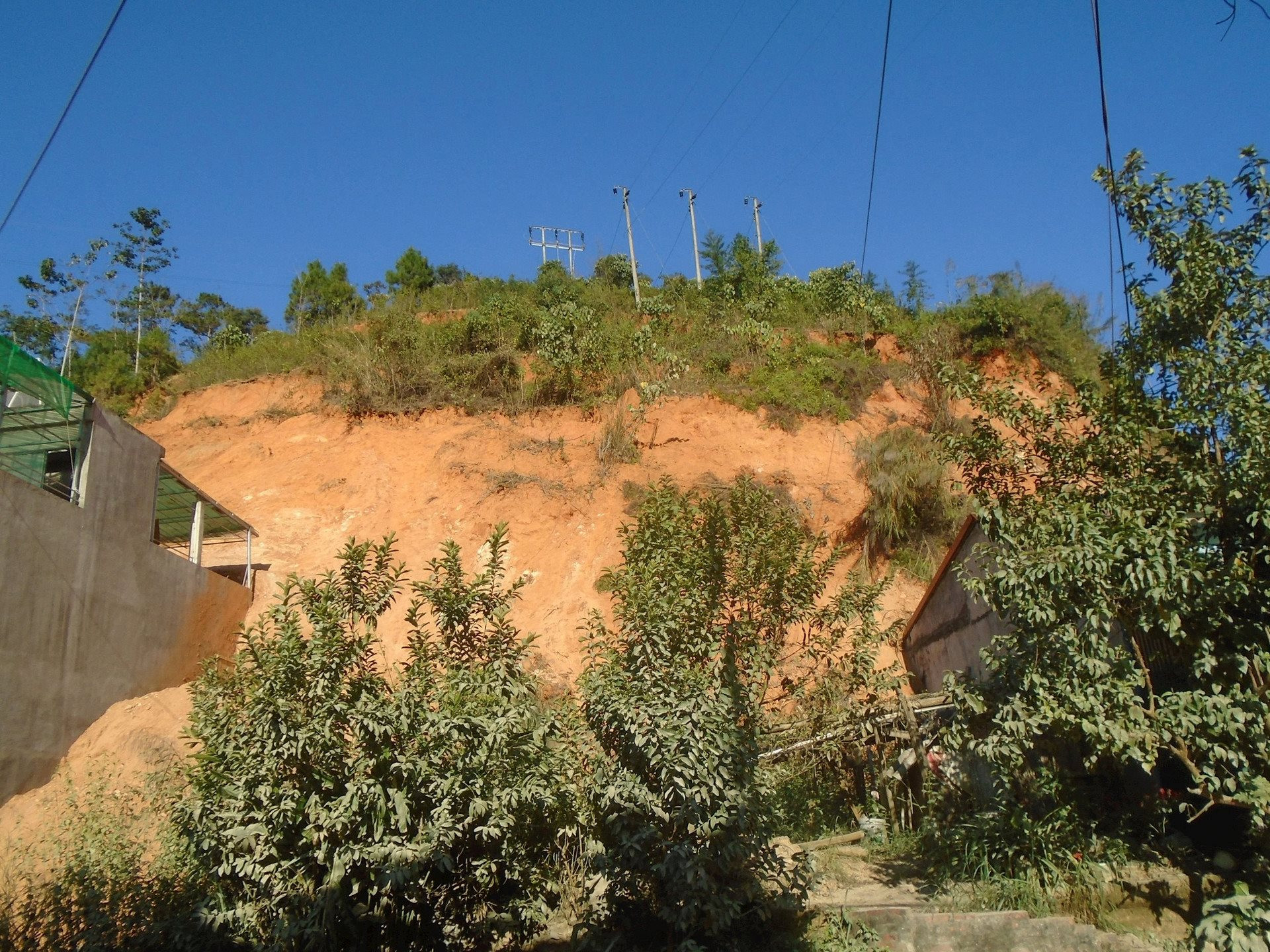
The survey results show that in the mountainous areas of 25 mountainous provinces in the North and Central regions, the investigation units in the Project identified 12,099 locations with signs of landslides from remote sensing image interpretation and terrain analysis on digital stereoscopic models, and 14,726 locations where landslides occurred from field surveys. Notably, the number of landslides identified from field surveys was recorded the most in the provinces of Son La, Nghe An, Quang Nam, Yen Bai..., but their distribution density according to natural area was recorded the most in the provinces of Yen Bai, Quang Ngai, Bac Kan, Quang Nam, Lang Son, Ha Giang, Son La,...
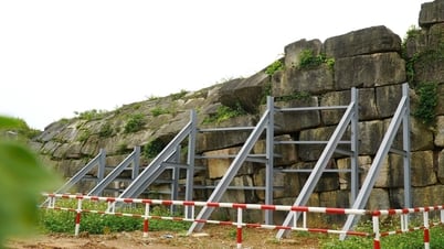
In particular, after inspecting the landslide scene in Phu Cuong commune, Tan Lac district, communes of Da Bac district, Hoa Binh province, and widespread flooding in the Red River Delta provinces, the Minister of Natural Resources and Environment at that time, Deputy Prime Minister Tran Hong Ha, urgently directed a project to conduct a survey of the current situation in 5 key communes of Da Bac district, Hoa Binh province.
PV: To achieve the above results, what difficulties did you and your colleagues overcome? Could you please share?
Mr. Pham Van Son: When we first started implementing the project, we encountered many difficulties in terms of technology and human resources. Because at that time, a set of technical regulations had not been established to serve the investigation of the current status of landslides, the Institute needed to coordinate and implement synchronously for all provinces according to the plan. At the same time, the scope of the investigation of the current status was over 37 mountainous provinces of Vietnam, so it would require a large amount of human resources, and had to coordinate with many units to implement together. To gradually overcome these difficulties, in 2012, when starting to implement in the first two provinces, Nghe An and Thanh Hoa, the Institute coordinated with units under the General Department of Geology and Minerals of Vietnam (now the Department of Geology of Vietnam and the Department of Minerals of Vietnam).
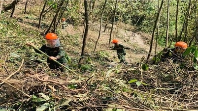
In addition, the field survey task is mainly carried out in mountainous areas, where the risk of landslides is very high. These are areas with many factors related to the formation and development of landslides such as large terrain slopes, weathered and cracked rocks and soil, and slope instability due to surface water and groundwater reducing the cohesion of rocks and soil. Not to mention, some areas are affected by population factors, and residents are at risk of being affected by landslides.
Overcoming the above difficulties, the Institute has successfully implemented the Project. I, along with the Institute's geological staff and coordinating units, have come up with general technical regulations for implementation, synchronized survey data, organized survey guidance sessions, assigned people to coordinate construction guidance to units in the field, and completed the set volume to ensure the technical requirements of the Project.
In addition to the difficulties, we were also fortunate to receive cooperation and coordination from local authorities throughout the investigation and survey process. When we learned that the survey team came to record information about landslides, the local authorities and people all wanted to have a database and data on landslides in their area, as a basis for warning, preventing natural disasters and planning and arranging population. The households affected by landslides all wanted the results of the survey to help the authorities to have a plan to help prevent the risk of landslides that endanger people and property or to receive government support to relocate if the area where their family lives is at risk of being affected by landslides.
PV: In response to people's expectations, how has the Institute of Geological Sciences and Mineral Resources brought landslide data to people? Could you please tell us?
Mr. Pham Van Son: The staff of the Institute of Geosciences and Mineral Resources and the coordinating units of the Ministry of Natural Resources and Environment have instructed on the use and transfer of the Project's products, which are a set of landslide risk warning zoning maps for 15 provinces and landslide status maps for 21 provinces, to local authorities and people.
The Institute hopes that the authorities and people can use these maps to serve the locality in planning for natural disaster prevention, minimizing damage, planning and developing population at each management level, ensuring stable socio-economic development in the locality. The good news is that many residential areas and houses recorded during the survey were affected and damaged by landslides and have been supported by local authorities to move and resettle for stable and long-term development.
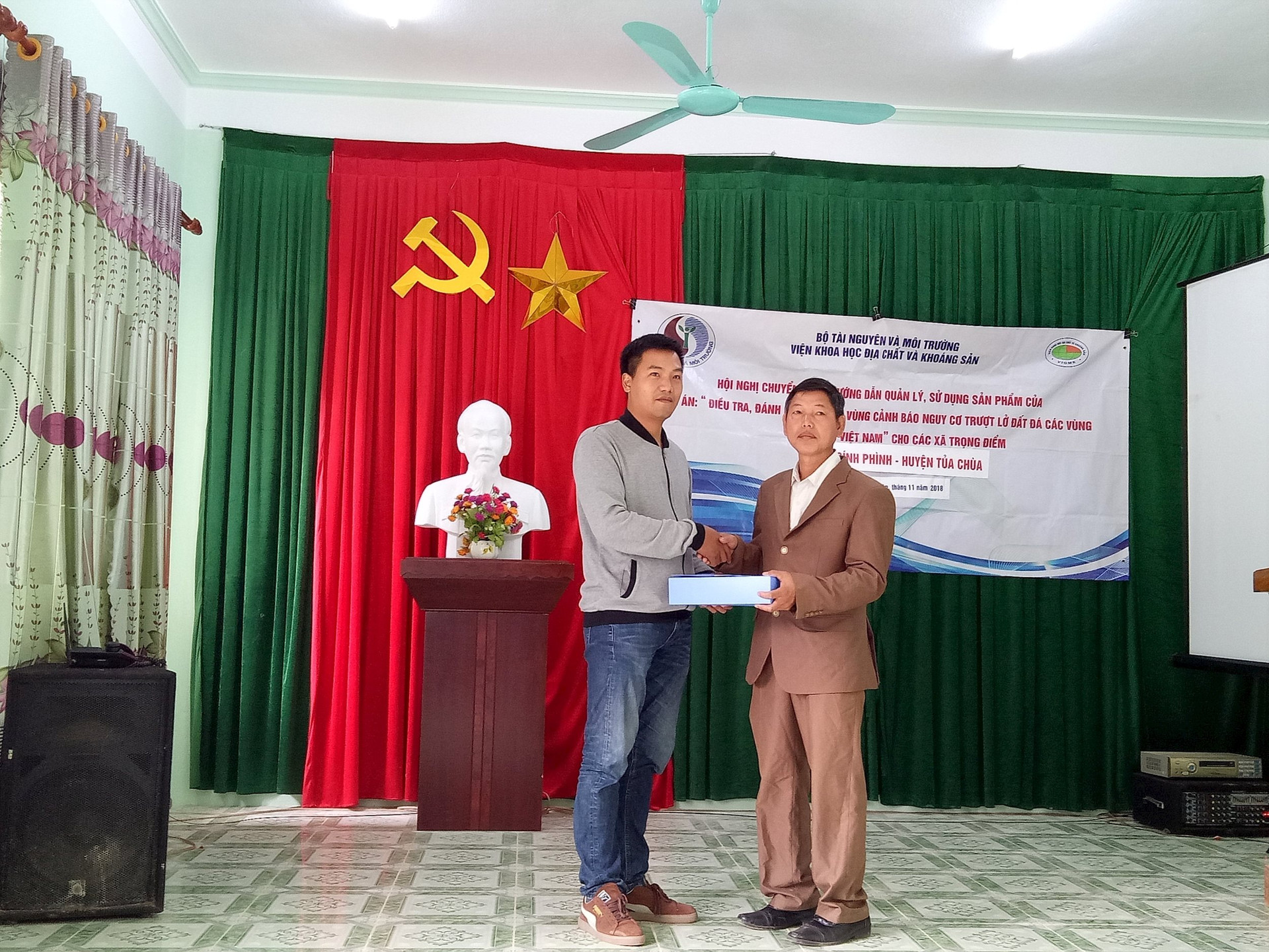
The handover of these valuable maps is being carried out in stages. During the years 2014-2021, the Institute has closely coordinated with the Central and local departments, agencies and branches to transfer and guide the management and use of the products completed in the years 2012-2018 to the localities at 3 Central level conferences, 6 Provincial level conferences and 59 Commune level conferences.
At the above conferences, in addition to the handover of completed results of previous years, the Institute and related units provided management and usage instructions to all officers assigned to directly manage and use the Project's products, supported localities in effectively using the transferred map sets, improving the ability to warn, prevent, avoid, and mitigate damage caused by landslides during the rainy and stormy seasons. The products received many positive comments and feedbacks to improve the quality of the products, making them suitable for users.
In addition to handing over the products, which are the above maps, the Institute of Geological Sciences and Mineral Resources also accompanies the locality throughout the process of use. This is demonstrated by the fact that when the locality uses the maps, any technical problems are enthusiastically supported by the Institute.
At the end of phase 1 in 2020, the Project achieved many detailed results assessing the level of landslide risk in many localities, motivating scientists to continue implementing the next tasks in phase 2. These positive results also made many localities that were handed over the product expect the Ministry of Natural Resources and Environment to continue building maps at the commune level and detailed landslide points to achieve higher efficiency in preventing flash floods and landslides.
Source
![[Photo] Prime Minister Pham Minh Chinh receives Rabbi Yoav Ben Tzur, Israeli Minister of Labor](https://vphoto.vietnam.vn/thumb/1200x675/vietnam/resource/IMAGE/2025/5/21/511bf6664512413ca5a275cbf3fb2f65)

![[Photo] Scientific workshop "Building a socialist model associated with socialist people in Hai Phong city in the period of 2025-2030 and the following years"](https://vphoto.vietnam.vn/thumb/1200x675/vietnam/resource/IMAGE/2025/5/21/5098e06c813243b1bf5670f9dc20ad0a)

![[Photo] Prime Minister Pham Minh Chinh attends the groundbreaking ceremony of Trump International Hung Yen Project](https://vphoto.vietnam.vn/thumb/1200x675/vietnam/resource/IMAGE/2025/5/21/ca84b87a74da4cddb2992a86966284cf)
![[Photo] Determining the pairs in the team semi-finals of the National Table Tennis Championship of Nhan Dan Newspaper](https://vphoto.vietnam.vn/thumb/1200x675/vietnam/resource/IMAGE/2025/5/21/eacbf7ae6a59497e9ae5da8e63d227bf)


Comment (0)