
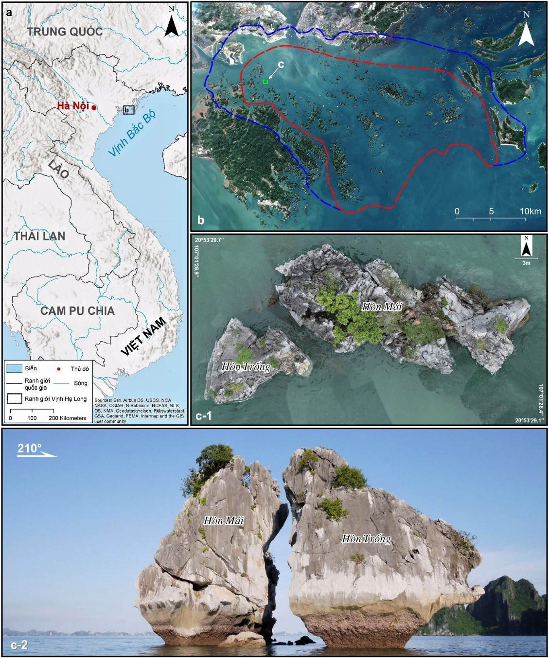
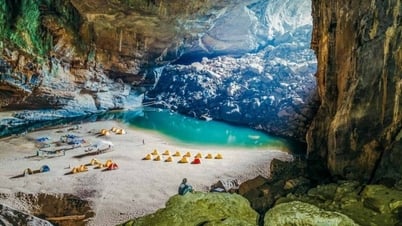
According to research, Trong Mai Islet is located in Ha Long Bay, far from the mainland, so the social factors affecting the erosion of the island's foot are mainly the movement of tourist boats in the Bay. The Institute of Geology and Mineral Resources identified two main social factors affecting the stability of Trong Mai Islet: civil activities and tourism activities.
Civil activities impact Ha Long Bay, including the Rooster and Hen Islet.
According to statistics, at the end of 2012, Ha Long Bay had 7 fishing villages with over 614 floating houses, most of which were concentrated in Hung Thang ward including the fishing villages: Cua Van, Ba Hang, Cap De and Vong Vieng. With many floating houses for seafood farming, trading and restaurant business, the large number of ships and passengers entering and leaving the area has affected the inland waterway traffic system, obstructing the flow of ships at sea, polluting the water environment; people, especially children, have difficulty accessing medical andeducational services... putting pressure on the work of protecting Ha Long Bay heritage.
This is also an important factor that increases the risk of geological disasters (landslides, rockfalls) because the natural forest ecosystem around the residential area will be greatly destroyed, and natural rock slopes will be affected by people anchoring their boats. In addition, the movement of a large number of boats will create artificial waves, increasing the possibility of erosion of the island's foot, creating frog jaws and triggering rockfalls.
Following the direction of the province, Ha Long City has developed a project to relocate and handle floating houses and fishing villages on the Bay and to stabilize the population, giving them a stable life and the opportunity to enjoy the social security policies of the state.
According to the report of Ha Long City, after more than 4 years of implementing the Project of relocating floating houses and fishing villages on the bay, the city has handed over 344 households to live on land; organized propaganda, mobilized and enforced the relocation of 287 floating houses, contributing to improving the effectiveness of conservation, promoting the value of Ha Long Bay and ensuring a stable and sustainable life for fishing village residents. Up to now, 364 households of the fishing village have settled on new land in the Ha Phong Ward Resettlement Area, hundreds of illiterate children of the fishing village have gone to school, Ha Long City has been organizing vocational training classes for fishermen, arranging suitable jobs for them.
According to investigation and survey data, although the relocation of people in the core area has been carried out very effectively, currently in the Ha Long Bay area, there are still some clusters of ships anchored, raising aquatic and seafood products in the water areas in the area east of Dau Be Island (Cong Sat lagoon) with about 50 ships and scattered in other areas. However, landslides and landslides in these areas do not occur at a high density, partly because these areas are all in wind-sheltered areas with well-developed vegetation cover, and partly because of long-term experience living at sea, people choose quite safe locations.
Tourism activities increase the risk of landslides on Hon Trong Mai
In addition to analyzing and evaluating the activities of people in the area of Hon Trong Mai, Ha Long Bay, the Institute of Geosciences and Mineral Resources also assessed the impact of tourism activities on the Bay on the current state of landslides, landslides, and erosion of the island's foot. Accordingly, there are 2 shipping lanes passing through the Hon Trong Mai area: the southern lane is about 120-200m away, the northern lane is about 100m away, large-sized vessels such as cargo ships, barges, overnight boats and high-speed boats often follow the above 2 lanes. Vehicles visiting the island often do not follow the lanes.
Ships, boats and canoes entering the Hon Trong Mai area often stop to take photos at a distance of 29m to 33m. After taking photos, the vehicles go around the island or turn around to visit other places. At low times (few vehicles visit), the vehicles can move forward (backward) away from the island to continue the journey. At peak times, when the density of visiting ships is high, the vehicles tend to approach the island and then circle back at a distance of 10m - 13m.
With this distance, tourist boats moving at slow speed create waves about 15-25cm high hitting Hon Trong Mai (under observation conditions at low tide). It will be more dangerous when the wave height rises to more than 2m (at high tide), the wave column will be larger and will have a greater impact on the system of cracks and cliffs, directly affecting the stability of Hon Trong Mai.
At peak times, the number of sightseeing boats is large, causing traffic jams along a long stretch, with vehicles jostling and colliding with each other and at risk of hitting the Rooster and Hen Islet.
Furthermore, according to monitoring data around the Hon Trong Mai area, there are many types of vehicles circulating here, including: large cargo ships, barges running along the channel, about 140m from the island; yachts, restaurant ships, overnight ships 100 - 140m; tourist ships on the day route 0 - 50m; canoes, water motorbikes.
Large vehicles passing through here are usually quite far away and move slowly, creating waves that are not high, ranging from 10 to 40cm (depending on distance and speed). When canoes, speedboats, and surf motorbikes pass by, they usually travel at high speed, creating much larger waves.
Canoes carrying 1 to 2 people when passing through the area at high speed can reach 30 km/h can create a wave column of at least 30 cm, larger canoes with a capacity of 4 to 8 people when moving at a speed of 30 km/h can create a water column of 40 to 60 cm, larger speedboats moving at a distance of >100m at the same speed can create a wave column >80 cm high that impacts the island. The impact time when these vehicles pass through lasts from 1 to 2 minutes. Not to mention some canoes visiting the island often circle the island many times.
According to the representative of the Quang Ninh Inland Waterways Port Authority, there are currently more than 400 tourist boats in operation in Ha Long Bay. Thus, the number of boats/ships operating in the Bay is relatively large. Most of these boats run on gasoline and a large number of old boats are vehicles that emit a large amount of CO2 into the water environment. Moreover, Ha Long Bay is a very famous tourist destination in our country and in the world, so the number of visitors is also relatively large, about 4-5 million visitors/year, which is also a factor that increases the amount of CO2 in the air as well as the water environment in the Bay.
Previous studies have shown that limestone affected by the environment is often easily dissolved (especially in CO2-rich environments) and is a soluble compound, so the rock is gradually eroded.
Finding solutions to reduce the impact on Hon Trong Mai
To minimize the impact on the stability of Trong Mai Islet, researchers have proposed a number of social solutions such as: Researching and dividing the flow and routes into and out of the observation and photography area of Trong Mai Islet; controlling the maximum distance that ships can approach Trong Mai Islet (estimated to be about 50m including the flow and route); controlling the time that ships stop to observe and take photos to minimize congestion and jostling; limiting the speed of ships passing through the area around the island to 5-10km/h when passing through the area with a radius of 200-300m around Trong Mai Islet.
In addition, it is necessary to regulate stopping times and arrange the schedule of sightseeing boats to avoid congestion and overload; upgrade the quality of sightseeing boats, convert boats using gasoline to green fuel (electricity); popularize and raise awareness of boat owners and tourists about environmental protection.
Regarding the conservation of Trong Mai Islet, the Department of Science and Technology of Quang Ninh province believes that the study and assessment of the current status and influencing factors as a basis for proposing solutions to conserve Trong Mai Islet is important and practical in serving the management, conservation and promotion of heritage values for many generations.
In the immediate future, the Department of Science and Technology of Quang Ninh province has issued a document advising the Provincial People's Committee to have solutions to divide traffic flow, time and speed of vehicles passing through appropriately, in order to minimize the impact of erosion and corrosion, affecting the safety and stability of Trong Mai islet.
The Quang Ninh Department of Transport has assigned the Quang Ninh Inland Waterways Port Authority to coordinate with the Ha Long Bay Management Board and related units to propagate and remind ship owners and captains not to exceed 10km/h when passing through this area.
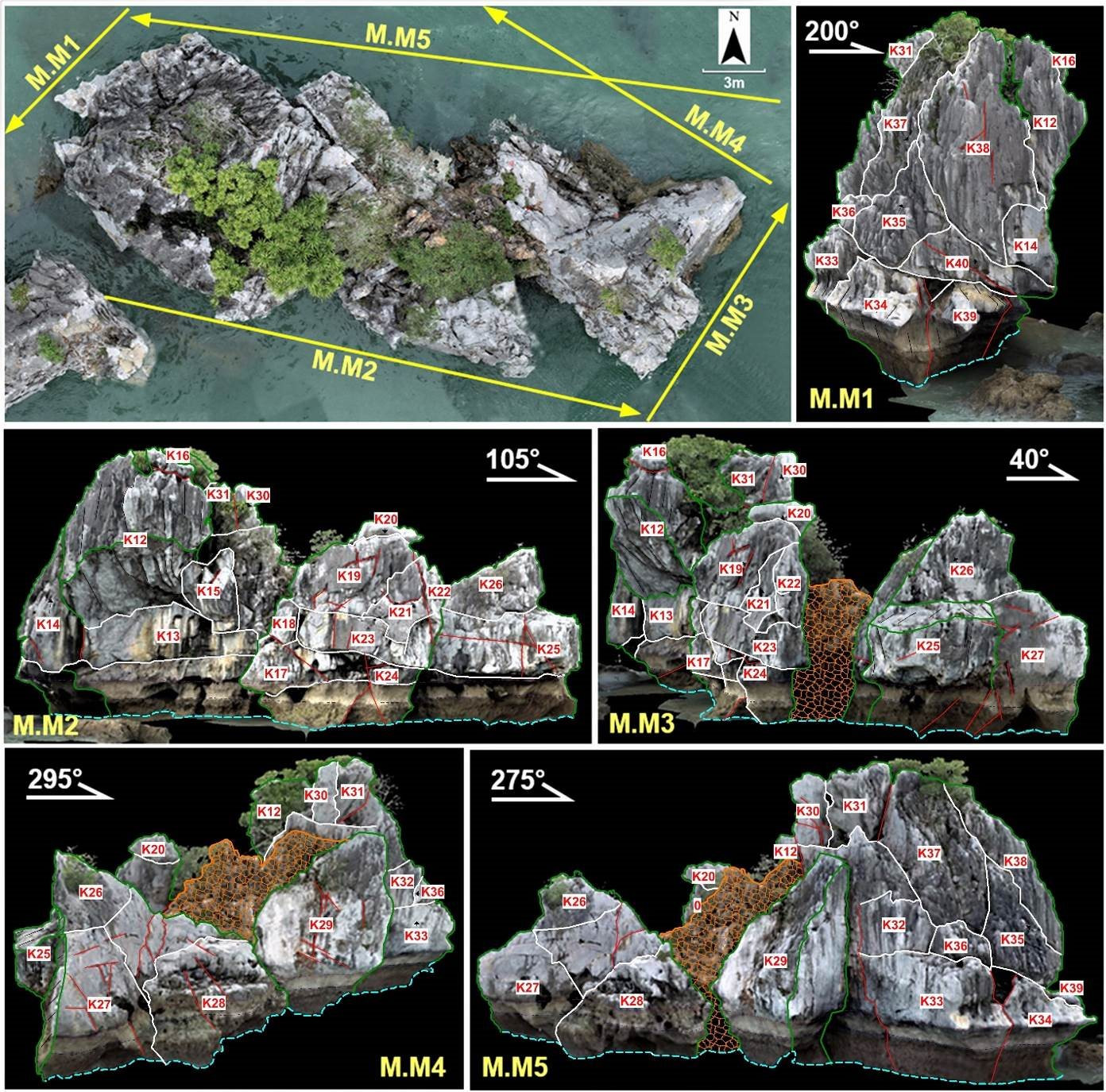
The results of the detailed investigation and measurement of the Hon Trong Mai area combined with satellite image analysis and 3D modeling using drones have identified 40 blocks at risk of landslides and collapse in the Hon Trong Mai area. Of which, Hon Trong has 11 blocks and Hon Mai has 29 blocks. Of the 40 blocks, 28 are at high risk (of which Hon Trong has 7 blocks and Hon Mai has 21 blocks), 2 are at medium risk in Hon Trong and 10 are at low risk (2 blocks in Hon Trong and 8 blocks in Hon Mai).
Source

![[Photo] The Government Standing Committee works with ministries and branches on the real estate market situation.](https://vphoto.vietnam.vn/thumb/1200x675/vietnam/resource/IMAGE/2025/5/24/e9b5bc2313d14c9499b8c9b83226adba)


![[Photo] Ho Chi Minh City holds funeral for former President Tran Duc Luong](https://vphoto.vietnam.vn/thumb/1200x675/vietnam/resource/IMAGE/2025/5/24/9c1858ebd3d04170b6cef2e6bcb2019e)


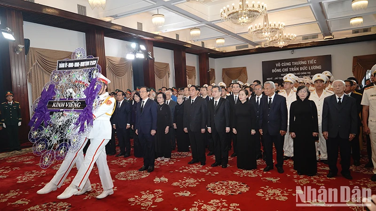
![[Photo] Party and State leaders visit former President Tran Duc Luong](https://vphoto.vietnam.vn/thumb/1200x675/vietnam/resource/IMAGE/2025/5/24/960db9b19102400e8df68d5a6caadcf6)


Comment (0)