
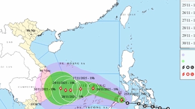
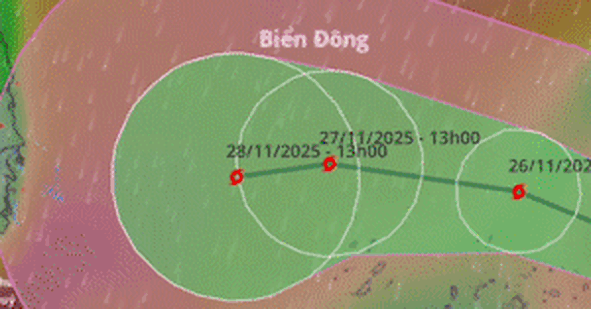
1. Forecast for the next 24 to 48 hours:
+) 04:00 on November 27: storm moving in West Northwest direction, speed 15-20km/h.
Location: 13.0N-115.2E; in the central East Sea, about 200km northeast of Song Tu Tay Island; Likely to strengthen; Intensity: level 10, gust level 13.
Affected area: Central East Sea area (including the sea area north of Truong Sa special zone).
+) 04:00 on November 28: storm moving in West Southwest direction, speed 5-10km/h.
Location: 12.4N-113.5E; in the central East Sea, about 150km northwest of Song Tu Tay Island; Likely to strengthen; Intensity: Level 11, gusts level 14.
Affected area: the central East Sea area (including the sea area north of Truong Sa special zone).
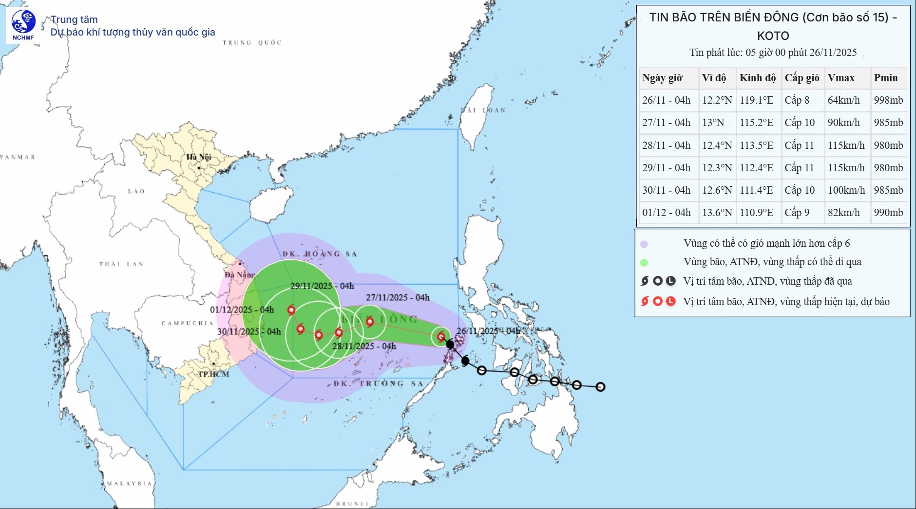
+) 04:00 on November 29: storm moving west, speed about 5km/h.
Location : 12.3N-112.4E; on the western sea area of the central East Sea, about 250km west-northwest of Song Tu Tay island; Intensity: Level 11, gust level 14.
Affected area: the central East Sea area (including the sea area north of Truong Sa special zone).
2. Warning of developments in the next 48 to 72 hours :
From the next 72 to 120 hours, the storm will move to the Northwest, at a speed of about 5km/h and gradually weaken.
At sea: The central East Sea area (including the sea area north of Truong Sa special zone) has strong winds of level 6-7; the area near the storm's eye has strong winds of level 8-10, gusting to level 13; waves 4.0-6.0m high, the area near the storm's eye is 6.0-8.0m; the sea is very rough.
Warning: During November 27-28, the central East Sea area (including the sea area north of Truong Sa special zone) may be affected by strong winds of level 11, gusts of level 14, waves 7.0-9.0m high, and rough seas.
Vessels operating in the above mentioned dangerous areas are susceptible to the impact of storms, whirlwinds, strong winds and large waves.
Source: https://baonghean.vn/tin-bao-tren-bien-dong-con-bao-so-15-10312595.html


![[Photo] Close-up of heavy damage at the school located on the banks of the Ban Thach River](/_next/image?url=https%3A%2F%2Fvphoto.vietnam.vn%2Fthumb%2F1200x675%2Fvietnam%2Fresource%2FIMAGE%2F2025%2F11%2F26%2F1764152130492_ndo_bl_img-8188-8805-jpg.webp&w=3840&q=75)


![[Photo] Opening of the 28th Session of the Hanoi People's Council](https://vphoto.vietnam.vn/thumb/402x226/vietnam/resource/IMAGE/2025/11/26/1764155991133_image.jpeg)


Comment (0)