
This afternoon (September 18), on its fanpage, the National Center for Hydro-Meteorological Forecasting issued a warning to people about fake news about tropical depression/ storm No. 4 .
According to the Center, the tropical depression is still offshore and has not entered as rumored online.
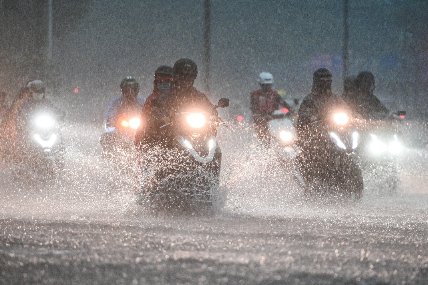
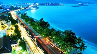
This afternoon and evening, the provinces of Quang Tri - Quang Ngai will have a temporary decrease in rain. This is not a phenomenon of rain reduction when the storm center passes.
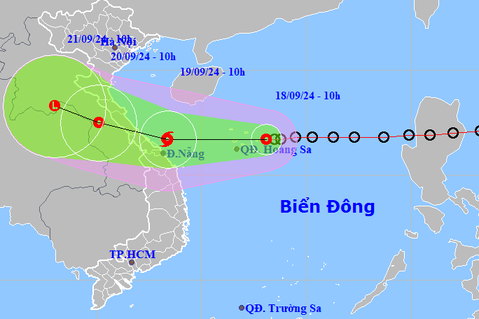
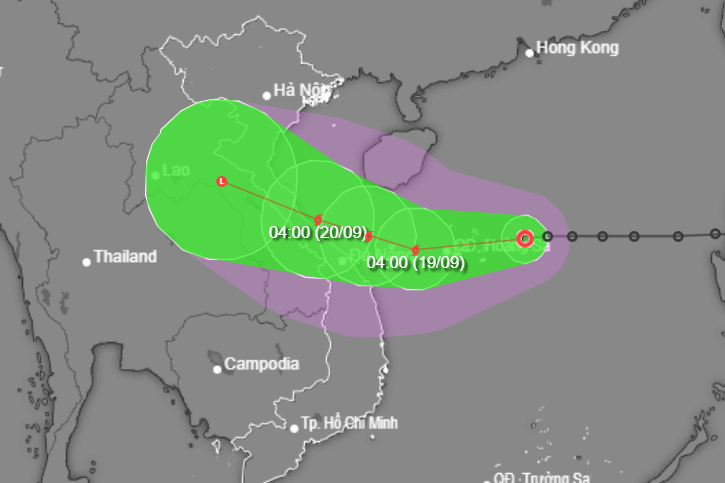
“The tropical depression is still far away from the Hoang Sa archipelago, and will approach the shore tomorrow morning and cause heavy rain and strong winds again from midnight to tomorrow morning (September 19), especially in the provinces from Quang Nam to Nghe An.
"We hope people do not subjectively think the storm has passed and lose vigilance," the meteorological agency emphasized.
At the same time, the National Center for Hydro-Meteorological Forecasting said that currently on social networking platforms, there are too many "self-proclaimed and virtual storm experts" who are "slashing" that the tropical depression/storm has entered the Central region, so the Center has issued this warning.
In particular, the National Center for Hydro-Meteorological Forecasting is the sole agency to issue and broadcast bulletins on forecasts and warnings of hydro-meteorological disasters and disaster risk levels nationwide according to regulations.
Citizens only follow the Center's page or other official pages that cite sources from the Center. Sources that are not directly issued by the Center are all unverified and fabricated news.
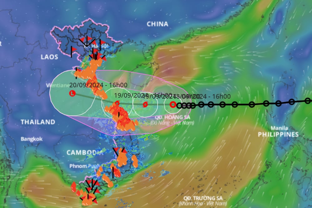
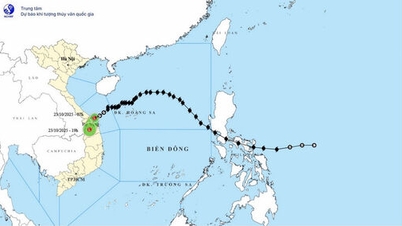
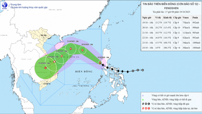
On the same afternoon, the Center's bulletin said that at 4 p.m., the center of the tropical depression was located in the Hoang Sa archipelago, about 430 km east-northeast of Da Nang. The strongest wind near the center of the tropical depression was level 7 (50-61 km/h), gusting to level 9; moving mainly westward at a speed of about 15 km/h.
It is forecasted that in the next 12 hours, the tropical depression will likely strengthen into a storm, level 8 intensity, gusting to level 10.
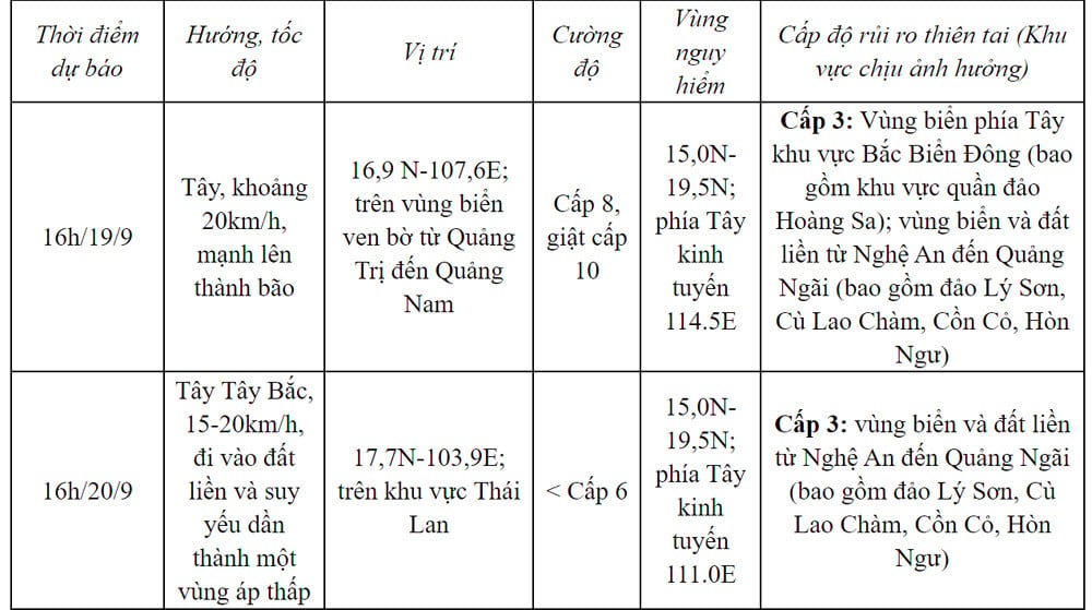
Due to the influence of the tropical depression, which later strengthened into a storm, the North East Sea area (including the Hoang Sa archipelago), the sea area from Nghe An to Quang Ngai (including Ly Son island district, Cu Lao Cham, Con Co, Hon Ngu) had strong winds of level 6-7, waves 2-4m high, the area near the storm center had winds of level 8 (62-74km/h), gusts of level 10 (89-102km/h), waves 3-5m high, rough seas.
Vessels operating in the above mentioned dangerous areas are susceptible to the impact of storms, whirlwinds, strong winds and large waves.
Coastal provinces from Quang Binh to Quang Nam need to be on guard against rising water levels due to strong winds of 0.3-0.5m, combined with high tides and big waves causing landslides of sea dykes and embankments, and flooding in low-lying areas.
On land, from early morning and on September 19, coastal areas from Ha Tinh to Quang Ngai will have winds gradually increasing to level 6-7, near the storm's eye level 8 (62-74km/h), gusting to level 10 (89-102km/h); deep inland, there will be gusts of level 6-7.
From this evening to September 20, in the North Central and Central Central regions, there will be heavy to very heavy rain with common rainfall from 100-300mm, locally over 500mm. From this evening to September 19, the Central Highlands and the South will have moderate rain, heavy rain and thunderstorms, locally very heavy rain with common rainfall from 30-60mm, some places over 100mm (rain concentrated in the afternoon and night).
Tropical depression 180km from Hoang Sa, Central region begins to have heavy rain
Why is there heavy rain in the Central region even though storm number 4 has not officially formed?
Storm No. 4 is coming, Central region will have heavy rain from September 18
Source: https://vietnamnet.vn/xuat-hien-tin-gia-bao-so-4-da-vao-mien-trung-trung-tam-khi-tuong-canh-bao-khan-2323426.html

![[Photo] Prime Minister Pham Minh Chinh chairs meeting on railway projects](https://vphoto.vietnam.vn/thumb/1200x675/vietnam/resource/IMAGE/2025/10/23/1761206277171_dsc-9703-jpg.webp)


![[Photo] President Luong Cuong holds talks with South African President Matamela Cyril Ramaphosa](https://vphoto.vietnam.vn/thumb/1200x675/vietnam/resource/IMAGE/2025/10/23/1761221878741_ndo_br_1-8416-jpg.webp)
![[Photo] Prime Minister Pham Minh Chinh meets with South African President Matamela Cyril Ramaphosa](https://vphoto.vietnam.vn/thumb/1200x675/vietnam/resource/IMAGE/2025/10/23/1761226081024_dsc-9845-jpg.webp)


Comment (0)