

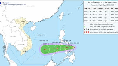
(Source: National Center for Hydro-Meteorological Forecasting)
According to the National Center for Hydro-Meteorological Forecasting, early on the morning of October 23, after entering the coastal waters of Hue- Da Nang city area, the tropical depression (weakened from storm No. 12) weakened into a low pressure area.
This is the last news on storm number 12.
At 7:00 a.m., the center of the low pressure area was at about 16.1 degrees North latitude; 108.5 degrees East longitude. The strongest wind in the center of the low pressure area decreased to below level 6 (below 39 km/h).
It is forecasted that in the next 12 hours, the low pressure area will continue to move mainly in the southwest direction, weakening and gradually dissipating.
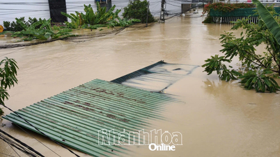
Due to the influence of the cold air strengthening combined with the East wind disturbance and post-storm circulation, the situation of heavy rain in the Central region and strong winds at sea is still complicated. It is necessary to pay attention to the next forecast bulletins of heavy rain and strong winds at sea.
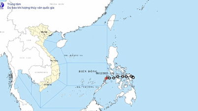
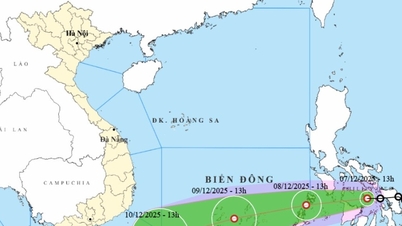
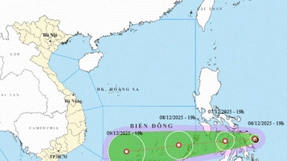
Regarding the development of the tropical depression near the East Sea, the National Center for Hydro-Meteorological Forecasting said that at 7:00 a.m. on October 23, the center of the tropical depression was at about 20.4 degrees North latitude and 121.4 degrees East longitude.
The strongest wind near the center of the tropical depression is level 7 (50-61km/h), gusting to level 9. Moving southwest at a speed of about 20km/h.
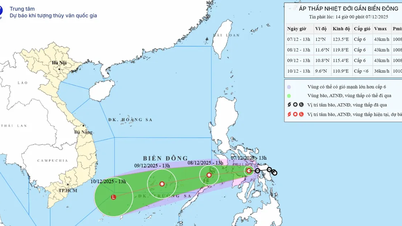
Forecast until 7am on October 24, the tropical depression in the eastern sea of the North East Sea with strong winds of level 6, gusts of level 8, moving in the South-Southwest direction at a speed of 20km/h. The affected area is the eastern sea of the North East Sea. Disaster risk level 3.
At 7:00 a.m. on October 25, the tropical depression was about 250 km east of Hoang Sa special zone with winds below level 6, moving southwest at a speed of about 20 km/h, gradually weakening. The affected area is the sea area south of the North East Sea. Disaster risk level 3.
Due to the influence of low pressure combined with strengthening cold air, the eastern sea area of the North East Sea has strong winds of level 6-7, gusts of level 9, waves 3-5m high, and rough seas.
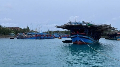
Ships operating in the above-mentioned dangerous areas are likely to be affected by storms, whirlwinds, strong winds and big waves./.
According to Vietnamplus
Source: https://www.vietnamplus.vn/tin-cuoi-cung-ve-bao-so-12-ap-thap-nhiet-doi-suy-yeu-thanh-vung-ap-thap-post1072041.vnp
Source: https://baolongan.vn/tin-cuoi-cung-ve-bao-so-12-ap-thap-nhiet-doi-suy-y-u-tha-nh-vu-ng-ap-tha-p-a205054.html


Comment (0)