
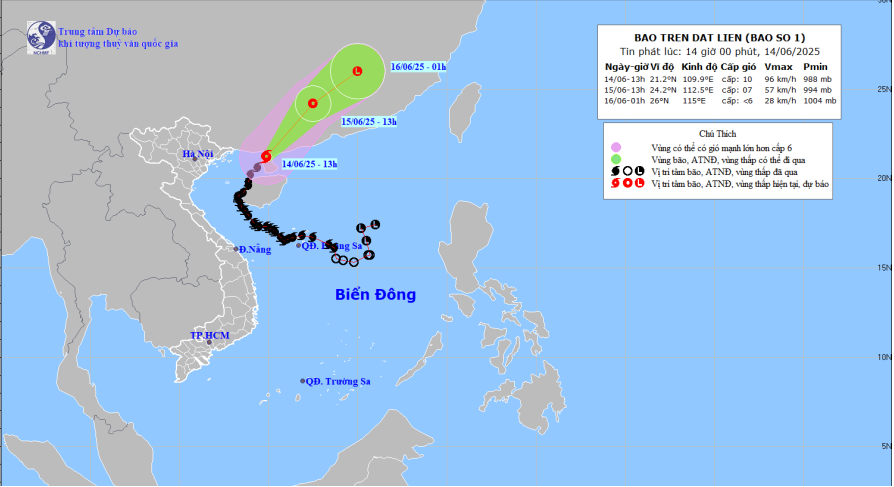
Forecast map of trajectory and intensity of storm No. 1 at 14:00 on June 14, 2025
According to information from the Tay Ninh Province Hydrometeorological Station, at 1:00 p.m. on June 14, the center of the storm was located at approximately 21.2 degrees North latitude; 109.9 degrees East longitude, on the Leizhou Peninsula (China). The strongest wind near the center of the storm was level 10 (89-102 km/h), gusting to level 12; moving northeast at a speed of 15-20 km/h.
Forecast for the storm (in the next 36 hours), the storm will move northeast, at a speed of 15-20km/h and gradually weaken into a tropical depression over the mainland of Guangdong province (China).
Due to the impact of the storm, the weather in Tay Ninh province is cloudy to cloudy, with rain in some places, in the afternoon and evening there are scattered showers and thunderstorms, some places have moderate rain, locally heavy rain, during thunderstorms, beware of thunder, strong gusts of wind and tornadoes, sunny days are intermittent.
HT
Source: https://baotayninh.vn/anh-huong-boi-con-ba-o-so-1-nhieu-dia-phuong-tai-tay-ninh-co-noi-mua-vua-cuc-bo-mua-to-a191386.html


Comment (0)