
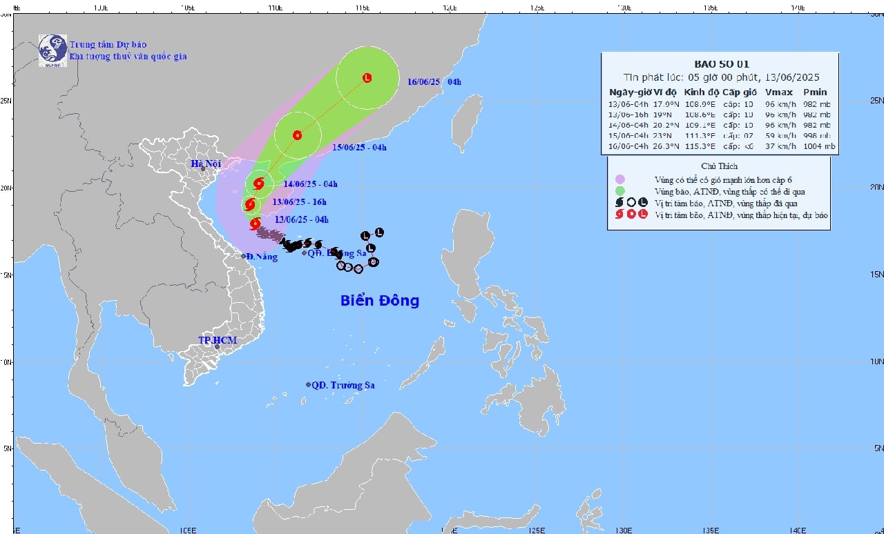
Forecast of trajectory and intensity of storm No. 1 at 5:00 a.m. on June 13, 2025.
At 4:00 a.m. on June 13, the center of the storm was located at approximately 17.9 degrees North latitude; 108.9 degrees East longitude, in the sea south of Hainan Island (China). The strongest wind near the center of the storm was level 10 (89-102 km/h), gusting to level 13; moving northwest at a speed of approximately 10 km/h.
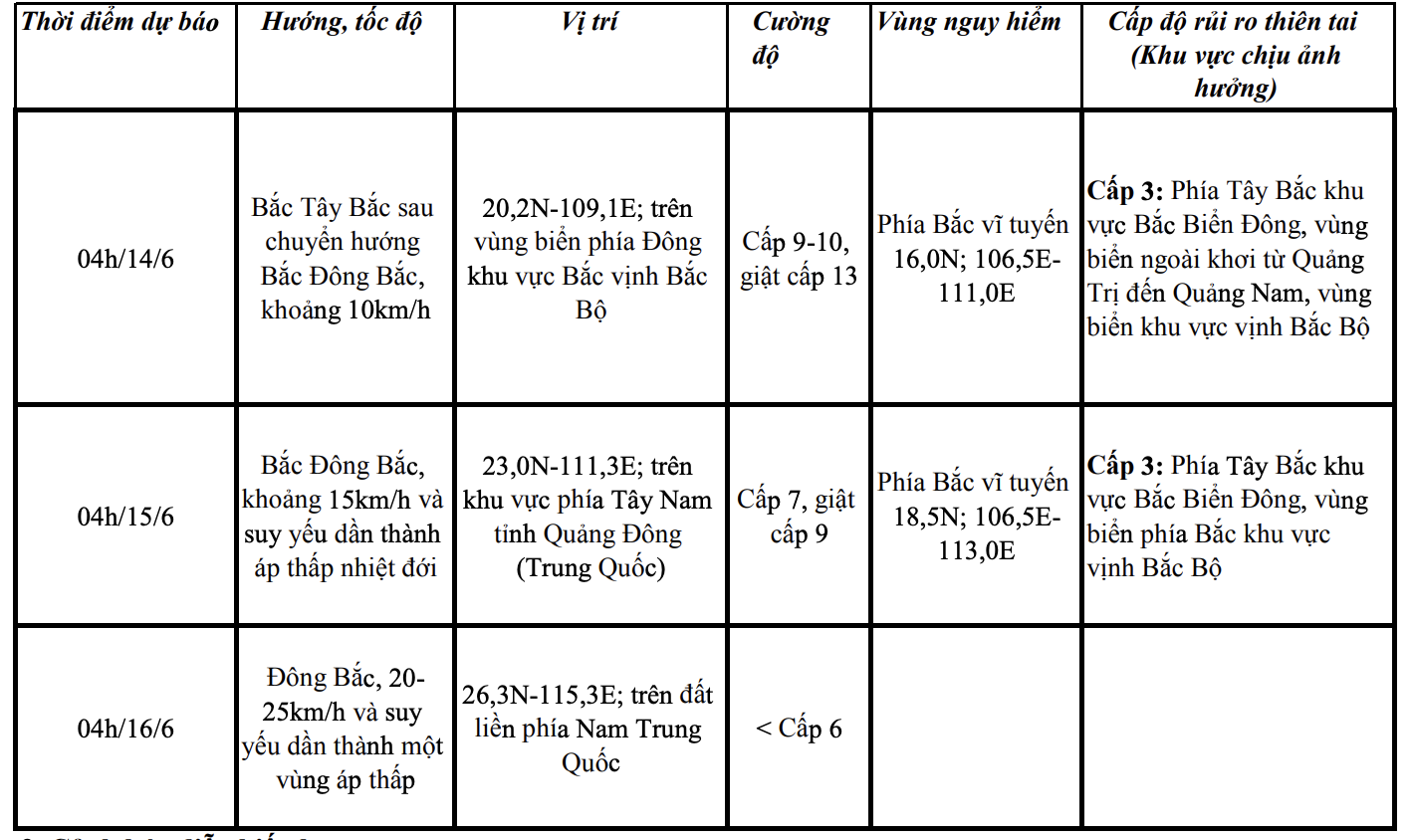
Forecast of storm developments in the next 24 to 72 hours as follows:
Thunderstorm warning
During the day and night of June 13, Thanh Hoa will have scattered showers and thunderstorms, with localized heavy rain (rain concentrated in the coastal plains and the South and Southwest of Thanh Hoa province); rainfall is generally 10-25mm, with some places over 50mm. During thunderstorms, there is a possibility of tornadoes, lightning and strong gusts of wind.
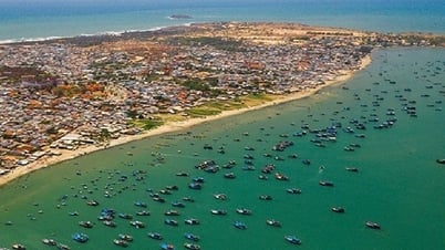
Strong winds and big waves at sea
Forecast for today and tonight (June 13) Thanh Hoa sea area will have showers and thunderstorms, strong northeast wind level 6, level 7, gust level 8, level 9, waves from 2-3.5m high, rough sea. During the storm, there is a possibility of tornadoes, whirlwinds and strong gusts of wind.
Coastal waters of districts: Nga Son, Hau Loc, Hoang Hoa, Sam Son City, Quang Xuong, Nghi Son Town and islands of Hon Ne, Hon Me, Hon Mieu, Hon Dot have strong northwest winds of level 6, gusting to level 7; rough seas. Waves are 1.5-2.5m high.
Offshore Thanh Hoa, strong northwest wind level 6-7, gust level 8-9, rough sea. Waves 2.5-3.5m high.
On the morning of June 14, in Thanh Hoa sea area, the West and Southwest wind is strong at level 6, gusting to level 7. The highest wave height is from 1.5-2.5m. Rough sea.
From noon on June 14, wind and waves gradually decreased.
Warning level of natural disaster risk due to strong winds at sea: Level 2
Due to the impact of high tides and storm surges, the coastal waters of Thanh Hoa are likely to experience unusually high sea levels, causing flooding in some low-lying coastal and river mouth areas between 5-7 p.m. on June 13 and 14.
Meteorological experts warn that all ships, anchorages, aquaculture areas, sea dykes and other activities in the above sea areas are at high risk of being affected by thunderstorms, strong winds and big waves.
NDS (Source: Thanh Hoa Hydrometeorological Station)
Source: https://baothanhhoa.vn/bao-so-1-giat-cap-13-gay-gio-manh-song-lon-tren-vung-bien-thanh-hoa-251958.htm


![[Video] Instructions on the process of receiving and handling administrative procedure records according to the provisions of Decree No. 118 of the Government](https://vphoto.vietnam.vn/thumb/402x226/vietnam/resource/IMAGE/2025/6/17/3fa28bed9d654390aa05ac37850ed5b6)


Comment (0)