
Update at 9am this morning (November 6), the National Center for Hydro-Meteorological Forecasting said that the center of storm No. 13 Kalmaegi is about 290km East Southeast of Quy Nhon ( Gia Lai ).
The strongest wind near the storm center is level 15 (167-183km/h), gusting to level 17, 1 level higher than before.
In the coming hours, the storm will continue to move at a very fast speed, about 25-30km/h in the West Northwest direction and maintain intensity at level 14-15, then decrease slightly.

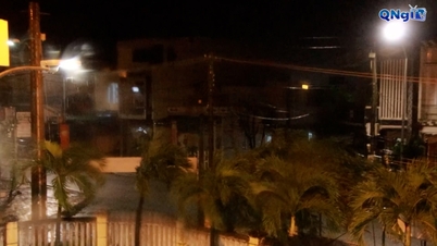
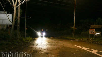
Meteorological experts say that tonight and tonight, the storm will make landfall in the central region of our country with very strong intensity, affecting a very large area.
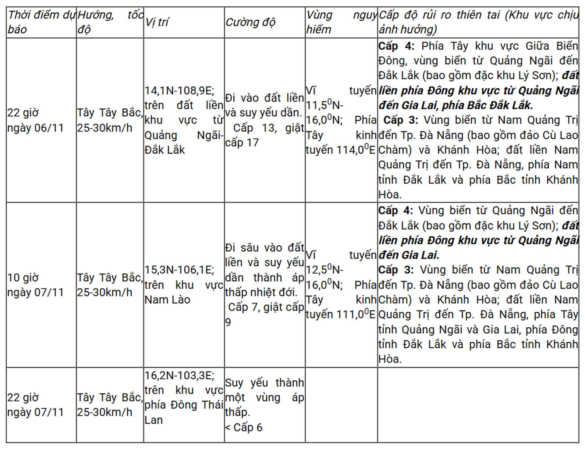
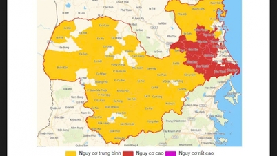
The meteorological agency warns of a level 4 natural disaster risk (very high level, just below level 5 which is a disaster level) in the western part of the central East Sea, the sea area from Quang Ngai to Dak Lak (including Ly Son special zone); the mainland in the eastern part of the area from Quang Ngai to Gia Lai.
Level 3: Sea area from South Quang Tri to Da Nang (including Cu Lao Cham Island) and Khanh Hoa; mainland from South Quang Tri to Da Nang, East of Dak Lak province and North of Khanh Hoa province.
From this evening, the warning level of natural disaster risk is level 4 in the sea area from Quang Ngai to Dak Lak (including Ly Son special zone); the eastern mainland area from Quang Ngai to Gia Lai.
Level 3: Sea area from South Quang Tri to Da Nang (including Cu Lao Cham Island) and Khanh Hoa; mainland from South Quang Tri to Da Nang, west of Quang Ngai and Gia Lai provinces, east of Dak Lak province and north of Khanh Hoa province.
Specifically in terms of intensity, storm Kalmaegi is considered the strongest storm to hit our country since the beginning of 2025, with a very large area of strong winds above level 6, stretching from South Quang Tri to North Khanh Hoa.
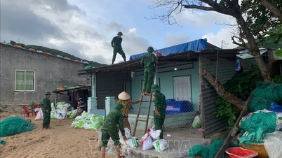
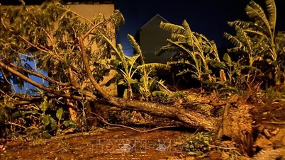
Forecast, at 7pm, when the storm center is on the coastal area of Quang Ngai - Dak Lak, the storm intensity will still be very strong at level 13-14, gusting to level 17. By 10pm, the storm center will be on land in the area from Quang Ngai - Dak Lak with the intensity still strong at level 13, gusting to level 17. With this wind speed, the storm can uproot trees, blow off roofs of houses, especially temporary houses or weak structures; overturn vehicles, light vehicles and cause serious danger to people walking outdoors.
From this evening, on the mainland from the South of Da Nang City to Dak Lak, the wind will gradually increase to level 6-7, then increase to level 8-9, the area near the storm's eye will be level 10-12 (focusing on the East of Quang Ngai - Gia Lai provinces), gusting to level 14-15.
The area from South Quang Tri to North Da Nang City and North Khanh Hoa Province has strong winds of level 6-7, gusting to level 8-9. The strongest winds will be from tonight to early tomorrow morning.
At the same time, from tonight and tonight, the western provinces from Quang Ngai to Gia Lai will see winds gradually increase to level 6-7, and near the storm's eye, winds will increase to level 8-9, gusting to level 11.
At 10:00 a.m. on November 6, the storm center was 270 km East Southeast of Quy Nhon (Gia Lai); the strongest wind was level 15 (167–183 km/h), gusting over level 17. Updates will be made in the next hours when the storm makes landfall. Source: NCHMF
Mr. Mai Van Khiem, Director of the National Center for Hydro-Meteorological Forecasting, emphasized: "We assess this as an especially dangerous storm, with very strong intensity in the East Sea area. When it makes landfall, the storm may still maintain very strong winds, causing strong impacts from the evening to the night of November 6."
At the same time, the circulation of storm No. 13 caused widespread heavy rain in the South Central and Central Central regions. In particular, the rain center was concentrated from Da Nang to Dak Lak with common rainfall of 200-400mm, in some places over 600mm in two days 6-7/11.
In the area from South Quang Tri to Hue, Khanh Hoa and Lam Dong, the rain is generally from 150-300mm, in some places it is very heavy rain over 450mm. From November 8, heavy rain in the above areas tends to decrease.
Particularly in Thanh Hoa to Northern Quang Tri, from November 7-8, the storm circulation will cause moderate to heavy rain with rainfall of 50-150mm, in some places very heavy rain over 200mm.
Meteorological experts also warned that heavy, concentrated rain in a short period of time, combined with high water levels in river systems, increases the risk of flooding in many areas.
Provinces and cities under flood warning include Dak Lak, Gia Lai, Quang Ngai, Da Nang and Hue. Floodwater levels may exceed alert levels 2 to 3, and even higher than alert level 3 on some rivers.
The entire mountainous area, especially the West Central Highlands and Central Highlands, is warned of a high risk of flash floods and landslides.
Vietnamnet.vn
Source: https://vietnamnet.vn/bao-so-13-kalmaegi-tang-len-cap-15-dem-nay-dinh-diem-mua-rat-to-va-gio-cuc-manh-2459851.html
![[Photo] Prime Minister Pham Minh Chinh receives the delegation of the Semiconductor Manufacturing International (SEMI)](https://vphoto.vietnam.vn/thumb/1200x675/vietnam/resource/IMAGE/2025/11/06/1762434628831_dsc-0219-jpg.webp)
![[Photo] Closing of the 14th Conference of the 13th Party Central Committee](https://vphoto.vietnam.vn/thumb/1200x675/vietnam/resource/IMAGE/2025/11/06/1762404919012_a1-bnd-5975-5183-jpg.webp)


Comment (0)