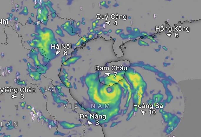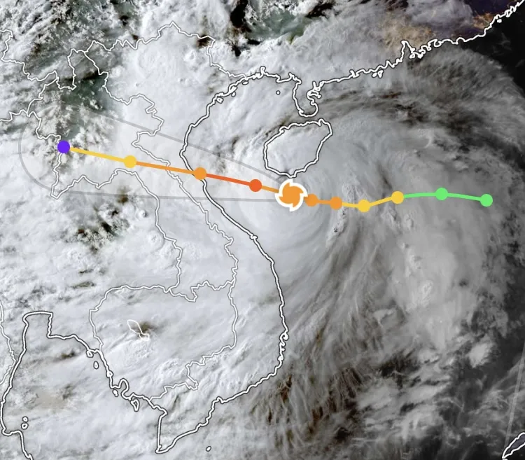
According to the National Center for Meteorological and Hydrological Forecasting: at 6 PM on August 24th, Typhoon No. 5 had intensified to level 14 (150-166 km/hour), with gusts up to level 17, moving in a west-northwest direction at a reduced speed of approximately 15 km/hour.
Previously, the storm reached level 12 on the morning of August 24th and intensified to level 13 in the early afternoon today. Its basic direction of movement today is westward. Thus, in just two hours, the storm has increased by one level and is showing signs of changing direction.
At 6 PM, the storm's center was located at approximately 17.8 degrees North latitude and 109.6 degrees East longitude, about 435km east of Nghe An, 410km east of Ha Tinh , and 360km east of northern Quang Tri.
According to the Department of Meteorology and Hydrology ( Ministry of Agriculture and Environment ), the meteorological agency is currently issuing warnings about Typhoon No. 5 every hour .

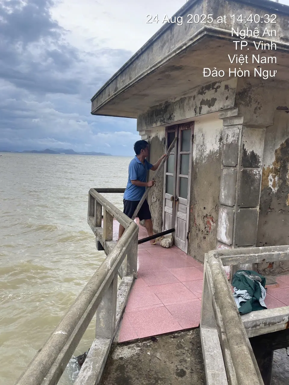
Eight localities simultaneously issued a ban on sea travel.
According to the Department of Dike Management and Disaster Prevention (Ministry of Agriculture and Environment), as of now, eight coastal provinces and cities from Ninh Binh to Quang Ngai have issued a ban on sailing, requiring all vessels to stop going out to sea to avoid risks.
Over 675,000 people in coastal and low-lying areas from Thanh Hoa to Da Nang had been prepared for evacuation to safe locations before the landfall.


Large storm cloud disc - rainfall exceeding 700mm in some areas forecast.
The National Center for Meteorological and Hydrological Forecasting warns that in the next 24-48 hours , the storm will continue to maintain its strong intensity as it approaches the mainland, causing widespread heavy rain.
Rainfall is expected to be between 200-400mm, with exceptionally heavy rainfall exceeding 700mm in some areas from Thanh Hoa to northern Quang Tri. The meteorological agency warns of a high risk of flash floods, landslides, and flooding in the North Central and Northern provinces, along with the possibility of tornadoes, lightning, and strong gusts of wind during thunderstorms.
Heavy rain is forecast to continue until August 26th , then gradually decrease, but low-lying areas and dike systems will continue to face significant pressure. Coastal localities need to proactively protect the safety of people, infrastructure, and agricultural production, including nearly 300,000 hectares of rice, over 77,000 hectares of fruit trees, and 57,000 hectares of rubber plantations at risk of being affected.
Source: https://www.sggp.org.vn/bao-so-5-da-dat-muc-cuong-phong-post809973.html


![[Video] Vehicles banned from crossing Long Bien Bridge for 2 months.](https://vphoto.vietnam.vn/thumb/1200x675/vietnam/resource/IMAGE/2026/03/28/1774680289371_1-png.)


![[Photo] General Secretary To Lam attends the ceremony commemorating the 80th anniversary of the Traditional Day of the Vietnamese Sports and Physical Education Sector.](https://vphoto.vietnam.vn/thumb/1200x675/vietnam/resource/IMAGE/2026/03/28/1774673986806_a1-bnd-4909-8531-jpg.)
![[Photo] Close-up of an Australian warship visiting Tien Sa port, Da Nang](https://vphoto.vietnam.vn/thumb/1200x675/vietnam/resource/IMAGE/2026/03/28/1774675489416_tau-5-jpg.)


Comment (0)