
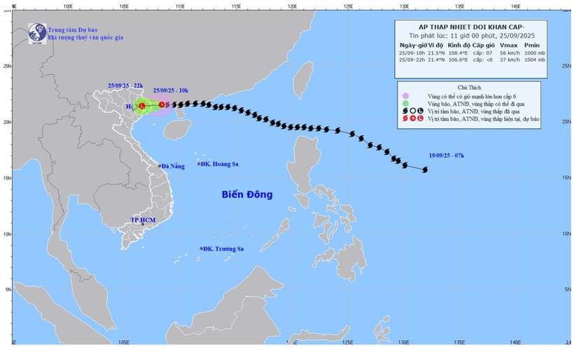
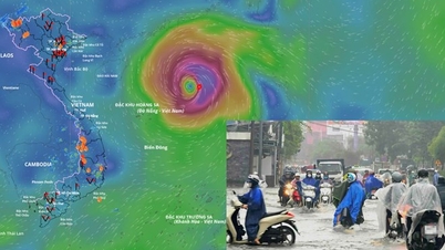
Map of forecast trajectory and intensity of tropical depression issued at 11:00 a.m. on September 25, 2025. (Photo: National Center for Hydro-Meteorological Forecasting)
Due to the influence of storm No. 9, in Bach Long Vi special zone ( Hai Phong ), there were strong winds of level 7, gusts of level 8, waves 2m high; Quang Ha (Quang Ninh) had strong winds of level 6, gusts of level 8; Cua Ong (Quang Ninh) had strong winds of level 6; Mong Cai (Quang Ninh), Phu Lien (Hai Phong), Van Ly (Ninh Binh) and Vu Ninh (Hung Yen) had gusts of level 6.
At 10:00, the center of the tropical depression was at about 21.5 degrees north latitude; 108.4 degrees east longitude, over the sea of Quang Ninh . The strongest wind near the center of the tropical depression was level 7 (50-61km/h), gusting to level 9. Moving westward at a speed of 15-20km/h.
By 10 p.m. on September 25, the low pressure moved westward at about 20 km/h, gradually weakening into a low pressure area over the northeastern region. Disaster risk: Level 3 in the northern Gulf of Tonkin and northeastern coast.
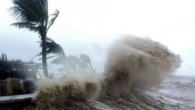
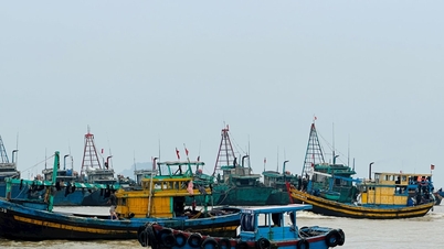
Due to the influence of the tropical depression, at sea, the northern area of Bac Bo Gulf (including Bach Long Vy, Van Don, Co To, Cat Hai and Hon Dau Island) has strong winds of level 6-7, gusts of level 9, waves 2-3m high; rough seas. Ships, boats, and aquaculture areas in the above-mentioned dangerous areas are all strongly affected by strong winds and big waves.
On land, coastal areas from Quang Ninh to Hai Phong have strong winds of level 6, in some places level 7, gusting to level 8-9; deep inland areas in the northeast have strong gusts of level 6-7.
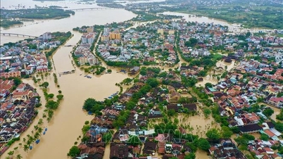
From the afternoon of September 25 to the end of the night of September 26, the Northern region, Thanh Hoa and Nghe An will have heavy rain, some places will have very heavy rain with common rainfall of 80-180mm, some places will have over 300mm. Beware of heavy rain causing urban flooding.
From now (September 25) to September 27, there is a possibility of a flood on rivers in the Northern region, Thanh Hoa, and Nghe An.
Flood peaks on Thao River, Lo River, upper Thai Binh River, Hoang Long River, Buoi River, upper Ma River reached alert level 1-2, some rivers were above alert level 2. Heavy rain is likely to cause flooding in low-lying areas; flash floods on small rivers and streams, landslides on steep slopes.
Source: https://nhandan.vn/bao-so-9-suy-yeu-thanh-ap-thap-nhiet-doi-sau-khi-di-vao-vung-bien-tinh-quang-ninh-post910421.html

![[Photo] Prime Minister Pham Minh Chinh receives Lao Minister of Labor and Welfare Phosay Sayasone](https://vphoto.vietnam.vn/thumb/1200x675/vietnam/resource/IMAGE/2025/11/11/1762872028311_dsc-2246-jpg.webp)


![[Photo] Chu Noodles - the essence of rice and sunshine](https://vphoto.vietnam.vn/thumb/1200x675/vietnam/resource/IMAGE/2025/11/11/1762846220477_ndo_tl_7-jpg.webp)


![Dong Nai OCOP transition: [Article 3] Linking tourism with OCOP product consumption](https://vphoto.vietnam.vn/thumb/402x226/vietnam/resource/IMAGE/2025/11/10/1762739199309_1324-2740-7_n-162543_981.jpeg)


Comment (0)