

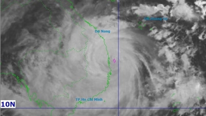
According to the National Center for Hydro-Meteorological Forecasting, at 8:00 a.m. this morning, November 6, the center of storm No. 13 was at about 13.1 degrees North latitude - 112 degrees East longitude, about 310km East Southeast of Quy Nhon ( Gia Lai ). The strongest wind near the center of the storm is level 14 (150-166km/h), gusting to level 17. In the next 3 hours, the storm will continue to move quickly and mainly in the West direction, at a speed of about 25km/h.
Vietnam's Meteorological Agency said that at 7:00 p.m. tonight (November 6), the storm's center was at 14.0 degrees North latitude - 109.4 degrees East longitude, right on the coastal area from Quang Ngai to Dak Lak , only 70-100km from shore.
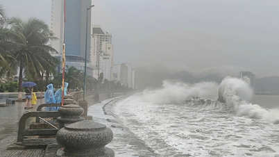
At this time, the storm is still very strong at level 13-14, gusting to level 17, near the storm center there are strong gusts of wind, 7-9m high waves, and rough seas.
From about 9 p.m. to dawn tomorrow, November 7, the eye of the storm will make landfall directly on the mainland of the provinces from Quang Ngai to Dak Lak. The eye of the storm will have strong winds of level 12-13, gusting to level 15-16, with the focus of impact being the eastern part of Quang Ngai and Gia Lai provinces.
After moving deep inland, the storm weakened into a tropical depression, and by 7:00 a.m. on November 7 was only level 7, gusting to level 9 in the southern Laos area.
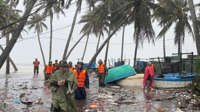
The meteorological agency noted that before the storm hits the shore, the pre-storm circulation has affected, causing heavy rain and gusts of wind, and caution against tornadoes and whirlwinds.

In coastal areas from Quang Ngai to Khanh Hoa, winds will gradually increase to level 8-11, near the storm center will be level 12-14, gusting to level 17; inland areas from South Da Nang to Dak Lak, winds will be level 8-9, near the storm center will be level 10-12, gusting to level 14-15.
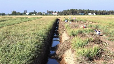
From this afternoon and tonight, the Da Nang - Dak Lak area will have very heavy rain, with average rainfall of 200-400mm, and in some places over 600mm; areas from South Quang Tri to Khanh Hoa will have heavy to very heavy rain, with a high risk of flash floods, landslides and inundation in low-lying areas.
According to the Department of Hydrometeorology, this year's storm No. 13 (Kalmaegi) has a similar trajectory and intensity to storm No. 12 Damrey in 2017 and storm No. 9 Molave in 2020, both of which are strong storms, moving quickly and causing heavy rain over a wide area in the Central Central region and Central Highlands.
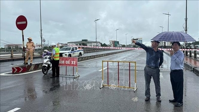
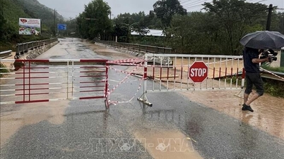
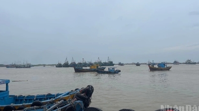
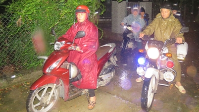
The meteorological agency warns that today, all ships operating in the danger zone must urgently move to safe shelter.
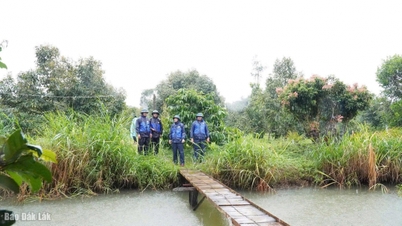
People in areas directly affected by the storm need to proactively reinforce their houses, avoid leaving their homes when there are strong winds and follow the instructions of local authorities.
Source: https://www.sggp.org.vn/toi-nay-6-11-bao-do-bo-dat-lien-tu-quang-ngai-den-dak-lak-post821957.html
![[Photo] Closing of the 14th Conference of the 13th Party Central Committee](https://vphoto.vietnam.vn/thumb/1200x675/vietnam/resource/IMAGE/2025/11/06/1762404919012_a1-bnd-5975-5183-jpg.webp)


![[Photo] Prime Minister Pham Minh Chinh receives the delegation of the Semiconductor Manufacturing International (SEMI)](https://vphoto.vietnam.vn/thumb/1200x675/vietnam/resource/IMAGE/2025/11/06/1762434628831_dsc-0219-jpg.webp)


Comment (0)