
According to the National Center for Hydro-Meteorological Forecasting, at 4:00 p.m. on November 6, the center of storm No. 13 was at about 13.5 degrees North latitude - 110.0 degrees East longitude, on the sea from Quang Ngai to Dak Lak , about 90 km southeast of Quy Nhon.
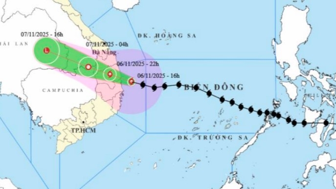
The strongest wind near the storm center is level 14 (150-166 km/h), gusting to level 16. The storm is moving in the West Northwest direction, at a speed of about 30 km/h.
Due to the storm's impact, at Ly Son, Dung Quat, Hoi An, Phu Cat, and Hoa Nhon Dong stations, strong winds of level 8-10, gusts of level 11, waves from 5 to 10 meters high, and rough seas were recorded.
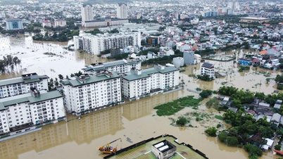
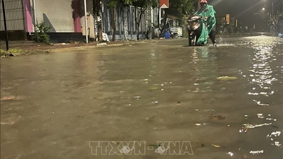
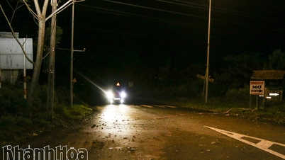
Many places in the area from Hue City to Khanh Hoa had heavy rain over 100mm, locally over 150mm, causing flooding and local traffic disruption.
Storm forecast:
By 10 p.m. on November 6, the storm will make landfall in the area from Quang Ngai to Dak Lak, gradually weakening to level 10, gusting to level 12.
In the early morning of November 7, the storm continued to weaken into a tropical depression in the southern Laos region, with winds still at level 7, gusting to level 9.
On the afternoon of November 7, the storm's circulation weakened into a low pressure area when it moved to the East of Thailand.
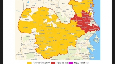
The storm disaster risk level is warned at level 4 for coastal areas from Quang Ngai to Dak Lak, including Ly Son island, and level 3 for areas from southern Quang Tri to Khanh Hoa.
Warning of the impact of storm No. 13:
Strong winds – big waves – rising water: The sea area from South Da Nang to Dak Lak has strong winds of level 8-11, near the storm center level 12-14, gusting to level 16. Waves are 8-10m high, the sea is very rough. Sea level rises 0.5-1.5m, highest at Dung Quat (1.5m), Hoi An (1.3m), Thuan An (1.0m). There is a high risk of flooding in low-lying areas, waves overtopping dikes, coastal erosion and slowing flood drainage.
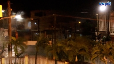
On land, the area from Quang Ngai to Gia Lai has strong winds of level 10-12, gusting to level 15; from South Quang Tri to North Khanh Hoa has winds of level 6-7, gusting to level 9. The strongest winds are concentrated from the evening to the night of November 6.
Widespread heavy rain:
From the evening of November 6 to the end of November 7, the Da Nang - Dak Lak area will have very heavy rain, with rainfall ranging from 150-300mm, with some places experiencing over 500mm. The southern provinces of Quang Tri - Hue - Khanh Hoa - Lam Dong will have heavy to very heavy rain, with rainfall ranging from 100-250mm, with some places experiencing over 400mm.
From November 7-8, rain spread from Northern Quang Tri to Thanh Hoa with rainfall of 50-150mm, in some places over 200mm.
Recommendations:
The meteorological agency warned people not to go out to sea, limit travel, proactively reinforce houses, evacuate low-lying areas and prepare essential supplies in case of big storms.
Localities need to maintain 24/7 duty, monitor reservoirs, and be ready to respond to the risk of flash floods and landslides in mountainous areas.
Source: https://baolaocai.vn/bao-so-13-giat-cap-16-do-bo-vao-khu-vuc-tu-quang-ngai-den-gia-lai-post886192.html
![[Photo] Closing of the 14th Conference of the 13th Party Central Committee](https://vphoto.vietnam.vn/thumb/1200x675/vietnam/resource/IMAGE/2025/11/06/1762404919012_a1-bnd-5975-5183-jpg.webp)


![[Photo] Prime Minister Pham Minh Chinh receives the delegation of the Semiconductor Manufacturing International (SEMI)](https://vphoto.vietnam.vn/thumb/1200x675/vietnam/resource/IMAGE/2025/11/06/1762434628831_dsc-0219-jpg.webp)


Comment (0)