
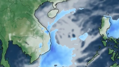
On October 14th, according to the National Center for Meteorological and Hydrological Forecasting, the tropical convergence zone, with its axis located at approximately 10-13 degrees North latitude, is connected to a low-pressure area located at approximately 11.6-12.5 degrees North latitude and 113.6-114.6 degrees East longitude.
Over the next 24 hours, the low-pressure system will move slowly in a west-northwest direction and has the potential to strengthen.
According to Mr. Nguyen Van Huong, Head of the Weather Forecasting Department, the low-pressure area in the central part of the East Sea is tending to move from East to West, heading towards the central mainland.
In the coming days, the low-pressure system may strengthen to approximately tropical depression level, causing strong gusts of wind in coastal areas, from Quang Tri to Binh Dinh. Around November 16-17, the low-pressure system will move inland, bringing rain to Central Vietnam.
"The interaction of cold air with a tropical convergence zone containing a low-pressure area, coupled with the easterly winds, will continue to cause heavy rain in Central Vietnam . The heavy rainfall in this area in the coming period will see changes in the rain center," Mr. Huong stated.
Specifically, according to Mr. Huong, on October 14-15, heavy rain will remain concentrated from Quang Tri to Quang Nam , with a tendency to spread to Binh Dinh, the northern part of Kon Tum province, and Gia Lai. During October 16-17, the low-pressure system will move inland, and the addition of strong southeasterly winds will cause heavy rain in this area.
The meteorological agency predicts that rain is likely to continue moving northward during October 16-18.
Previously, Dr. Nguyen Ngoc Huy (Huy Nguyen), an expert on climate change and natural disaster warning, also predicted that this low-pressure system would cause heavy rain in Quang Ngai, Quang Nam, Da Nang , and Thua Thien Hue provinces from now until October 16th.
Subsequently, the low-pressure system brought heavy rain to Quang Tri, Quang Binh, and Ha Tinh - Nghe An provinces from October 17-20.
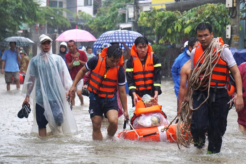
Therefore, according to Dr. Huy, the immediate risk of flooding and landslides is in Quang Nam, Da Nang, Thua Thien Hue, Quang Tri, etc., followed by Quang Binh, Ha Tinh and Nghe An.
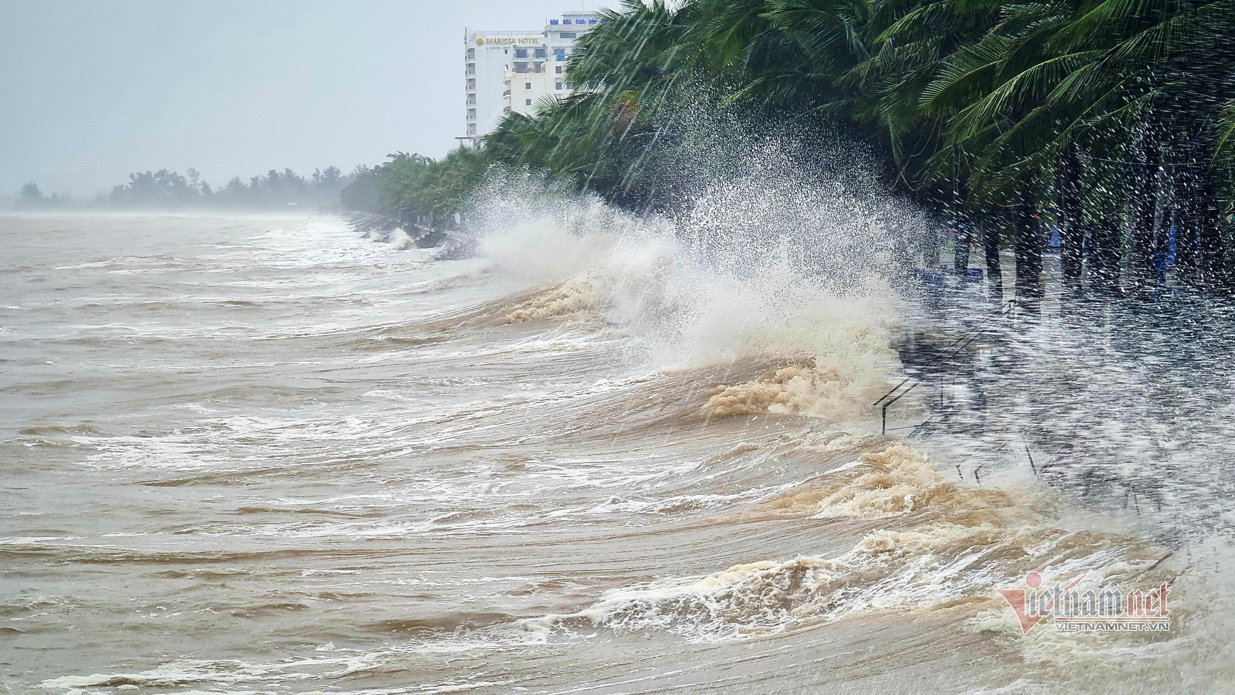
Additionally, during the night of October 14th and the day of October 15th, the sea area from Quang Tri to Quang Ngai, the northern part of the East Sea (including the sea area around the Hoang Sa archipelago) and the central East Sea will experience heavy rain and thunderstorms; the southern part of the Gulf of Tonkin, the sea area from Binh Dinh to Ca Mau, Ca Mau to Kien Giang and the Gulf of Thailand will experience scattered rain and thunderstorms. Tornadoes and strong gusts of wind (level 7-8) are possible during thunderstorms.
What are the causes of the heavy, continuous rainfall in Central Vietnam, and when will it stop?
Central Vietnam continues to face successive heavy rains at least until October 20th, and the situation is likely to worsen, with many complex developments. Some areas have experienced extremely heavy rainfall, up to 800mm, causing widespread flooding.
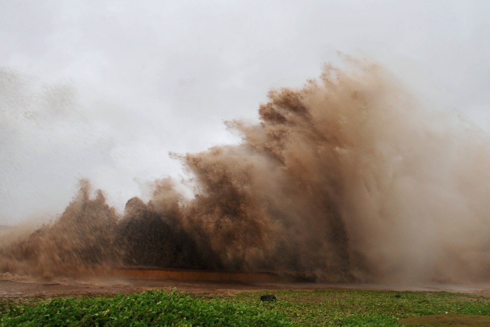
A low-pressure area has formed over the South China Sea, bringing heavy rain and thunderstorms.
Due to the influence of a low-pressure system, the sea area from Quang Tri to Quang Ngai, the northern part of the East Sea (including the sea area around the Hoang Sa archipelago), and the central part of the East Sea will experience heavy rain and thunderstorms.
Source


Comment (0)