
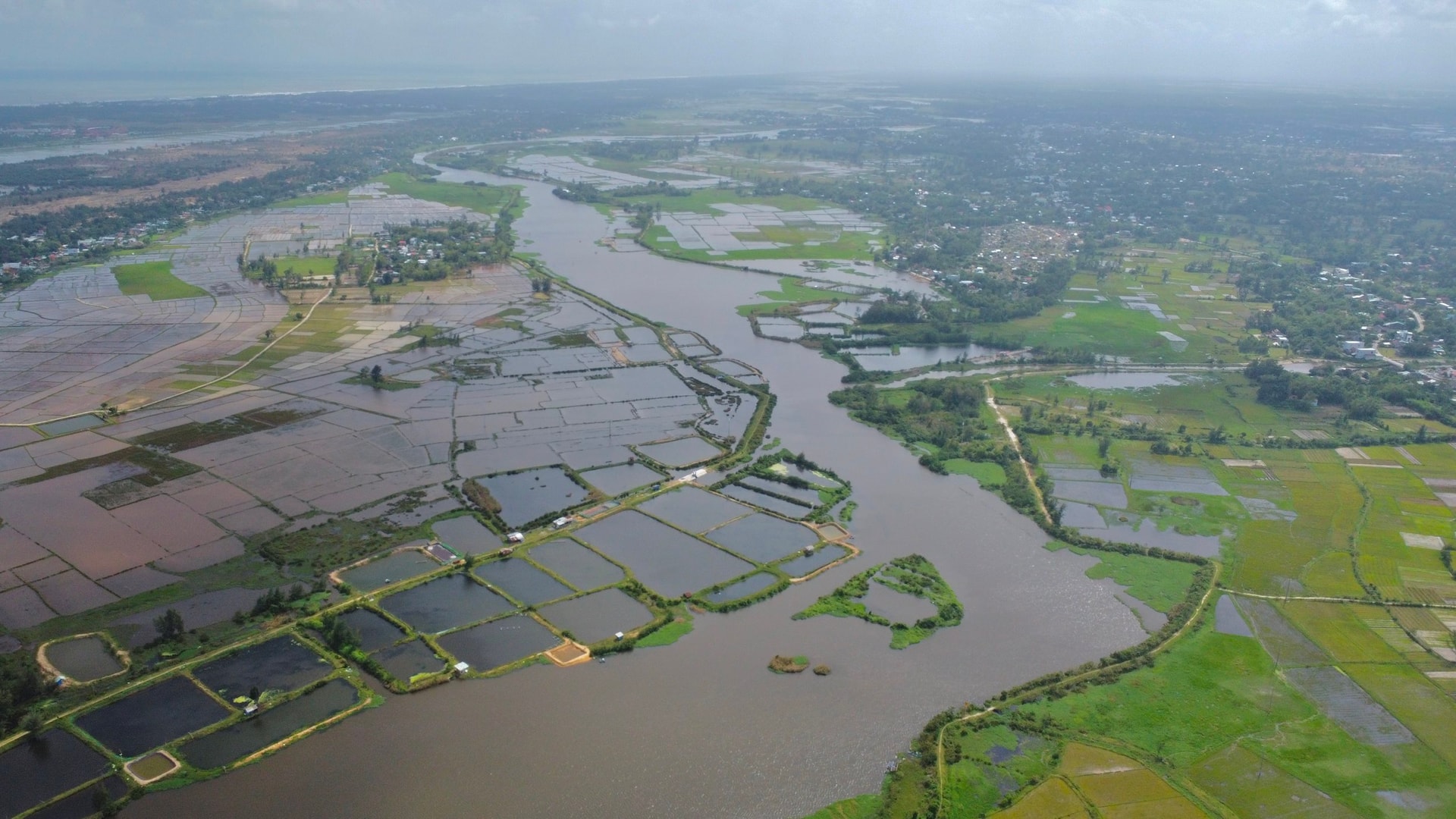
During the historic flood at the end of October, many communes and wards in the eastern part of the city were severely flooded for a long time, such as Dien Ban Dong, Hoi An Tay, Hoi An, Hoi An Dong, Duy Nghia, Thang An. In addition to the heavy rainfall causing a lot of water from upstream to flow through the Thu Bon River, the cause was also due to the impact of urbanization, which reduced the ability to drain floods in this area compared to before.
Associate Professor, Dr. Architect Hoang Vinh Hung, Director of the National Institute for Urban and Rural Planning, recommends that regulating lakes and open drainage channels are important solutions to reduce flooding and regulate water during floods. The drainage system must be continuously connected, especially in areas with high urbanization rates in the east such as Hoi An and Tam Ky to minimize flooding during the rainy season, especially during times of extreme weather such as storms and floods.
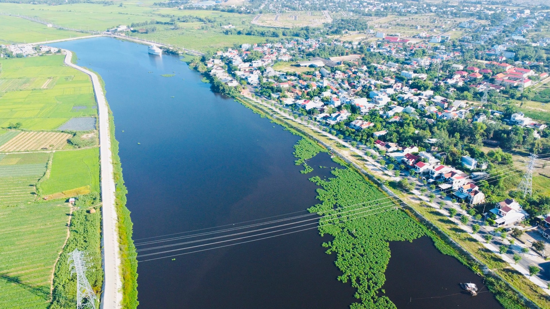
In fact, in recent years, urban and residential areas have been continuously formed in some communes and wards in the eastern region. It is alarming that the drainage infrastructure in some areas is not synchronized, limiting the ability to drain floods, and posing a risk to the entire community in the area when there is heavy rain and floods. In addition, this area currently has two silted rivers, the Co Co River and the Truong Giang River, which also significantly affect the ability to drain floods for residents living along the river basin.
According to Mr. Nguyen Su, former Secretary of Hoi An City Party Committee, Hoi An being flooded is normal, almost every year, but severe flooding is unusual. “Rivers and fields are very important in flood drainage. In the upcoming urban planning orientation of Hoi An, it is very necessary to protect existing natural water-retaining landscape areas to have places to retain water, minimizing major flooding for residential areas,” said Mr. Nguyen Su.
Realizing the increasingly serious risk of flooding in this area, the local government previously implemented the project "Developing the environment and urban infrastructure to respond to climate change in Hoi An city". In which, completed component projects contributed to reducing flooding in this area, including the flood warning system on the Vu Gia - Thu Bon river, the construction of Lai Nghi reservoir and Phap Bao lake. However, the most important component project, dredging the Co Co river, is still unfinished and has been suspended since the beginning of 2024.
Regarding the Truong Giang River, the government is currently promoting the implementation of a very large project, the "Integrated Adaptive Development of Quang Nam Province" project with a budget of more than 2,700 billion VND. Notable items expected to reduce flooding in the southeastern area of the city include dredging 60km of Truong Giang River and investing in a complex of flood drainage works for the old city of Tam Ky.
Regarding this river, previously, the World Bank (WB) disaster risk management expert recommended planning a natural wetland park combined with integrated flood risk management for the area north of the Yangtze River. This plan is expected by the expert to ensure the current socio -economic development process in Duy Nghia and Thang An communes, while preserving the precious wetland ecosystem in the area.
According to general assessment, the eastern part of Da Nang city in the future will face many risks from climate change, including the fear of severe flooding. Therefore, the authorities need to soon promote the dredging project of Truong Giang river as well as restart the dredging of Co Co river to share flood drainage capacity, creating a foundation for sustainable urbanization of this area.
Source: https://baodanang.vn/cai-thien-kha-nang-tieu-thoat-lu-cho-vung-dong-3309505.html
![[Photo] Prime Minister Pham Minh Chinh chairs a meeting on housing policy and the real estate market.](https://vphoto.vietnam.vn/thumb/1200x675/vietnam/resource/IMAGE/2025/11/11/1762838719858_dsc-2107-jpg.webp)
![[Photo] Chu Noodles - the essence of rice and sunshine](https://vphoto.vietnam.vn/thumb/1200x675/vietnam/resource/IMAGE/2025/11/11/1762846220477_ndo_tl_7-jpg.webp)


![Dong Nai OCOP transformation: [Article 4] Reaching national standard products](https://vphoto.vietnam.vn/thumb/402x226/vietnam/resource/IMAGE/2025/11/11/1762825820379_4702-cac-san-pham-trai-cay-chung-nhan-ocop-nongnghiep-174649.jpeg)


![Dong Nai OCOP transition: [Article 3] Linking tourism with OCOP product consumption](https://vphoto.vietnam.vn/thumb/402x226/vietnam/resource/IMAGE/2025/11/10/1762739199309_1324-2740-7_n-162543_981.jpeg)


Comment (0)