
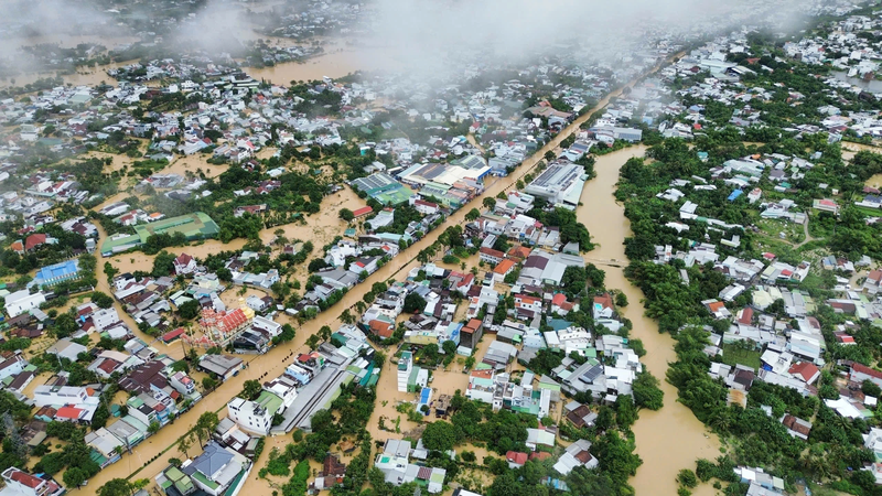
Faced with the situation that many sections of National Highway 1 through Gia Lai, Dak Lak and Khanh Hoa continue to be deeply flooded, causing prolonged traffic jams, the Vietnam Road Administration has directed the Road Management Areas to coordinate with local authorities to organize traffic flow from a distance, ensuring traffic safety and limiting congestion.
In Gia Lai province, the section Km1229+00-Km1230+00 has been flooded since the morning of November 19 and the water has not yet receded. Authorities have deployed traffic diversions towards National Highway 1D to reduce pressure on the flooded area and prevent safety risks.
In Dak Lak province, three heavily flooded areas include sections Km1340+00-Km1343+00, Km1350-Km1353 and section Km1327-Km1328 on the Tuy Hoa bypass. As of November 21, the water has not receded on these flooded sections, continuing to pose a potential danger to people and vehicles. The Vietnam Road Administration has issued a comprehensive traffic diversion plan and early separation of traffic to ensure traffic safety.
Accordingly, vehicles from the north going south on National Highway 1, reaching Km1213+400 (Ba Di bridge intersection), are guided to turn onto National Highway 19 to Pleiku city (Gia Lai), connecting with Ho Chi Minh road at Km1597+800. From here, vehicles continue to move to Buon Ma Thuot city, join National Highway 26 at Km151+00 to Khanh Hoa, return to National Highway 1 at Km1421+350. This plan is applied in both directions to disperse traffic, reduce congestion, and limit traffic conflicts at deep flooded areas.
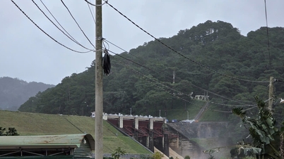
In Khanh Hoa province, the section Km1451+600 was flooded due to the discharge of the irrigation dam, about 80cm deep over a length of nearly 1km. The road management unit has removed the median strip, cleared the trash, increased drainage capacity; at the same time, temporarily closed the route and coordinated with functional forces to divert traffic through the inner-city road system of Nha Trang city to continue the journey in both directions.
On the evening of November 20, immediately after receiving the request from the Lam Dong Department of Construction for support with spare materials to handle serious landslides, the Vietnam Road Administration assigned the Road Management Area IV to urgently coordinate and deploy an emergency response plan, focusing on supporting about 5,000 rock cages to handle negative slopes, repair damage and ensure traffic safety in the context of prolonged heavy rain.
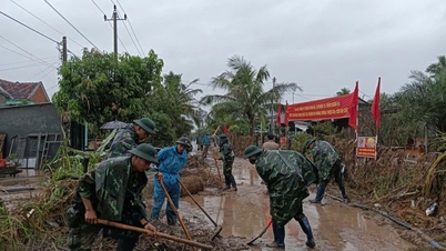
According to local reports, continuous heavy rains in recent days have caused a series of landslides, subsidence, and road breaks on many national highways through Lam Dong province. Major routes such as National Highways 20, 28, and 27 have recorded many severely damaged spots, posing potential traffic safety risks and disrupting connections between regions.
On National Highway 20, many large landslides appeared consecutively at Prenn, Mimosa, and D'ran passes. At Km224+600-Km224+700 (Prenn pass), the negative slope collapsed, half of the roadbed towards Ho Chi Minh City collapsed. At Mimosa pass, the section Km226+600-Km226+800 collapsed up to 40m deep, completely breaking the roadbed and surface. In particular, at D'ran pass, the slide had an area of up to 3,500m² with about 60,000m³ of rock and soil falling down, seriously threatening traffic safety.
On National Highway 28, many sections from Km47+252 to Km54+00 have subsidence, cracks, and landslides. At Km253+400, a 100m long crack appeared; the area at Km307+550 continues to subside, cracks, and the negative slope has collapsed close to the road shoulder, threatened by the rising water level of the Krong No River.
On National Highway 27, negative slope landslides occurred at many locations such as Km87+300, Km88+000, Km91+400, Km99+830... Many sections were gouged 4-9m deep, causing damage to the road surface, soft guardrails, culvert walls and auxiliary works.

In the face of the emergency, the Lam Dong Department of Construction has mobilized maximum human resources, equipment and materials to ensure temporary traffic. However, the large amount of damage has caused the locality to lack rock cages to promptly handle the negative slope landslides, so the province has requested Road Management Area IV for emergency support.
On the evening of November 20, the Vietnam Road Administration requested Road Management Area IV to proactively coordinate and agree on a plan to provide spare materials so that the locality can promptly implement the repair. After receiving the materials, Lam Dong province will arrange its own workers, means of transport and implement construction at key locations to ensure safe and smooth traffic as soon as possible.
Source: https://baolamdong.vn/chu-dong-phan-luong-khac-phuc-su-co-giao-thong-tren-cac-tuyen-quoc-lo-mien-trung-tay-nguyen-404255.html


Comment (0)