
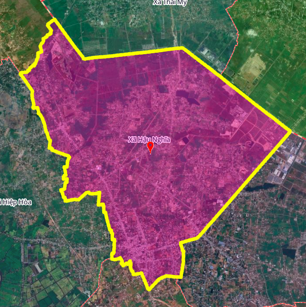
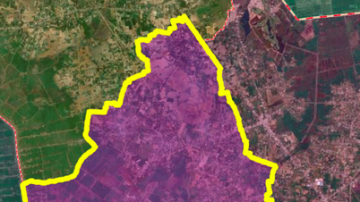
Hau Nghia Commune is one of 96 commune-level administrative units of Tay Ninh province, geographically bordering many important areas. To the north, it borders Thai My and An Ninh communes; to the east, it borders Tan An Hoi and Duc Lap communes; to the south, it borders Hoa Khanh commune; to the west, it borders Hiep Hoa commune. According to the land use planning adjustment map for the period 2021-2030 of Duc Hoa district, Long An province, this locality will open 3 new main roads with a total length of about 15.6 km.
Analysis of 3 planned routes
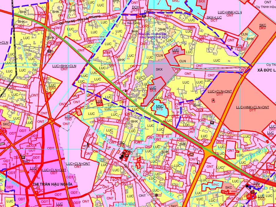
The routes are determined based on the adjusted land use planning map for the period 2021-2030 of Duc Hoa district, Long An province. Although Hau Nghia commune belongs to Tay Ninh province, this planning is referenced from the neighboring locality, showing the regional connection between provinces in the area.
1. Route connecting to 3/2 Street
This route starts at the intersection of 3/2 Street and Nguyen Thi Hanh Street, extends north and ends at Tan My - Duc Lap Thuong District Road. The total length of the route is about 4.6 km.
This route plays an important role in connecting the main traffic axis of 3/2 Street with the district road system, facilitating the circulation of goods and travel of people in the area.
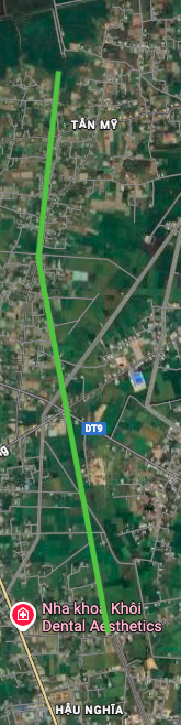
2. Route parallel to Provincial Road 9
This is the longest route of the three, about 6.3 km. The route runs parallel to Provincial Road 9, starting near Tan My - Duc Lap Thuong District Road and ending at Provincial Road 823 (near Minh Tam Pagoda).
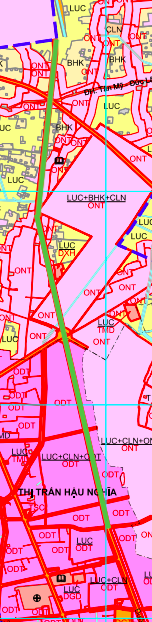
With its considerable length, this route will create a new traffic axis, reducing pressure on Provincial Road 9 and opening up space for urban development along both sides of the route.
3. Route connecting to Provincial Road 823
The route starts at Provincial Road 823 near Duc Lap market, extends north and ends near Duc Huy pagoda. The route is about 4.7 km long.
This route will improve traffic connectivity in the western part of the commune, especially the area with Duc Lap market - an important residential and commercial area.
Summary of information on 3 routes
| STT | Route name | Starting point | End point | Length |
|---|---|---|---|---|
| 1 | Road connecting to 3/2 Street | 3/2 - Nguyen Thi Hanh Street | Tan My - Duc Lap Thuong District Road | 4.6 km |
| 2 | Parallel road to Provincial Road 9 | Near Tan My District Road - Duc Lap Thuong | Provincial Road 823 (near Minh Tam Pagoda) | 6.3 km |
| 3 | Road connecting to Provincial Road 823 | Near Duc Lap market | Near Duc Huy Pagoda | 4.7 km |
Planning resources and legal notes
All the above routes are determined based on the Land Use Planning Adjustment Map for the period 2021 - 2030 of Duc Hoa district, Long An province . This is an important legal basis for investors and people to refer to when they need to transact real estate or learn about the regional infrastructure development plan.
Important Note: The information about the routes in the article is drawn relatively based on the planning map above. The illustrative diagrams are taken from Google Map to help readers easily visualize the route location.
Warning for investors and people
1. Verify official information: People and investors need to contact directly with the People's Committee of Hau Nghia commune, the People's Committee of Duc Hoa district or the Department of Construction, the Department of Natural Resources and Environment of Long An province to get the most accurate information about the planning.
2. Legal transparency: Before making any real estate transaction in the area where the route passes through, it is necessary to carefully check the legality of the land plot, to avoid the case where the land is in the clearance planning without being clearly announced.
3. Implementation progress: The land use plan for the period 2021-2030 is a medium-term plan. The specific time for investment and construction of roads depends on capital sources and investment priorities of the locality and province. It is necessary to monitor the annual public investment plan to update progress.
4. Differences in administrative boundaries: It should be noted that the planning information is referenced from Duc Hoa district, Long An province while Hau Nghia commune belongs to Tay Ninh province. This shows inter-regional planning coordination, but also requires caution when applying the information.
Project information may change according to planning adjustments. Buyers need to verify the legality before making a decision. Prices and sales policies depend on the time of transaction.
Source: https://baolamdong.vn/duong-se-mo-theo-quy-huach-o-xa-hau-nghia-3-tuyen-duong-chinh-voi-tong-chieu-dai-156-km-404578.html


Comment (0)