
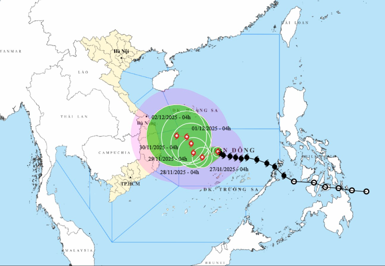
Accordingly, forecasts for the development of storm No. 15 are still highly dispersed among forecast models and international hydrometeorological agencies.
It is forecasted that from November 28, when the storm moves close to the 113th meridian (east longitude), the subtropical high pressure will weaken and a low pressure trough will appear in the westerly wind zone at an altitude of 5,000m, which may change the direction of the storm's movement, leading to different possibilities for the direction of movement and impact of storm No. 15 on the seas as well as the mainland of Vietnam.
The highest possibility now (80% probability) is that the storm will change direction and move mainly north when reaching the sea northwest of Truong Sa special zone (about 500km east of the coast from Gia Lai - Khanh Hoa).
Accordingly, from about 113 degrees east longitude, the storm changed direction to move north, weakening into a low pressure area, then this low pressure area is likely to drift towards the mainland of the Central provinces, weakening at sea.
On land, there is little chance of storms. But the area from Da Nang to Lam Dong is likely to experience widespread heavy rain in the first days of December 2025, with the focus on coastal areas.
According to current analysis, the possibility of rain is not as extreme as the rain that occurred from November 16 to 21.
In the immediate future, units and localities need to monitor the storm's developments; strictly manage vessels going out to sea; organize counting and notify owners of vessels and captains of vessels operating at sea of the location, direction of movement and developments of the storm so that they can proactively avoid, escape or not move into dangerous areas at sea.
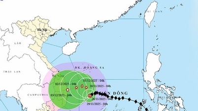
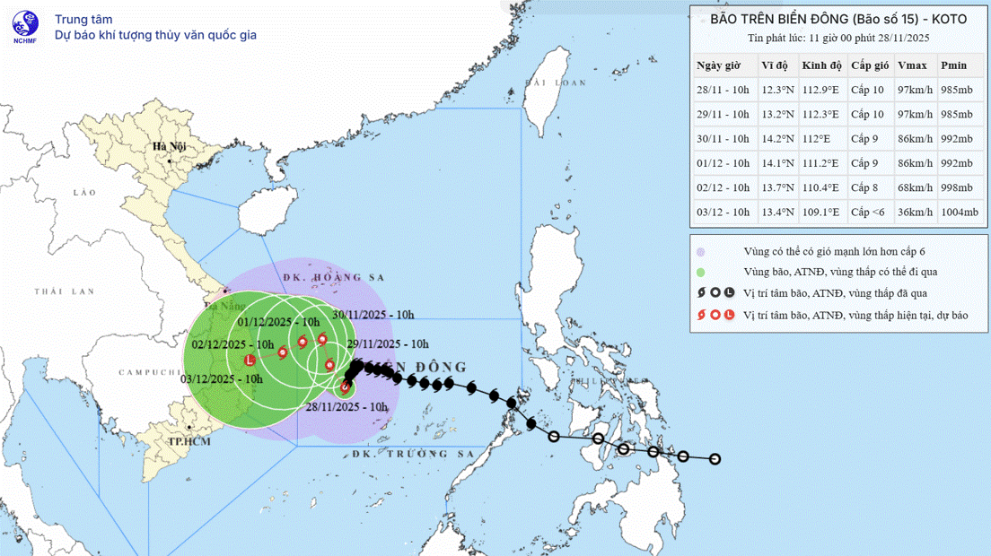
Storm No. 15 continuously changes direction of movement
According to the forecast bulletin of the National Center for Hydro-Meteorological Forecasting, at 4:00 a.m. on November 28, the center of storm No. 15 was at about 12.5 degrees north latitude, 112.1 degrees east longitude, about 190km northwest of Song Tu Tay Island with the strongest wind at level 12, gusting to level 15.
The storm continuously changed direction, moving west-southwest, west-northwest, northwest, north-northwest, west-northwest in the western sea area of the central East Sea at a slowing speed of only 3-5km/hour and gradually weakening.
Due to the storm's influence, the central East Sea area (including the sea area north of Truong Sa special zone) has strong winds of level 7-9, the area near the storm's eye has strong winds of level 10-12, gusting to level 15; waves 4-6m high, the area near the storm's eye 7-9m, and very rough seas.
Ships operating in dangerous areas at sea are susceptible to the effects of storms, whirlwinds, strong winds and large waves.
[ VIDEO ] - Deputy Director of the National Center for Hydro-Meteorological Forecasting Hoang Phuc Lam informed about the impact of storm No. 15:
Source: https://baodanang.vn/dau-thang-12-co-kha-nang-xay-ra-mua-lon-tu-da-nang-den-lam-dong-3311614.html
![[Photo] Prime Minister Pham Minh Chinh chairs the 15th meeting of the Central Emulation and Reward Council](/_next/image?url=https%3A%2F%2Fvphoto.vietnam.vn%2Fthumb%2F1200x675%2Fvietnam%2Fresource%2FIMAGE%2F2025%2F11%2F27%2F1764245150205_dsc-1922-jpg.webp&w=3840&q=75)


![[Photo] President Luong Cuong attends the 50th Anniversary of Laos National Day](/_next/image?url=https%3A%2F%2Fvphoto.vietnam.vn%2Fthumb%2F1200x675%2Fvietnam%2Fresource%2FIMAGE%2F2025%2F11%2F27%2F1764225638930_ndo_br_1-jpg.webp&w=3840&q=75)


Comment (0)