
On the morning of June 25, the Ho Chi Minh City People's Committee held a conference to announce the Ho Chi Minh City Master Plan to 2040, with a vision to 2060. The city's new plan has inherited and promoted the achievements of previous plans, resolving the shortcomings and inadequacies of the old plan.
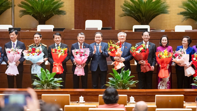
Speaking at the opening of the conference, Vice Chairman of the Ho Chi Minh City People's Committee Bui Xuan Cuong said that the approved planning this time is not only a legal requirement, but also creates a solid and important foundation, a compass for the city to concretize development goals in the new period. The planning also helps Ho Chi Minh City maximize its potential and advantages, effectively exploit specific mechanisms and policies, creating a strong driving force for the breakthrough and sustainable development of the city and the Southern key economic region.
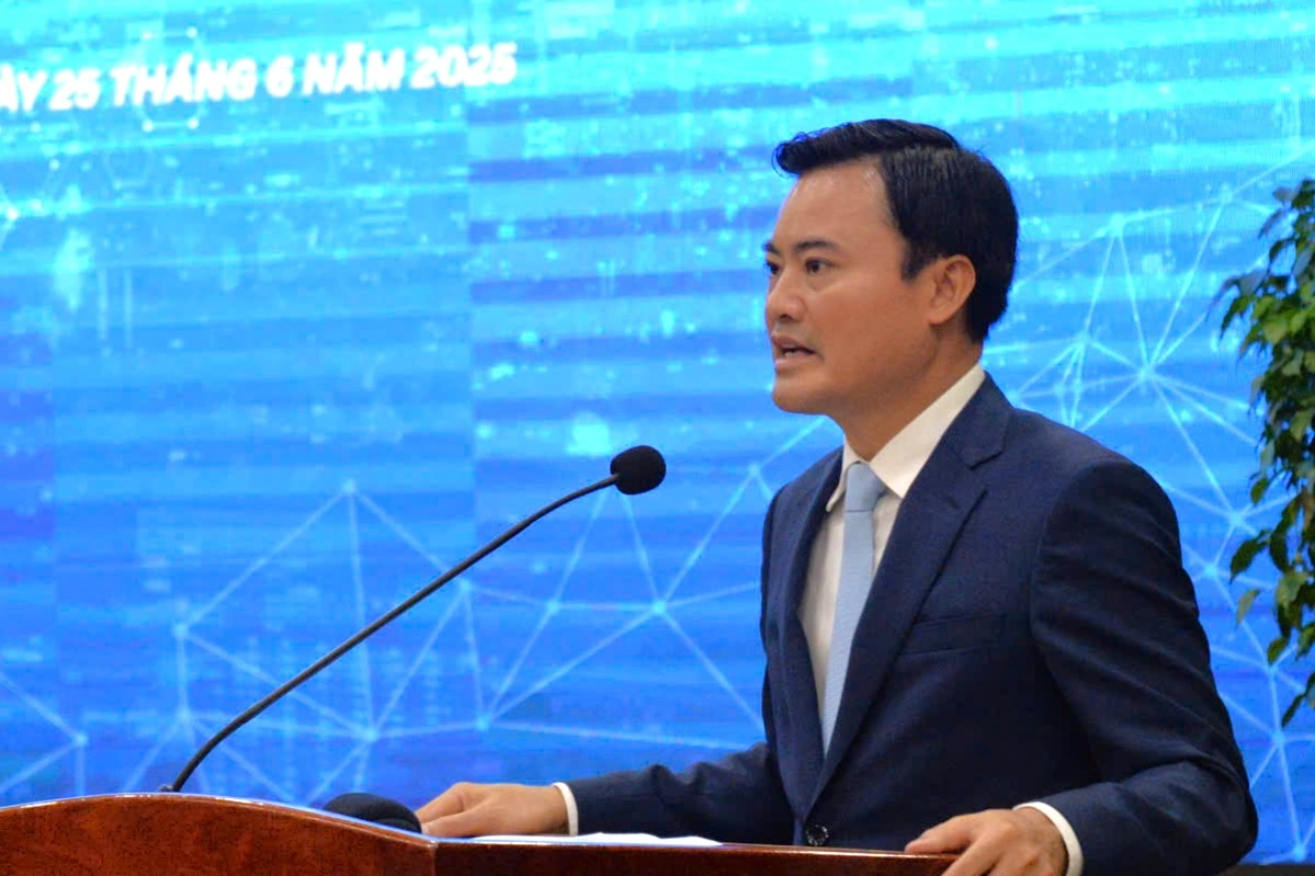
Vice Chairman of Ho Chi Minh City People's Committee Bui Xuan Cuong speaks at the conference announcing the adjusted planning project of Ho Chi Minh City (Photo: HQ).
According to the master plan adjustment project, by 2060, Ho Chi Minh City will be a global, civilized, modern, and humane city with a development level on par with major cities in the world . The locality is oriented to be an economic, financial, and service center of Asia, playing the role of a growth pole, a driving force for the development of the southern region and the whole country, an area with a high standard of living and quality of life, with distinctive economic and cultural development, attracting international financial institutions and economic groups.
The urban space of Ho Chi Minh City is shifting towards promoting creativity and high interaction, associated with the development of knowledge-based economy and high technology, improving the efficiency of socio-economic development. Dynamic areas are formed to promote the role of regional centers and growth poles of the whole country.
Multi-center model with 6 partitions
According to the planning adjustment decision, Ho Chi Minh City is a special urban area directly under the Central Government, an important economic, cultural,educational , scientific and technological center of the country, playing a pioneering role in leading innovation and creativity. The city has an important position in the national urban development strategy; is one of the tourism, financial - commercial and logistics service centers of Southeast Asia and Asia - Pacific; and a healthcare center in the ASEAN region.
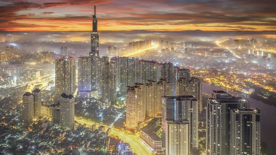
It is forecasted that by 2030, the population of Ho Chi Minh City will be about 11-13.7 million people; by 2040, it will be about 14-16.5 million people. The total construction land of the city by 2030 will be about 100,000-105,000 hectares (an average of 73-75 square meters/person); by 2040, the total construction land of the city will be about 125,000-130,000 hectares (an average of 75-93 square meters/person).
By 2040, Ho Chi Minh City is expected to have a population of up to 16.5 million people (Photo: Hai Long).
Ho Chi Minh City will develop according to the multi-center urban model, forming multi-functional urban zones with the core being key areas of finance, trade, tourism, culture, sports, research, training and high-tech production to promote interaction in socio-economic activities and development linkages. Urban space is linked to the organization of public transport systems, conveniently connected to national and international transport networks, creating traffic corridors and developing urban economy.
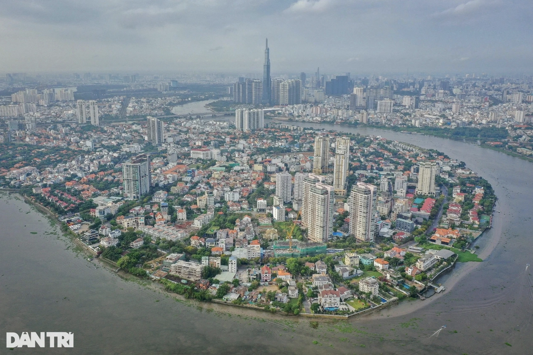
The spatial structure of Ho Chi Minh City develops according to 6 sub-regions including the central region and the eastern, western, northern, southern and southeastern regions. Each sub-region is structured in a multi-functional direction, linked to key development areas that play a central role in the region, the country and the world in order to create job opportunities and a high-quality living environment.
In which, the central urban area is located inside Ring Road 2 and north of Doi Canal and Te Canal.
The Eastern zone is the current Thu Duc city, expected to develop into Thu Duc urban zone.

Map of total land use of 9 subdivisions in Thu Duc City (Photo: Thu Duc City).
The Western zone includes the northern area of the central urban zone and part of the southern area - the part located west of Can Giuoc River of Binh Chanh district, and the part west of National Highway 1 through Binh Tan district at present, expected to develop into Binh Chanh urban zone.
The Northern region includes Cu Chi district, Hoc Mon district and the northern part of National Highway 1 through District 12 at present, expected to develop into the Cu Chi - Hoc Mon urban region.
The southern zone includes the area south of Kenh Doi in District 8, the area east of Can Giuoc River in Binh Chanh District, District 7 and Nha Be District at present, expected to develop into the urban zone of District 7 - Nha Be.
The Southeast zone includes the entire current Can Gio district, expected to develop into the Can Gio urban zone.
Creating new development corridors
The new planning of Ho Chi Minh City aims to organize a regional infrastructure system connecting Ho Chi Minh City with neighboring localities, the whole country and internationally according to strategy and focus. Areas within the city are strengthened to organize effective urban activities, associated with the development of public transport.
The city focuses on redeveloping existing urban areas, expanding urban development space associated with improving land use efficiency and optimizing the organization of technical infrastructure systems. Urban space is created in a diverse way, maximizing the ability to provide jobs, aiming to develop urban services that meet international standards.
On the other hand, the locality also preserves and promotes the value of the city's diverse architectural, landscape and ecological space, especially the typical values of urban areas in river and estuary areas and adapts to climate change.
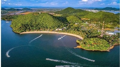
Ho Chi Minh City will form a marine economic corridor (Photo: Trinh Nguyen).
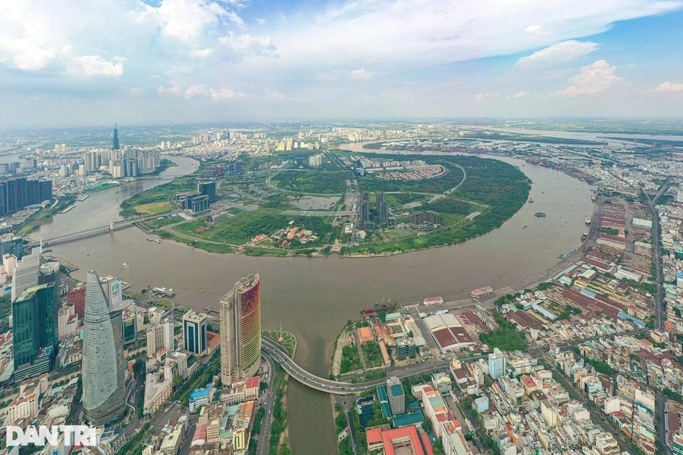
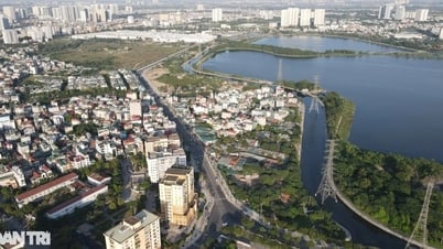
According to the vision of the master plan, Ho Chi Minh City will form new development corridors along the Saigon River and coastal areas.
In particular, the development corridor along the river takes the Saigon River space as the facade for the city, from the traditional central area on the riverside, the city develops the urban strip on both sides of the river into a central urban strip. This is a destination with a unique identity, associated with the landscape of the river and the history of the city's formation and development.
The routes along the Saigon River are organized to connect the ecological urban space, develop public transport with large capacity. The main traffic hubs will be connected to each area, the public park strip will be continuously formed along the river, organize bicycle and walking routes throughout to connect the urban space, ensure the ability to access and use utilities and services.
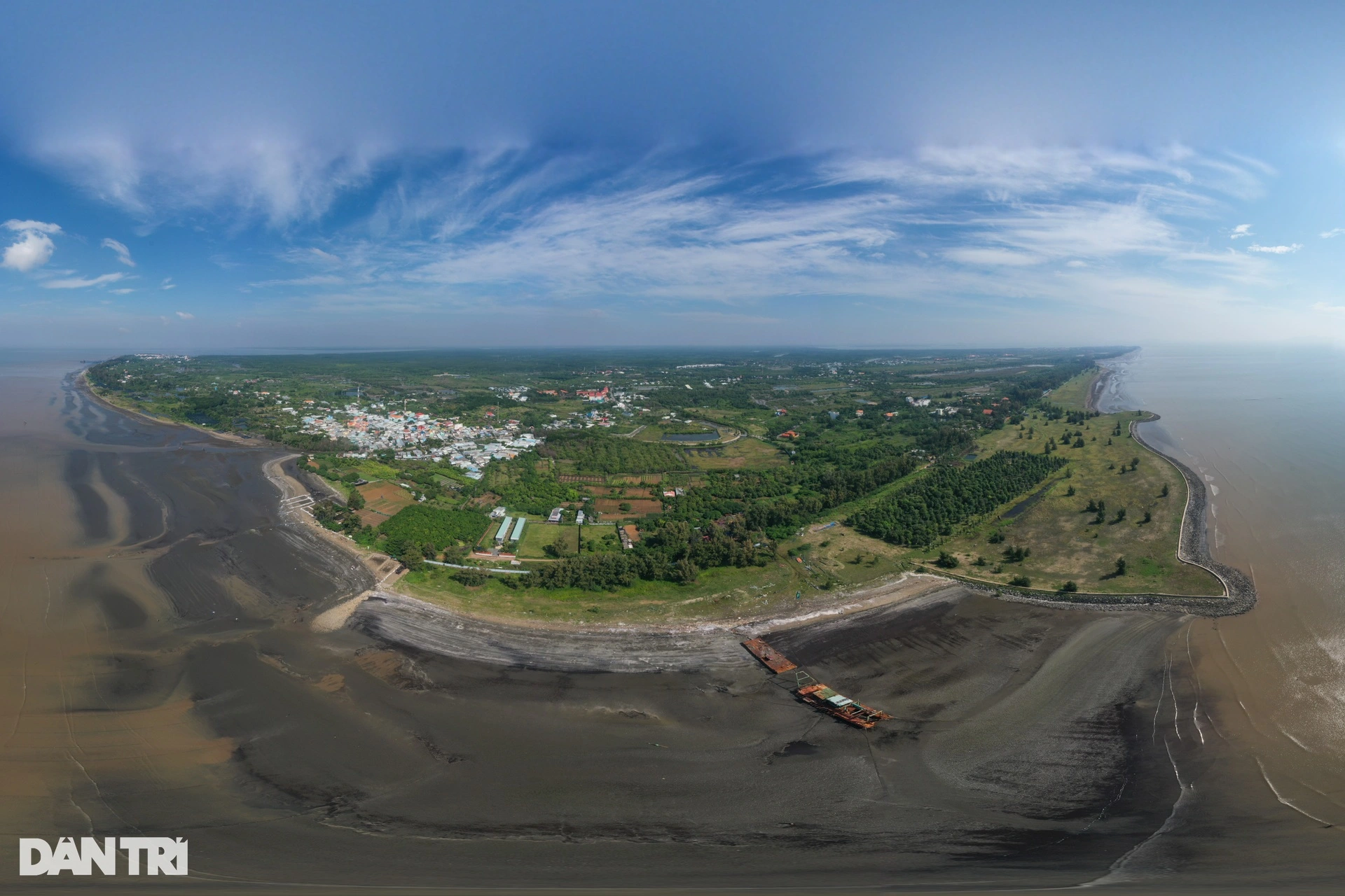
The coastal economic corridor will be linked to the organization of the inter-regional transport system, connecting the southern coastal area of the city with neighboring provinces. The new development corridor of Ho Chi Minh City also connects marine economic centers such as international transit ports, urban areas of tourism, technology, coastal ecology, sea encroachment, and the Can Gio mangrove biosphere reserve.
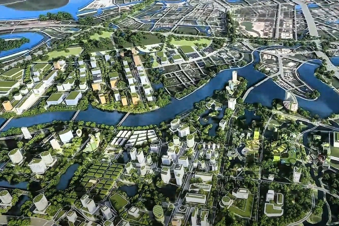
Urban perspective along the Saigon River of Ho Chi Minh City in the future (Graphic: Planning - Architecture Channel).
In addition, Ho Chi Minh City continues to upgrade, develop and form new high-tech zones with a total area of about 2,200-2,600 hectares, including: Ho Chi Minh City High-Tech Zone, Science and Technology Park in Thu Duc urban area; Phu My Hung High-Tech Zone in Cu Chi district today. The locality also develops other technology zones in the central urban area and in the current Cu Chi, Binh Chanh and Nha Be districts.
In existing areas, the space is transformed towards increasing the connection of production activities, focusing on research and development, perfecting the creative ecosystem to lead the technological level of the region and the country; forming a research space - combining high-tech application, human resource training and production, and trading high-tech products. Ho Chi Minh City aims to create a creative ecosystem, connecting production activities, services and accommodation organizations suitable for the new production model.
In the coming period, Ho Chi Minh City will focus on developing industrial functions, including: 33 industrial parks, 3 export processing zones and 7 industrial clusters, with a scale of about 9,200-10,200 hectares in areas along Ring Road 3, the bypass of National Highway 22, Hiep Phuoc Port and some areas with convenient traffic connections and functional conversion in Binh Chanh, Cu Chi, and Bac Can Gio at present...
Dantri.com.vn
Source: https://dantri.com.vn/xa-hoi/dieu-chinh-quy-hoach-tphcm-dua-song-vuon-ra-bien-phat-trien-da-trung-tam-20250624090142684.htm
![[Photo] Candidates take the first graduation exam with the new Literature topic](https://vphoto.vietnam.vn/thumb/1200x675/vietnam/resource/IMAGE/2025/6/26/dfded9e317554c25a3e26defe672ebb7)

![[Photo] General Secretary To Lam receives Australian Ambassador to Vietnam Gillian Bird](https://vphoto.vietnam.vn/thumb/1200x675/vietnam/resource/IMAGE/2025/6/26/ce86495a92b4465181604bfb79f257de)


Comment (0)