1. Geographical location, area, population, administrative unit
Dak Lak province is located in the center of the Central Highlands, the source of the Serepok river system and part of the Ba river, located in the geographical coordinates from 107o28'57" to 108o59'37" East longitude and from 12o9'45" to 13o25'06" North latitude, with an average altitude of 400-800m above sea level, 1,410 km from Hanoi and 350 km from Ho Chi Minh City. - Bordering Gia Lai province to the North - Phu Yen and Khanh Hoa to the East - Lam Dong and Dak Nong to the South - Cambodia to the West. Dak Lak has an area of 13,125.37 km2, the total population of the province as of 2012 reached 1,796,666 people, the population density reached more than 137 people/km². Of which, the urban population reached 432,458 people, the rural population reached 1,364,208 people. The male population reached 906,619 people, the female population reached 890,047 people. Dak Lak's community consists of 47 ethnic groups. Of which, Kinh people account for over 70%; ethnic minorities such as Ede, M'nong, Thai, Tay, Nung... account for nearly 30% of the province's population.
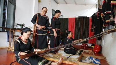
The province's population is unevenly distributed across the districts, mainly concentrated in Buon Ma Thuot city, towns, district capitals, along National Highways 14, 26, 27 such as Krong Buk, Krong Pak, Ea Kar, Krong Ana. Districts with low population density are mainly particularly disadvantaged districts such as Ea Sup, Buon Don, Lak, Krong Bong, M'Drak, Ea Hleo, etc. In the province, in addition to the local ethnic minorities, there are also a large number of migrants from the northern and central provinces who come to Dak Lak to settle down. In recent years, Dak Lak's population has fluctuated due to mechanical increase, mainly spontaneous migration, which has put great pressure on the province in terms of solving residential land, production land and issues of social life, security and order, and ecological environment. Dak Lak is a province with many ethnic groups living together, each with its own cultural beauty. Especially the traditional culture of the Ede, M'Nong, Gia Rai ethnic groups... with gong festivals, buffalo stabbing, spring elephant racing; stilt house architecture, communal house; famous ancient musical instruments such as gong sets, lithophones, T'rung; Central Highlands epics... are valuable tangible and intangible cultural products, in which "Central Highlands Gong Cultural Space" has been recognized by UNESCO as an oral masterpiece and intangible cultural heritage of humanity. All the fine cultural traditions of the ethnic groups create the diversity and richness of Dak Lak's culture. The Ede ethnic group belongs to the Malayo-Polynesian language family, and their main areas of residence are the northern and southern districts: from Ea Hleo, Buon Ho down to M'Drak and extending up to Buon Ma Thuot. The M'nong ethnic group belongs to the Mon-Khmer language family, and their main areas of residence are the southern districts and along the southwestern border. *Dak Lak province has 15 district-level administrative units, including 01 city, 01 town and 13 districts. Of which, there are 184 commune-level administrative units, including 152 communes, 20 wards and 12 towns. LIST OF ADMINISTRATIVE UNITS UNDER DAK LAK PROVINCE
2. Terrain
| STT | NAME | AREA (Km2) | POPULATION (people) | YEAR OF ESTABLISHMENT |
| 1 | Buon Ma Thuot City | 377.18 | 339,879 | June 5, 1930 |
| 2 | Buon Ho Town | 282.52 | 99,949 | December 23, 2008 |
| 3 | Ea Sup District | 1,765.63 | 62,497 | August 30, 1977 |
| 4 | Krong Nang District | 614.79 | 121,410 | November 9, 1987 |
| 5 | Krong Buk District | 357.82 | 59,892 | 1976 |
| 6 | Buon Don District | 1,410.40 | 62,300 | October 7, 1995 |
| 7 | Cu M'Gar District | 824.43 | 168,084 | January 23, 1984 |
| 8 | Ea Kar District | 1,037.47 | 146,810 | September 13, 1986 |
| 9 | M'Drak district | 1,336.28 | 69,014 | August 30, 1977 |
| 10 | Krong Pac District | 625.81 | 203.113 | 1976 |
| 11 | Krong Bong District | 1257.49 | 90,126 | September 19, 1981 |
| 12 | Krong Ana District | 356.09 | 84,043 | September 19, 1981 |
| 13 | Lak District | 1256.04 | 62,572 | 1976 |
| 14 | Cu Kuin District | 288.30 | 101,854 | August 27, 2007 |
| 15 | Ea H'Leo District | 1,335.12 | 125.123 | 3/4/1980 |
The province's terrain is very diverse: located in the West and at the end of the Truong Son range, it is a large plateau, with gently sloping, undulating, and fairly flat terrain interspersed with low plains along the main rivers. The terrain of the province gradually decreases from the Southeast to the Northwest. 3. Climate The climate of the whole province is divided into two sub-regions. The Northwest region has a hot, dry climate in the dry season; the East and South regions have a cool, temperate climate. The agro-ecological climate of the province is divided into 6 sub-regions: - Ea Sup plain sub-region accounts for 28.43% of the natural area. - Buon Me Thuot - Ea H'Leo plateau sub-region accounts for 16.17% of the natural area. - M'Drak hill and plateau sub-region accounts for 15.82% of the natural area. - Krong Ana - Serepok riverside sub-region accounts for 14.51% of the natural area. - The Chu Yang Sin highland sub-region accounts for 3.98% of the natural area. - The Rlang Dja highland sub-region accounts for 3.88% of the natural area. In general, the climate varies between terrain types and decreases with altitude: the area below 300 m is hot and sunny all year round, from 400 - 800 m the climate is hot and humid and above 800 m the climate is cool. However, the seasonal rainfall regime is a limitation for the development of agricultural commodity production. The climate has two distinct seasons: rainy season and dry season. The rainy season starts from May to the end of October, concentrating 90% of the annual rainfall. The dry season is from November to April of the following year, with insignificant rainfall.
Provincial Information Portal


![[Photo] Memorial service for former President Tran Duc Luong in Ho Chi Minh City](https://vphoto.vietnam.vn/thumb/1200x675/vietnam/resource/IMAGE/2025/5/25/c3eb4210a5f24b6493780548c00e59a1)
![[Photo] President Luong Cuong receives Lao Vice President Pany Yathotou](https://vphoto.vietnam.vn/thumb/1200x675/vietnam/resource/IMAGE/2025/5/25/958c0c66375f48269e277c8e1e7f1545)
![[Photo] Prime Minister Pham Minh Chinh meets the Vietnamese community in Malaysia](https://vphoto.vietnam.vn/thumb/1200x675/vietnam/resource/IMAGE/2025/5/25/1f11d1256d7745a2a22cc65781f53fdc)


![[Photo] President Luong Cuong receives Vice President of the Cambodian People's Party Men Sam An](https://vphoto.vietnam.vn/thumb/1200x675/vietnam/resource/IMAGE/2025/5/25/6f327406164b403a8e36e8ce9d3b2ad2)






























Comment (0)