
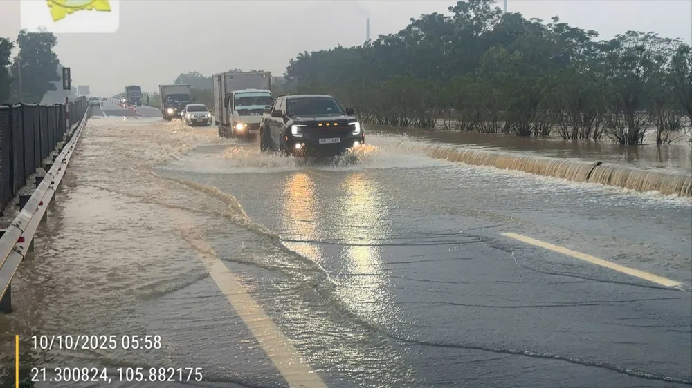
In particular, the section from Km28+800 - Km29+050 from Thai Nguyen to Hanoi was flooded 60cm deep and 150m long. The section from Km28+850 - Km29+050 from Hanoi to Thai Nguyen was flooded 15cm deep and 100m long.
Currently, road management units are coordinating with Thai Nguyen province traffic police to regulate traffic at intersections to avoid congestion.

Currently, vehicles with less than 9 seats from Hanoi to Thai Nguyen and Cao Bang need to take the Hanoi - Thai Nguyen highway to Bac Phu intersection at Km26, exit to National Highway 3 at Km24 - and National Highway 37 to Bac Ninh .
In the afternoon from Cao Bang, Thai Nguyen to Hanoi, go on highway CT 07 to Yen Binh intersection at Km41+850, exit to National Highway 3 at Km42, continue to Hanoi and the delta provinces.

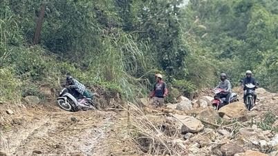
The Vietnam Road Administration also said that, up to this point, there are still some points on national highways managed by localities that are blocked by deep floodwaters or large landslides that are being actively repaired.
In particular, Thai Nguyen province still has some traffic jams on National Highway 3B and National Highway 279; Cao Bang province on National Highway 34 and National Highway 34B.
In particular, Tuyen Quang province still has a traffic jam at Km63+710 - Km63+900 QL34, which is the area of Bac Me power plant , expected to open into the positive slope to temporarily clear the road before October 15.
The Vietnam Road Administration is continuing to direct units to urgently overcome and closely coordinate, supporting localities to clear traffic jams at the earliest possible time.
Source: https://www.sggp.org.vn/duong-cao-toc-ha-noi-thai-nguyen-dang-ngap-ung-ach-tac-giao-thong-post817250.html


Comment (0)