

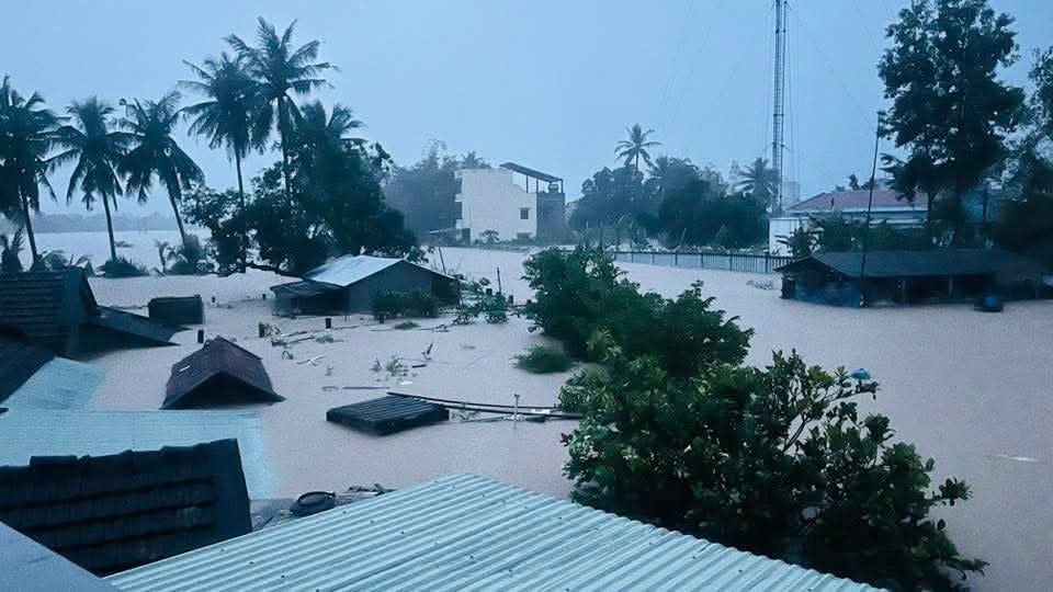
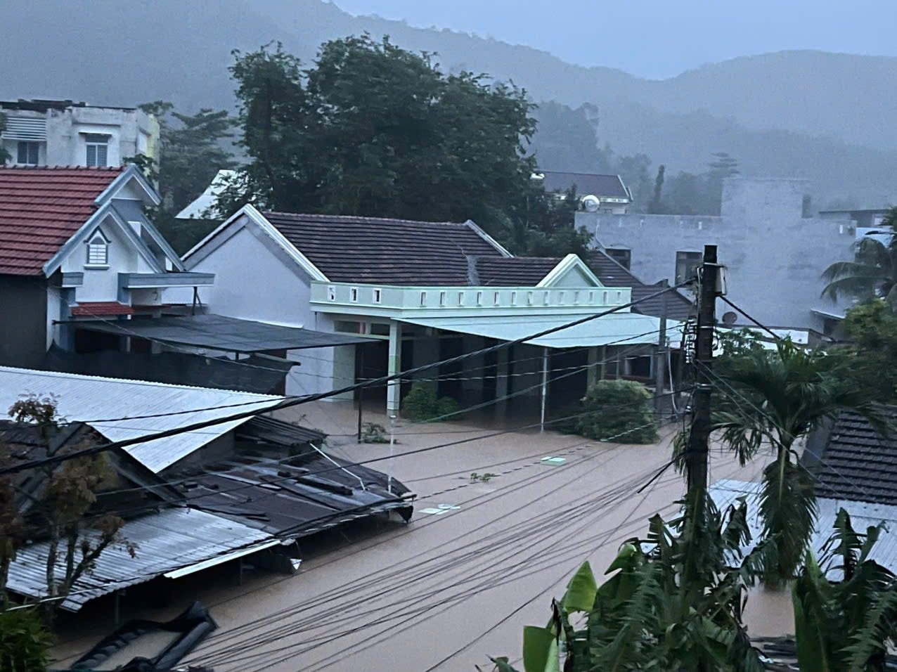
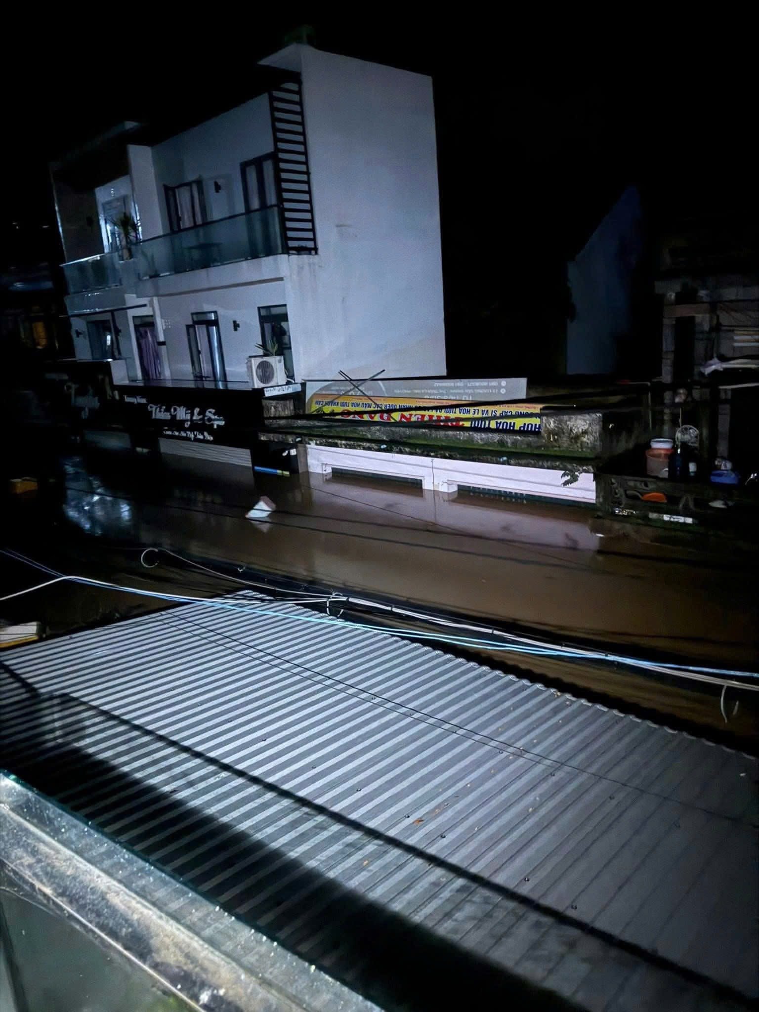
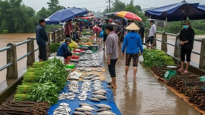
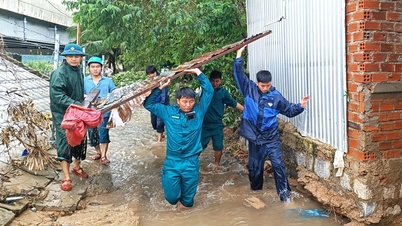
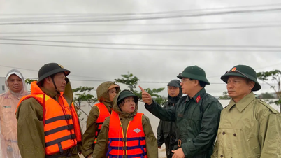
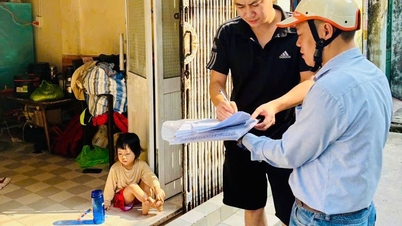
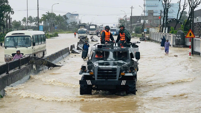
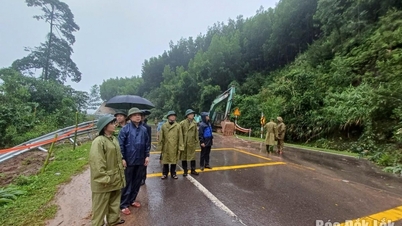
From the evening of November 18 to the morning of November 19, prolonged heavy rain caused many areas in the East of Dak Lak (formerly Phu Yen ) to be deeply flooded, dozens of households called for help when water flooded into their houses at midnight.
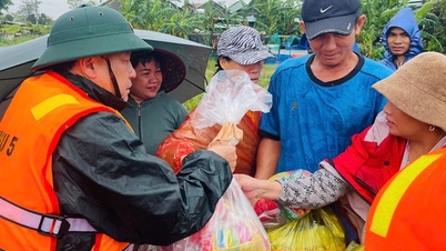
Tuy An Tay commune leaders said dozens of houses in Region 8 and Region 9 were heavily flooded. Rescuers worked through the night to bring dozens of people to safety. However, due to the strong currents, many areas were inaccessible, and many people were still trapped on their roofs.
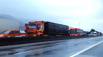
On the morning of November 19, the leader of the Traffic Police Department of Dak Lak Province Police said that rising floodwaters had completely paralyzed National Highway 25, National Highway 29 and National Highway 1, making it impossible for traffic to pass.
“We have blocked all three routes, no vehicles can pass. As for Highway 1, vehicles have to wait for the water to recede before they can continue, so the traffic is stuck for a long time,” he informed.
In Dong Xuan district, heavy rains lasting two days caused the water level of the Ky Lo River to rise abnormally quickly. In the early morning of November 18, many houses were flooded up to their roofs, forcing the authorities to organize emergency evacuations.
According to the Dak Lak Province Hydrometeorological Station, in the past 10 hours (up to 5:00 a.m. on November 19), the eastern part of the province has experienced very heavy to extremely heavy rain. The rainfall from 7:00 p.m. on November 18 to 5:00 a.m. on November 19 was generally 100 - 240 mm; Hoa My Tay alone measured 401.4 mm, Hoa Dong 273.4 mm. The western part of the province has experienced moderate to heavy rain with rainfall of 5 - 40 mm.
It is forecasted that from November 19 to 21, the eastern part of Dak Lak (including the old M'Drak district) will continue to have heavy to very heavy rain, with total rainfall of 100 - 200 mm, and in some places over 300 mm. The western part of the province will have moderate rain, with heavy rain in some places, with total rainfall of 10 - 30 mm.
PV (synthesis)Particularly large emergency floods on Ba River and large floods on Kon, Thu Bon and Tra Khuc Rivers
According to the National Center for Hydro-Meteorological Forecasting, flood levels on the Kon, Ba, and Krong Ana rivers are rising; the Bo and Huong rivers (Hue city), and other rivers from Da Nang city to Khanh Hoa are fluctuating.
In the next 12 hours, flood on Kon River will continue to rise and be above alert level 3, Ba River at Phu Lam station will continue to rise and be above alert level 3 (at historical flood level in 1993: 5.21m); flood on Tra Khuc River, Thu Bon River, Krong Ana River will continue to rise and be above alert level 2.
In the next 12-24 hours, floods on Kon and Ba rivers will fluctuate at very high levels and above alert level 3; Krong Ana river will continue to rise and be above alert level 2; floods on Thu Bon and Tra Khuc rivers will continue to fall and be at alert level 1 to alert level 2.
Warning: In the next 24 hours, floods on Huong River, Bo River, Vu Gia River, Srepok River will fluctuate at alert level 1 to alert level 2 and above alert level 2; other rivers in Quang Ngai, Gia Lai , Dak Lak, Khanh Hoa will fluctuate at alert level 2 to alert level 3, some rivers above alert level 3.
Widespread flooding occurred in provinces/cities from Hue city to Khanh Hoa . There is a high risk of flash floods on rivers and streams and landslides on slopes in provinces/cities from Hue city to Khanh Hoa.
River floods inundate low-lying areas along the river, affecting activities such as waterway transport, aquaculture, agricultural production, people's lives and socio- economic activities.
Flood disaster risk warning level: Level 4.
Source: https://baohaiphong.vn/hang-tram-nha-dan-o-dak-lak-ngap-sau-qua-noc-nguoi-dan-bi-co-lap-keu-cuu-527152.html
![[Photo] General Secretary To Lam receives President of the Senate of the Czech Republic Milos Vystrcil](/_next/image?url=https%3A%2F%2Fvphoto.vietnam.vn%2Fthumb%2F1200x675%2Fvietnam%2Fresource%2FIMAGE%2F2025%2F11%2F21%2F1763723946294_ndo_br_1-8401-jpg.webp&w=3840&q=75)
![[Photo] President Luong Cuong receives Speaker of the Korean National Assembly Woo Won Shik](/_next/image?url=https%3A%2F%2Fvphoto.vietnam.vn%2Fthumb%2F1200x675%2Fvietnam%2Fresource%2FIMAGE%2F2025%2F11%2F21%2F1763720046458_ndo_br_1-jpg.webp&w=3840&q=75)

![[Photo] Visit Hung Yen to admire the "wooden masterpiece" pagoda in the heart of the Northern Delta](/_next/image?url=https%3A%2F%2Fvphoto.vietnam.vn%2Fthumb%2F1200x675%2Fvietnam%2Fresource%2FIMAGE%2F2025%2F11%2F21%2F1763716446000_a1-bnd-8471-1769-jpg.webp&w=3840&q=75)
![[Photo] National Assembly Chairman Tran Thanh Man holds talks with President of the Senate of the Czech Republic Milos Vystrcil](/_next/image?url=https%3A%2F%2Fvphoto.vietnam.vn%2Fthumb%2F1200x675%2Fvietnam%2Fresource%2FIMAGE%2F2025%2F11%2F21%2F1763715853195_ndo_br_bnd-6440-jpg.webp&w=3840&q=75)


Comment (0)