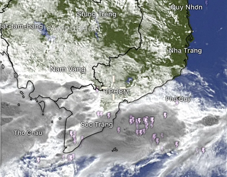
From the evening and throughout the night of June 2, many localities in the mountainous regions of the North experienced thunderstorms after a series of hot days, with some places experiencing very heavy rain. According to data from the National Center for Hydro-Meteorological Forecasting, the amount of rainfall measured from 5:00 p.m. on June 2 to this morning, June 3 at some stations was as follows: Viet Lam (Ha Giang) 158.4mm; San Vien 1 (Lang Son) 106.3mm; Sinh Long (Tuyen Quang) 67.4mm; Coc Pang ( Cao Bang ) 61.4mm...

Rain and wind continued early this morning in many places in the mountainous regions of the North, with rainfall ranging from 10-30mm, with some spots over 50mm.
The National Center for Hydro-Meteorological Forecasting said that in the afternoon and night of June 3, the Northwest region, the Northern Delta and the Northern Midlands and the North Central region will have thunderstorms. Heavy to very heavy rain is forecast in some places, with rainfall reaching 15-30mm, locally exceeding 80mm.
According to satellite cloud data from the Global Weather Forecast System (GFS - USA), a large convective cloud band is forming and moving from southern China to the northern mountainous region of our country. This is the result of the interaction between the low pressure trough with an axis passing through the North and the low-level Southeast wind zone carrying moisture from the sea to the mainland, combined with high mountainous terrain conditions, easily creating strong local thunderstorms.
Meteorologists warn of a high risk of tornadoes, lightning, hail and strong winds as the storms move down. Heavy rains in a short period of time can cause flash floods in small rivers and streams, landslides in steep terrain and flooding in low-lying areas.
People living in the northern mountainous areas, especially Ha Giang , Lang Son, Tuyen Quang, Cao Bang, need to closely monitor weather developments, limit travel during heavy rains, and proactively take measures to prevent natural disasters.
On June 3, Ho Chi Minh City and the Southern region continued to experience typical weather of the beginning of the rainy season. During the day, it was sunny, sometimes very sunny at noon, the highest temperature in Ho Chi Minh City ranged from 32-34 degrees Celsius, up to 35 degrees Celsius in some places. Humidity dropped to about 60%, causing a dry, hot, and stuffy feeling.
From about 3 p.m. onwards, convective clouds will develop strongly, especially in the western areas such as Binh Tan, Hoc Mon, Cu Chi... and gradually spread towards the inner city. It is forecasted that there will be showers and thunderstorms, with some places experiencing heavy rain with rainfall of 20-40mm. During thunderstorms, people need to be on guard against lightning strikes, strong gusts of wind of level 6-7 and the possibility of temporary flooding on low-lying roads.

In other southern provinces, the weather is sunny during the day, with temperatures ranging from 31 to 35 degrees Celsius. In the evening, there are scattered showers and thunderstorms, with some places experiencing heavy rain, accompanied by tornadoes and strong gusts of wind. The average rainfall is generally 20 to 50mm, with some places experiencing over 70mm. The rain usually lasts from 4 p.m. to 8 p.m., then gradually decreases and stops completely at night.
Source: https://www.sggp.org.vn/hom-nay-3-6-mien-bac-mua-lon-mien-nam-co-dong-ve-chieu-post797890.html


Comment (0)