
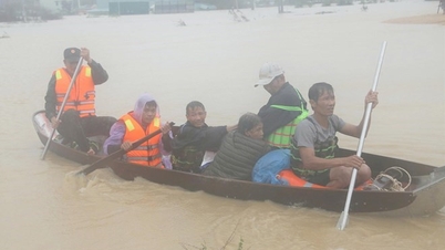
On November 22, the leader of the People's Committee of Ea Na commune (Dak Lak province) said that the suspension bridge over the Srepok river at the Dray Nur waterfall tourist area was swept away by floodwaters from upstream on the morning of November 21. At the time of the incident, there were no people on the bridge, so no human casualties were recorded.
The suspension bridge is about 70 meters long, connecting the two banks of the Srepok River. The tourist area was flooded more than 1.5 meters deep, the management board mobilized 10 people to cut the cable to disassemble the bridge, avoiding the bridge pillars being swept away.
 |
Rising floodwaters swept away a suspension bridge. Photo: Van Anh/ Dak Lak newspaper. |
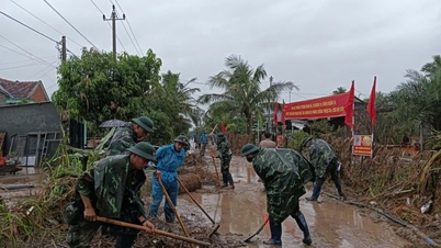
Authorities have cordoned off the scene to deal with the incident. Many facilities, including roads, restaurants and entertainment areas, were severely damaged, forcing tourism and business activities to be temporarily suspended.
Nguyen Huy, a local resident, was present at the scene on the morning of November 21. He said this was the first time he had witnessed the water level at Dray Nur waterfall rising so quickly and flowing so fiercely.
"The water flooded back, the management board dismantled the bridge to ensure the safety of the bridge pillars. The scene startled everyone and made them realize the terrible power of nature," Huy told Tri Thuc - Znews.
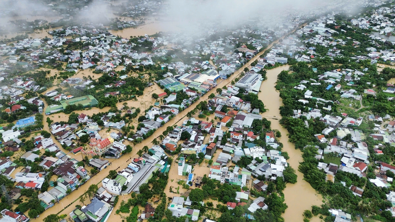
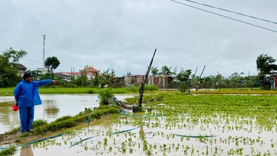
The flood situation in Dak Lak is becoming more complicated and serious in recent days. In Ea Na commune, the large flow from upstream combined with the water released from dams has created great pressure on the downstream area.
As of 9:00 a.m. on November 22, floods on the Krong Ana and Ba rivers are rising again.
In the next 24 hours, the flood on the Srepok River at Ban Don station will continue to increase, peak and decrease slowly, possibly exceeding the alarm level 3 by 3.9-4.5 m. The risk of flooding and associated natural disasters remains high, especially in the provinces from Dak Lak to Khanh Hoa and Dong Nai .
 |
Panoramic view of Dray Nur waterfall from above. Photo: Dray Nur waterfall eco-tourism area. |
Faced with the complicated situation of floods, Ea Na commune mobilized more than 180 people from various forces to support 69 households whose houses were flooded; evacuated 207 people, along with many other properties to safe places, ensuring safety for people and properties.
Dray Nur Waterfall is more than 30 km from Buon Ma Thuot center along Highway 14, passing Buon Kop Hydropower Plant nearly 3 km. This is a majestic waterfall, where the two rivers Krong Ana and Krong No merge to form the legendary Srepok River.
 |
Tourists check in at the Dray Nur waterfall suspension bridge in October. Photo: Ha Long. |
Amidst the vast wilderness, Dray Nur possesses pristine beauty and legends passed down through generations.
The lake at the foot of the waterfall is as blue as a gem, interspersed with rocks of unique shapes. Seen from afar, the waterfall looks like a giant wall of water, thousands of white threads of water intertwined, shimmering and magical.
Visitors to Dray Nur not only immerse themselves in nature but also experience many unique activities: camping to watch the sunrise, making rice wine by themselves, and enjoying Central Highlands specialties.
In addition, tours to improve health and spirit, such as cycling through green coffee gardens, crossing waterfalls on the Srepok River, and climbing along ancient rock slopes, are also experiences that attract many tourists.
Source: https://znews.vn/lu-cuon-troi-cau-trèo-o-khu-du-lich-noi-tieng-dak-lak-post1605012.html


Comment (0)