
According to the land use planning adjustment map to 2030 of Bac Giang city, Tan Tien ward is expected to have a number of new roads opened to synchronize traffic infrastructure and create conditions for the development of urban areas in the future.
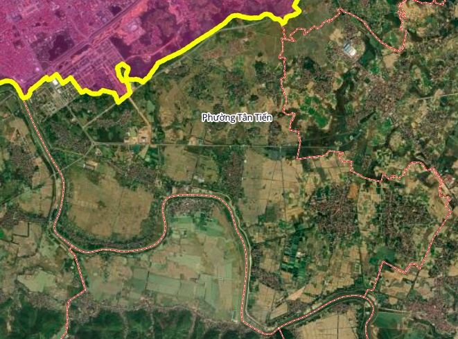
Below are details of three notable routes in this planning.
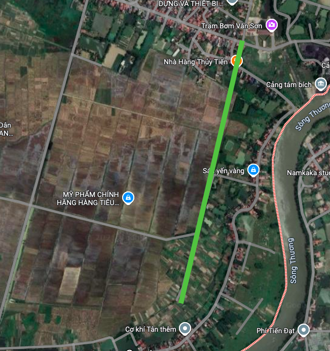
1. Route along the southern urban area
This route is expected to be about 1 km long. The starting point of the route is located at Van Son Pump Station and the end point connects to Thanh Cam village residential area. The route is planned to run along the future Southern high-class, smart, ecological service urban area, acting as the main traffic axis for this area.

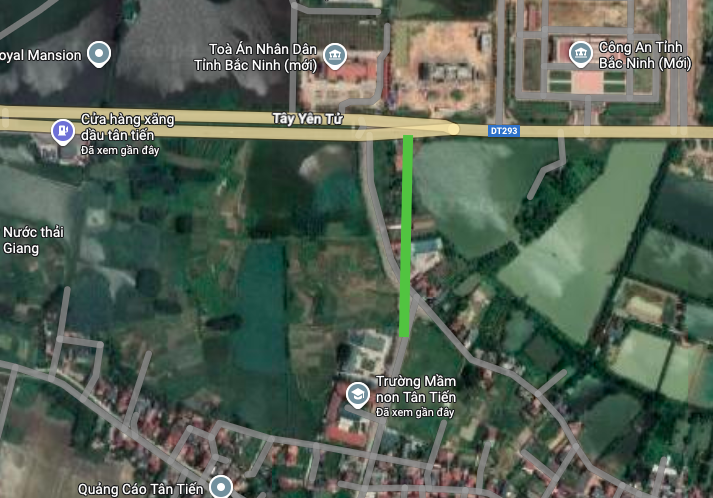
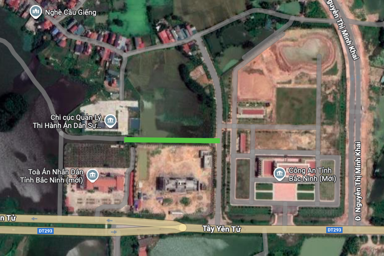
2. The route is perpendicular to Provincial Road 293
The second route is about 300 m long. The starting point of the route is on Tay Yen Tu Street, near the Bac Giang Provincial Procuracy (old), and runs perpendicular to Provincial Road 293 (DT293). This route helps to increase horizontal connectivity, reducing the load on existing main roads.
3. Route parallel to Tay Yen Tu road
The third route is a short section of about 150 m long, planned to run parallel to Tay Yen Tu Street and pass through the north of the old Bac Giang Provincial Procuracy. This route has the role of traffic diversion and serving neighboring residential areas.
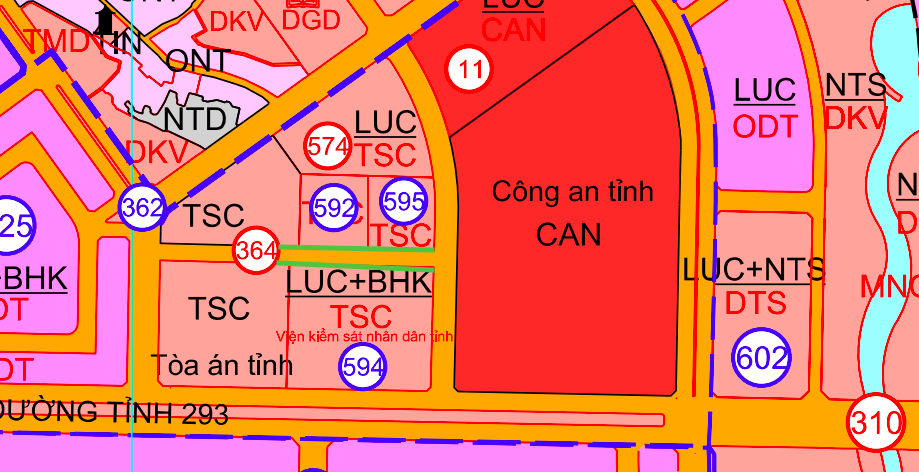
Note: The diagrams in the article are drawn relatively based on the map of land use planning adjustment to 2030 of Bac Giang City. Planning information may be adjusted in the future according to the decision of the competent state agency.
Source: https://baolamdong.vn/quy-hoach-3-tuyen-duong-moi-tai-phuong-tan-tien-bac-giang-399023.html
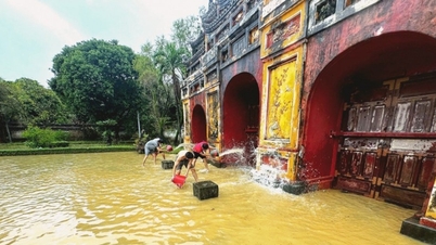
![[Photo] Da Nang: Water gradually recedes, local authorities take advantage of the cleanup](https://vphoto.vietnam.vn/thumb/1200x675/vietnam/resource/IMAGE/2025/10/31/1761897188943_ndo_tr_2-jpg.webp)
![[Photo] Prime Minister Pham Minh Chinh attends the 5th National Press Awards Ceremony on preventing and combating corruption, waste and negativity](https://vphoto.vietnam.vn/thumb/1200x675/vietnam/resource/IMAGE/2025/10/31/1761881588160_dsc-8359-jpg.webp)


Comment (0)