
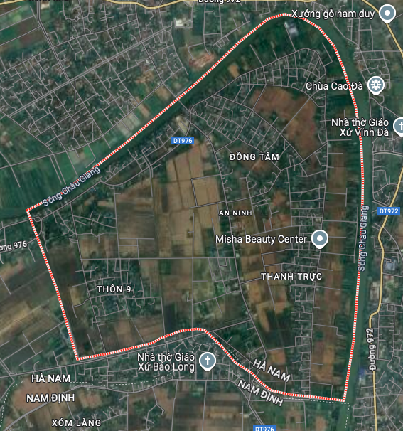
Overview of traffic planning of An Ninh commune
According to the land use planning adjustment map to 2030 of Binh Luc district, An Ninh commune will have a number of new traffic routes to complete the infrastructure network and enhance regional connectivity. These projects are part of the local socio -economic development orientation, promising to create significant changes to the face of the commune in the future.
Location and current infrastructure status
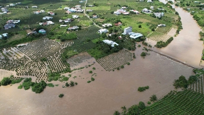
An Ninh is a commune located in the far east of Binh Luc district, Ha Nam province. The geographical location of the commune is quite special when it is surrounded by large rivers such as Chau Giang river in the north and east, and Ninh Giang river in the southwest.
Administratively, An Ninh commune borders Bo De commune to the west, Ly Nhan district to the north and east, and Nam Dinh province to the south. Currently, the commune's main traffic infrastructure has Provincial Road 976 running through it. In addition, the commune is also located near other important roads such as Provincial Road 972, Provincial Road 975 and National Highway 21B, facilitating connections with neighboring areas.
Details of new planned routes
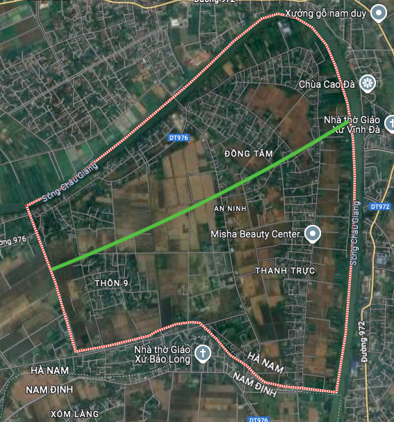
Based on the planning map, one of the most prominent traffic projects in An Ninh commune is the road running through the commune. This road has its starting point in An Tien village and its end point is expected to cross the Chau Giang river to connect with other areas.
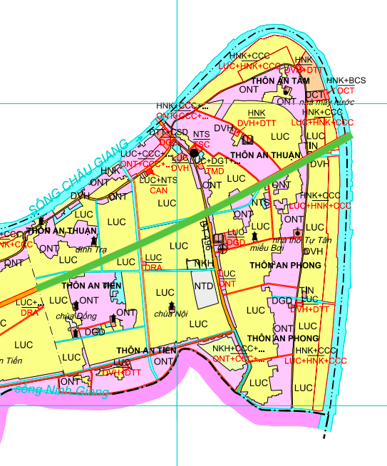
The formation of this new road axis is expected to shorten travel distances, promote trade and create development momentum for An Tam, An Thuan, An Phong and An Tien villages. This is an important step in synchronizing the commune's traffic infrastructure with the general network of the whole district.
Note on planning
Information on the routes to be opened is based on the adjusted land use planning map to 2030 of Binh Luc district. The actual route and implementation time may change depending on the capital allocation plan and decisions of competent state agencies. People and investors need to follow the official announcements to get the most accurate information.

Source: https://baolamdong.vn/quy-hoach-giao-thong-xa-an-ninh-ha-nam-den-nam-2030-398446.html
![[Photo] Flooding on the right side of the gate, entrance to Hue Citadel](https://vphoto.vietnam.vn/thumb/1200x675/vietnam/resource/IMAGE/2025/10/28/1761660788143_ndo_br_gen-h-z7165069467254-74c71c36d0cb396744b678cec80552f0-2-jpg.webp)

![[Photo] Draft documents of the 14th Party Congress reach people at the Commune Cultural Post Offices](https://vphoto.vietnam.vn/thumb/1200x675/vietnam/resource/IMAGE/2025/10/28/1761642182616_du-thao-tai-tinh-hung-yen-4070-5235-jpg.webp)


![[Photo] National Assembly Chairman Tran Thanh Man received a delegation of the Social Democratic Party of Germany](https://vphoto.vietnam.vn/thumb/1200x675/vietnam/resource/IMAGE/2025/10/28/1761652150406_ndo_br_cover-3345-jpg.webp)


![[Photo] President Luong Cuong attends the 80th Anniversary of the Traditional Day of the Armed Forces of Military Region 3](https://vphoto.vietnam.vn/thumb/1200x675/vietnam/resource/IMAGE/2025/10/28/1761635584312_ndo_br_1-jpg.webp)


Comment (0)