
Hoi An in the midst of a historic flood: On the morning of October 28th, the water level in the Hoai River remained high, causing some areas in Hoi An ancient town ( Da Nang ) to be flooded up to 2 meters deep. The ferry that normally carries passengers is now the only means of transportation during the storm and flood.
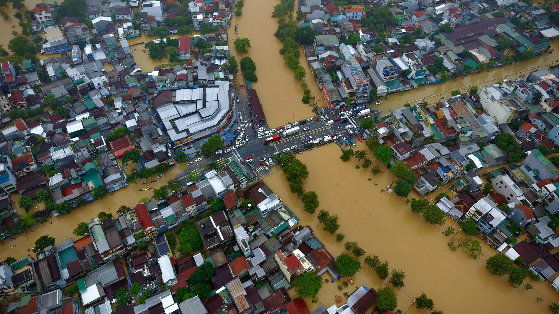
The North and South Central regions of Vietnam are experiencing prolonged flooding due to heavy rains. In Hue , the flood situation remains complex as of the morning of October 28th. The Bo and Huong rivers are at high levels. The entire city is submerged, causing difficulties for residents, with some low-lying areas experiencing deep flooding and many households isolated. Photo: Nhat Hoang.
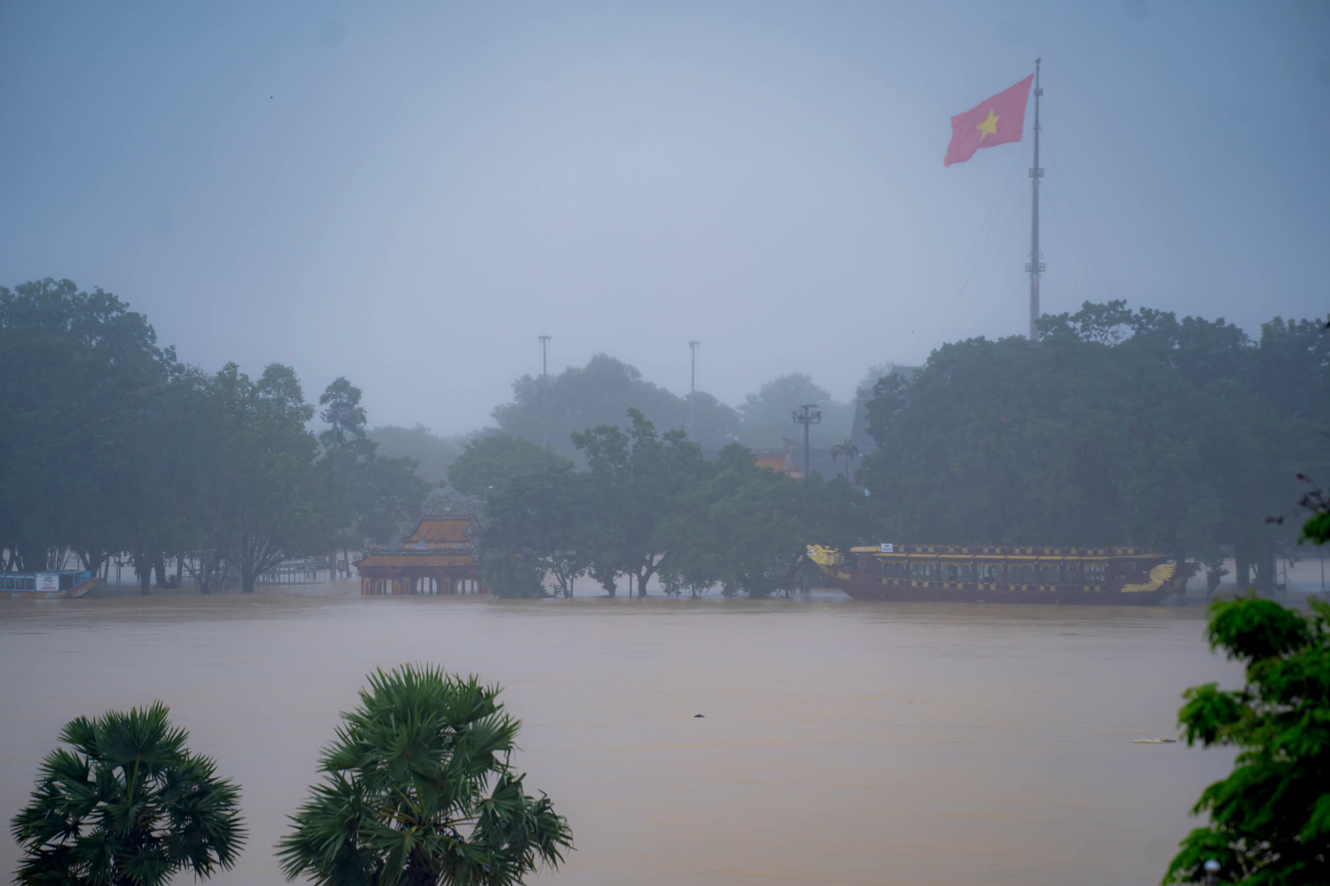
In the central area of Phu Xuan ward (Hue), the water level of the Perfume River is close to alarm level 3. The Nghênh Lương Đình historical site, located in front of the Hue Citadel, is flooded by more than 0.5 meters. Several roads inside the Imperial Citadel, Tu Duc Mausoleum, and Minh Mang Mausoleum are cut off due to floodwaters. The Hue Ancient Citadel Relics Conservation Center was forced to announce the suspension of tourist activities on October 27th. Photo: Le Dinh Hoang.
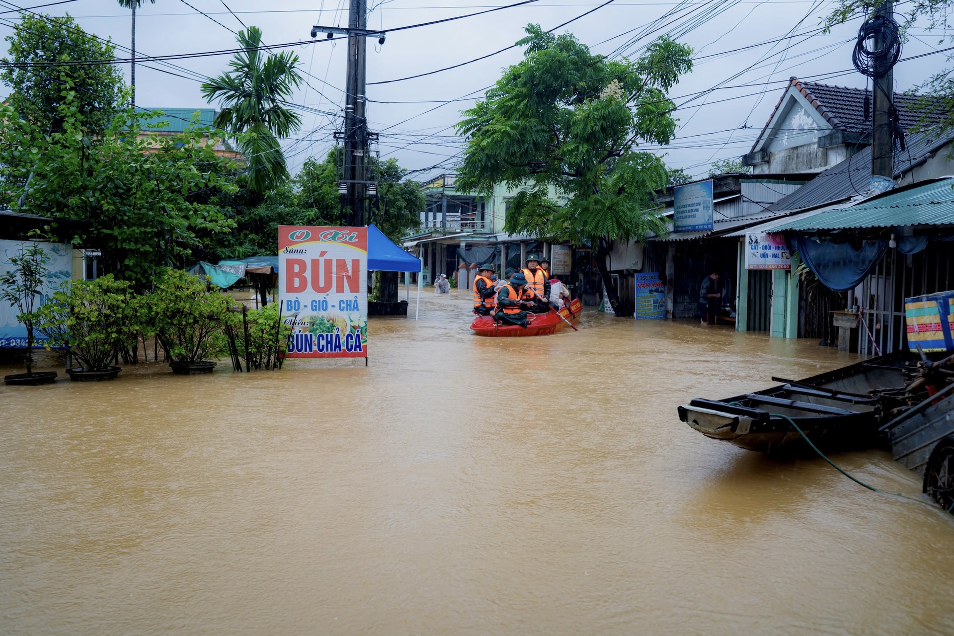
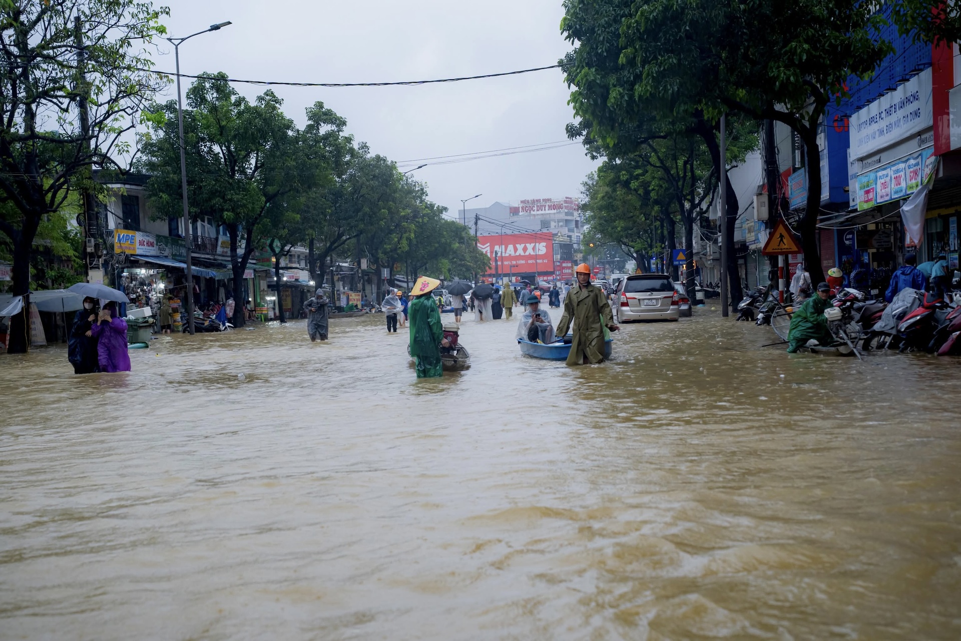
Severe flooding also occurred in Loc An commune, An Cuu ward, Thuan Hoa ward, etc. The People's Committees of the wards and communes assisted in evacuation and relocation of belongings, while strictly prohibiting people and vehicles from moving on rivers and lakes. According to the forecast of the Hue City Meteorological and Hydrological Agency, the locality will continue to experience heavy to very heavy rain until October 29th. Photo: Le Dinh Hoang.
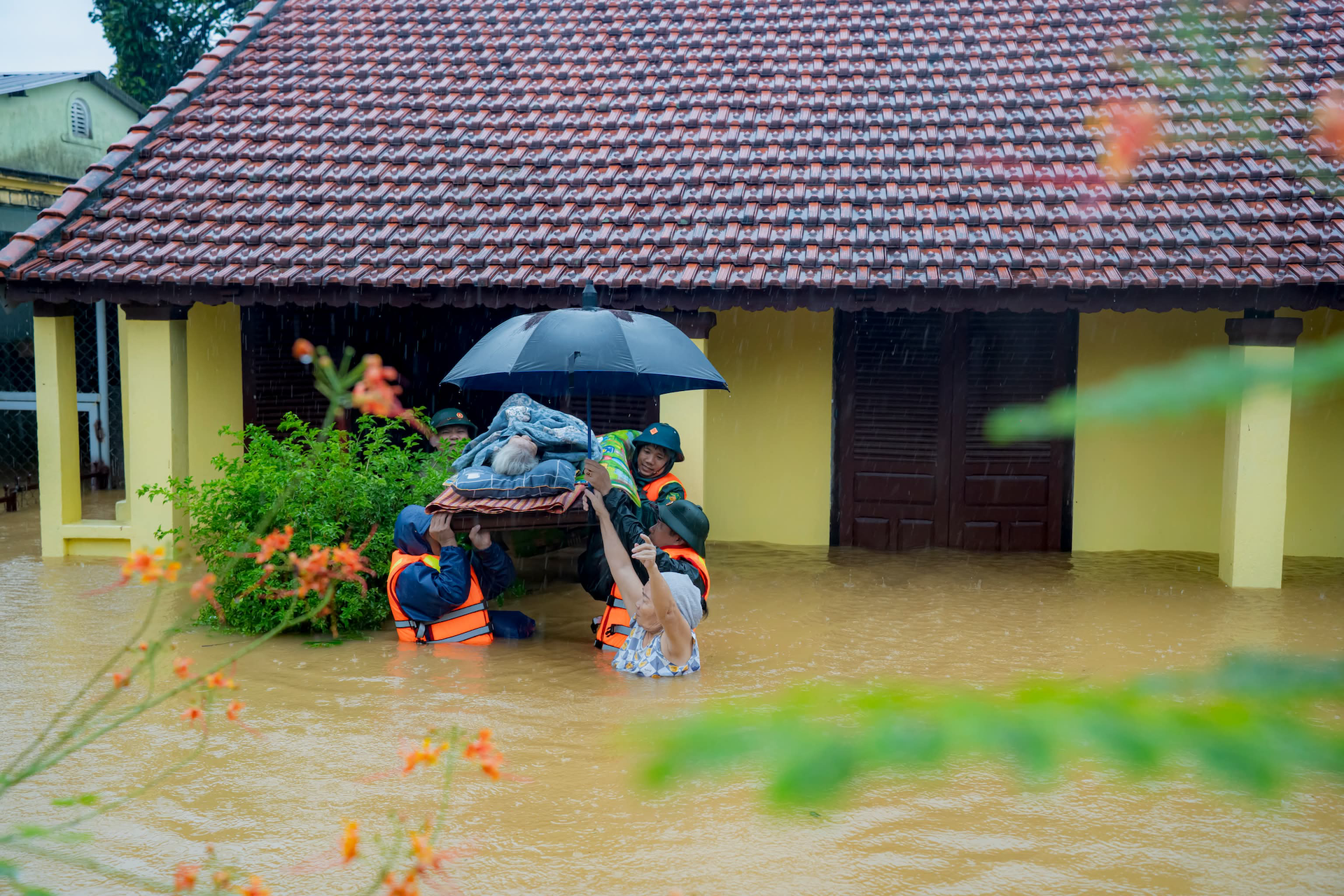
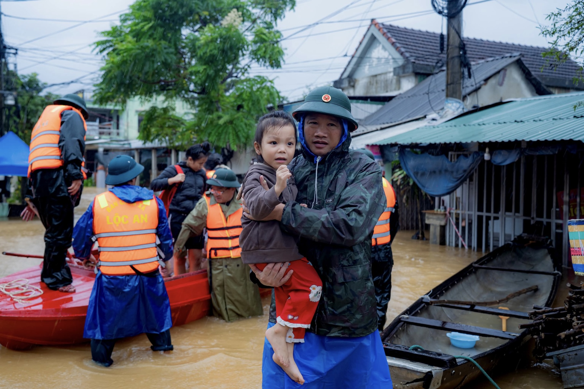
The An Cựu Ward Military Command assisted in rescuing an elderly man from his flooded home. Photo: Le Dinh Hoang.
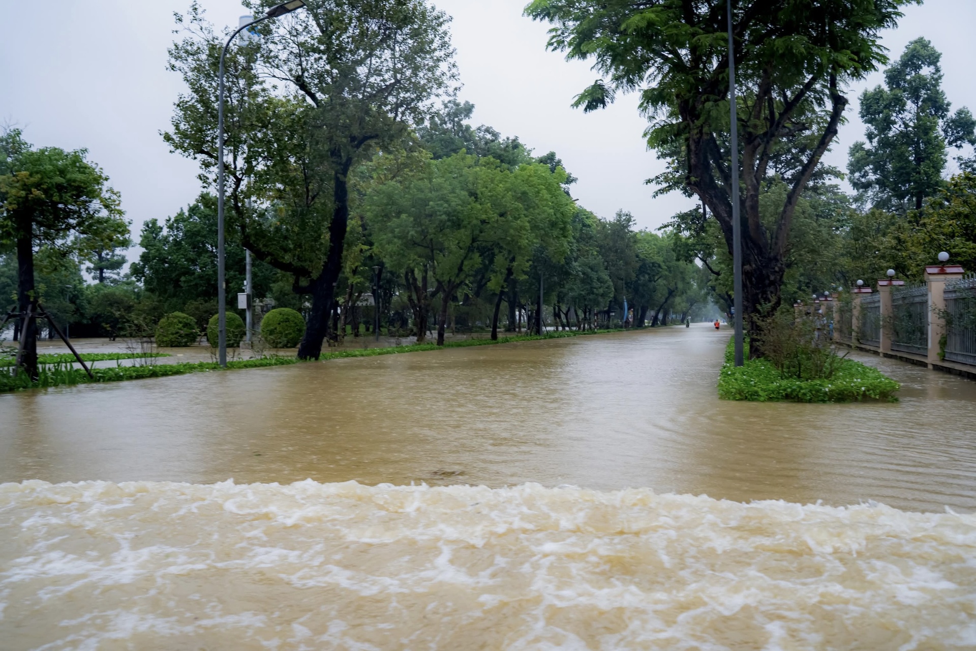
Water levels at monitoring stations on the Vu Gia (Ai Nghia) and Thu Bon (Cau Lau) rivers remain above alarm level 3. On the morning of October 28th, heavy rain poured down but then stopped intermittently. Photo: Hoi An People.
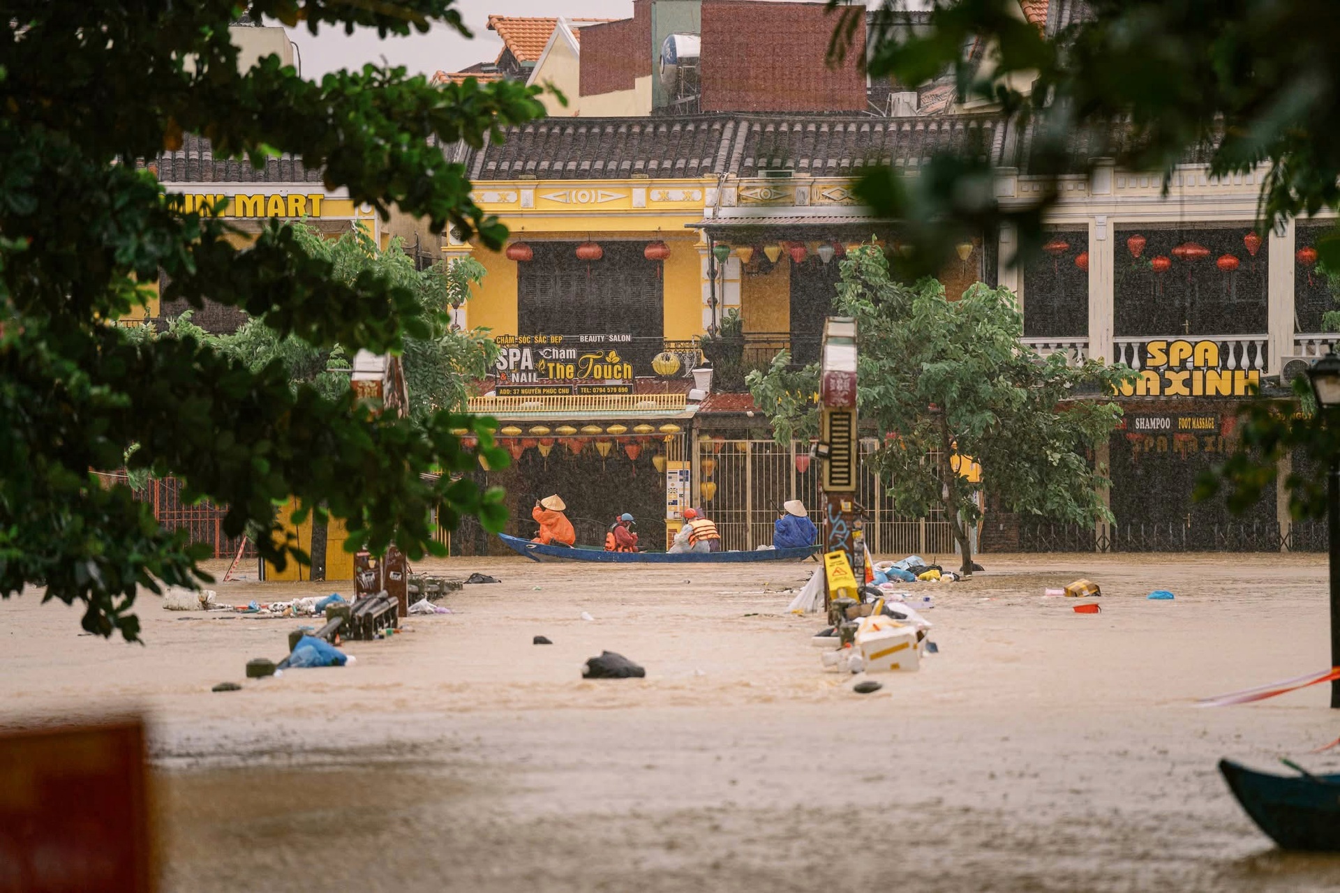

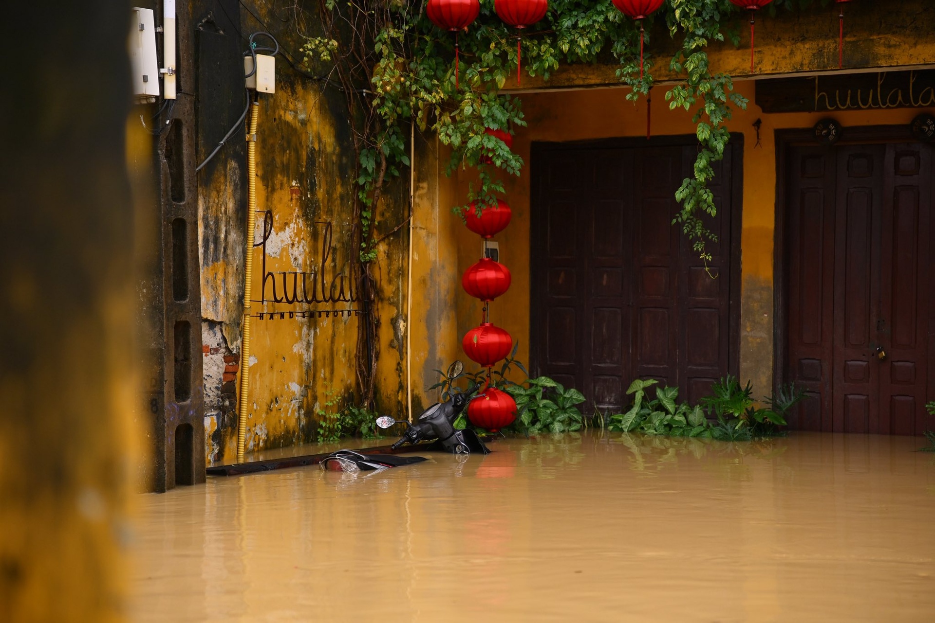
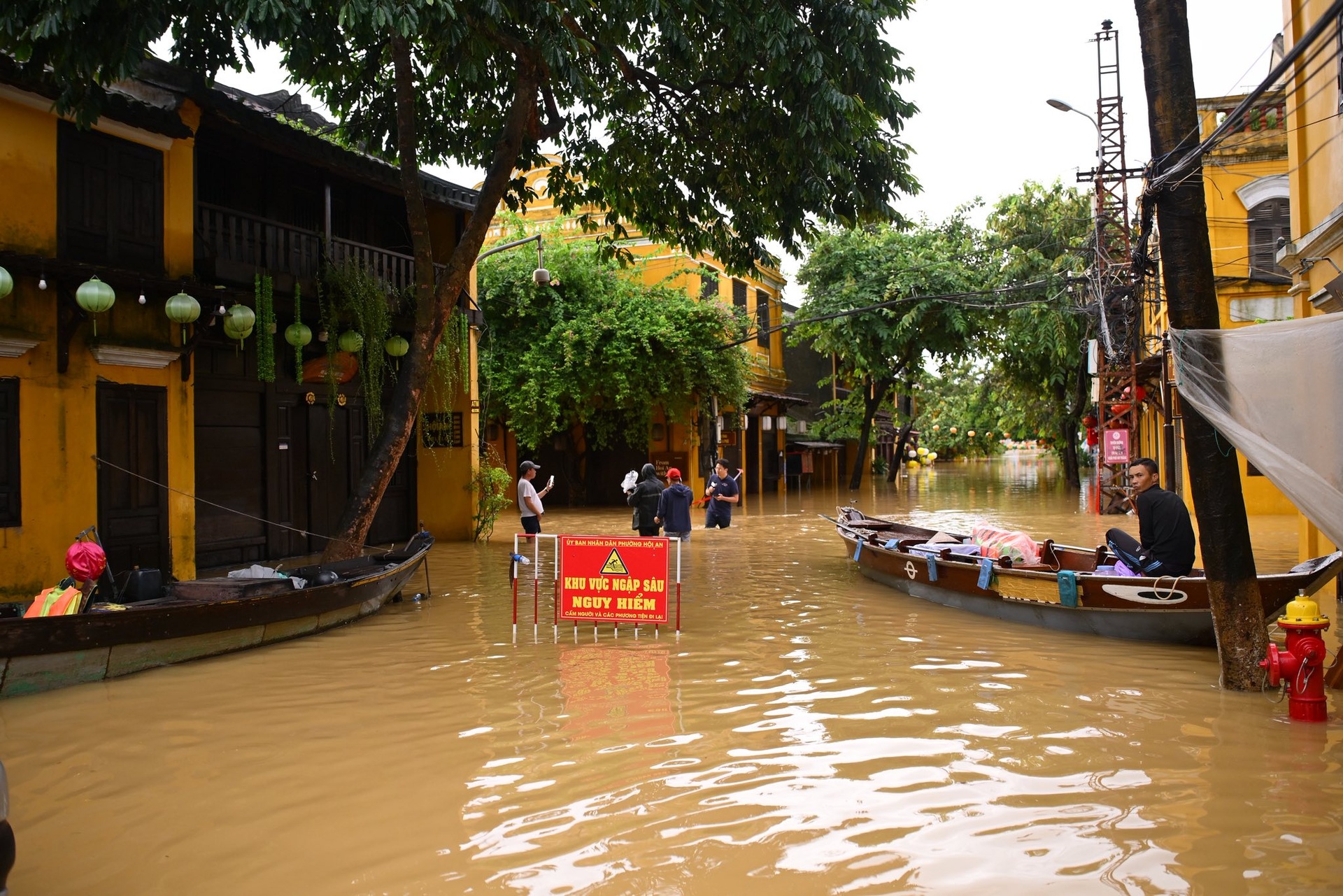
In Hoi An, several streets such as Tran Phu, Hai Ba Trung, Ba Trieu, and Tran Hung Dao are deeply flooded. The Hoai River's water level is at alarm level 3. Severe flooding, up to 2 meters in some areas, has prompted local authorities to activate the highest level of disaster prevention and control measures. Photo: Hoi An residents.

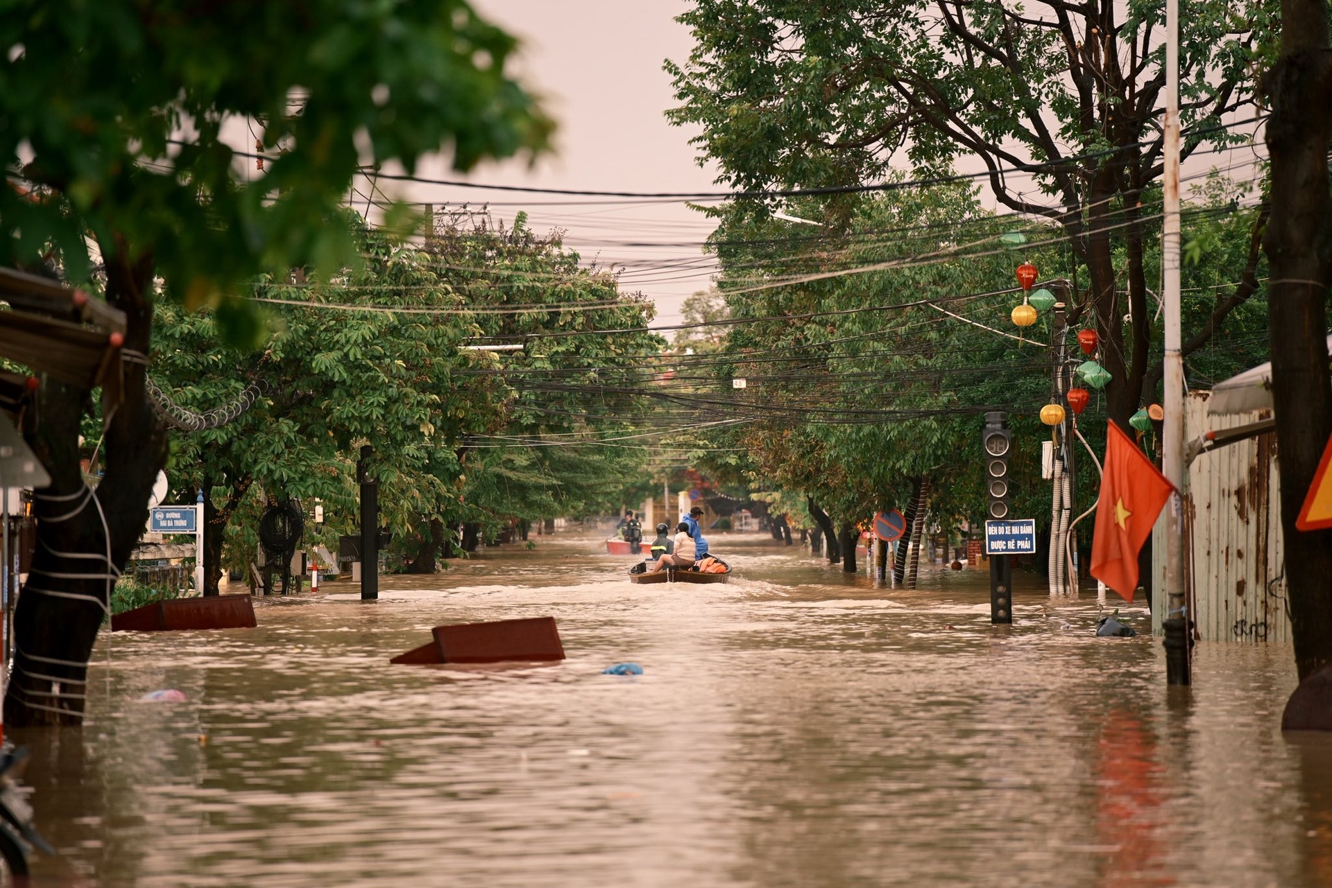
The ferry, normally used to carry tourists, is being repurposed to transport residents evacuating from the deeply flooded area. Photo: Hoi An resident.

A fabric shop owner moves merchandise to a higher level to protect their property. Photo: Hoi An resident.
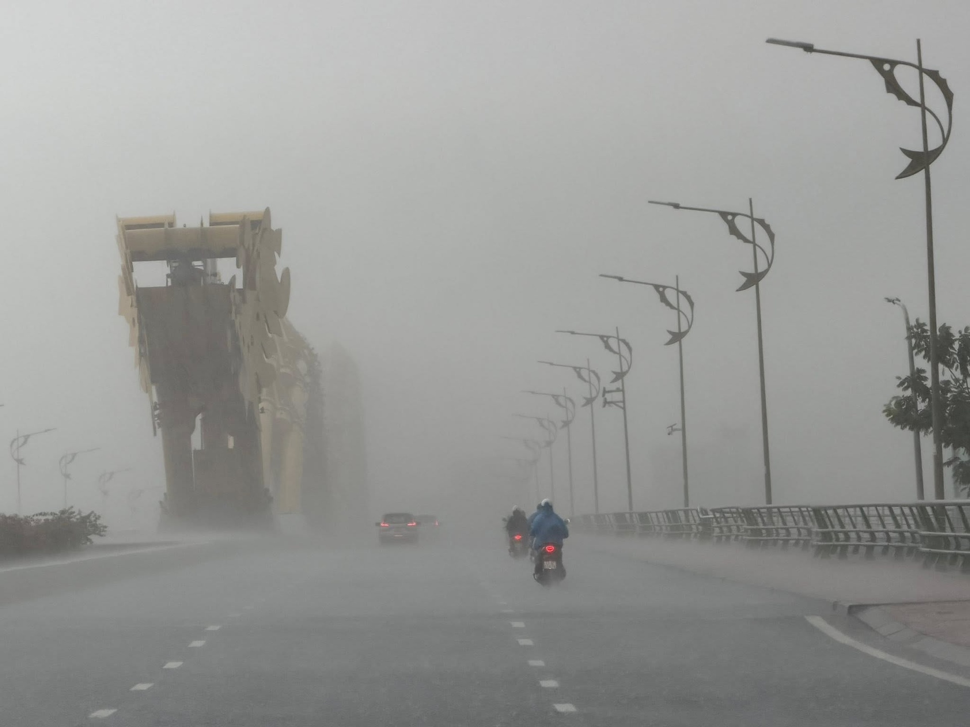
Heavy rain poured down on the Dragon Bridge in central Da Nang. According to the Central Vietnam Meteorological and Hydrological Station, the heavy rain will gradually decrease from now until October 30th. The prolonged rain is due to a strengthening cold air mass combined with an easterly wind disturbance. Photo: Moon Black.
Source: https://lifestyle.znews.vn/canh-lu-lich-su-bua-vay-hue-da-nang-hoi-an-post1597704.html


![[Photo] Prime Minister Pham Minh Chinh attends the Conference summarizing and implementing tasks of the judicial sector.](/_next/image?url=https%3A%2F%2Fvphoto.vietnam.vn%2Fthumb%2F1200x675%2Fvietnam%2Fresource%2FIMAGE%2F2025%2F12%2F13%2F1765616082148_dsc-5565-jpg.webp&w=3840&q=75)


Comment (0)