
 |
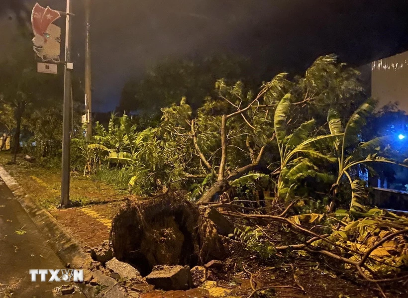
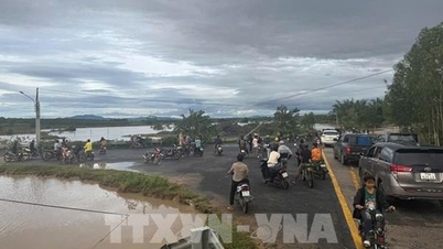
| Trees fell due to strong winds. (Photo: Le Phuoc Ngoc/VNA) |
According to the National Center for Hydro-Meteorological Forecasting, early on the morning of November 7, the tropical depression (weakened from storm No. 13 - Kalmaegi) weakened into a low pressure area in the Lower Laos region.
At 4:00 a.m., the low pressure area was located at about 14.6 degrees North latitude; 106.8 degrees East longitude. The strongest wind in the center of the low pressure area was below level 6 (below 39 km/h).
It is forecasted that in the next 12 hours, the low pressure area will continue to move mainly in the West Northwest direction, weakening and gradually dissipating.
This is the last news about storm number 13. Previously, on the night of November 6, the storm weakened into a tropical depression.
Heavy rain from Thanh Hoa to Da Nang and the Central Highlands
The National Center for Hydro-Meteorological Forecasting said that from now until the morning of November 7, the area from Southern Quang Tri to Da Nang city and the Central Highlands will have moderate rain, heavy rain, and locally very heavy rain with common rainfall of 20-50mm, locally over 80mm.
From November 7 to the end of November 8, the area from Thanh Hoa to Northern Quang Tri will have moderate rain, heavy rain, and locally very heavy rain with common rainfall of 50-150mm, locally over 200mm. Warning of the risk of heavy rain over 100mm/3 hours.
In addition, in the evening and night of November 7, in the Southern region, there will be scattered showers and thunderstorms with rainfall of 10-30mm, with some places having heavy rain over 70mm.
Warning of risk of heavy rain over 60mm/3h. From the night of November 8, heavy rain in the area from Thanh Hoa to Northern Quang Tri tends to decrease.
Level 1 natural disaster risk due to heavy rain, tornado, lightning, hail.
"Thunderstorms are likely to cause tornadoes, lightning, hail and strong gusts of wind. Heavy rain can cause flooding in low-lying areas, urban and industrial areas; flash floods in small rivers and streams; and landslides on steep slopes," noted Deputy Head of the Weather Forecasting Department Vu Anh Tuan.
Many sea areas have strong winds and high waves.
At sea, day and night of November 7, the southern area of Bac Bo Gulf has wind level 6, gusting to level 7-8, rough sea; at night the wind gradually decreases, waves 2.5-3.5m high.
The sea area from South Da Nang to Gia Lai has level 5 wind during the day, sometimes level 6, gusting to level 7-8, rough sea; at night the wind gradually decreases, waves 2-3m high.
In addition, on the day and night of November 7, the North East Sea area (including Hoang Sa special zone), the sea area from Lam Dong to Ca Mau, Ca Mau to An Giang and the Gulf of Thailand will have scattered showers and thunderstorms, with the possibility of tornadoes, strong gusts of wind of level 6-7 and waves over 2m high.
Warning: In the evening and night of November 8, the eastern sea area of the North East Sea will have northeast winds gradually increasing to level 6-7, gusting to level 8-9, rough seas, waves 3-5m high.
Marine disaster risk level 2. All vessels operating in the above areas are at high risk of being affected by strong winds and large waves.
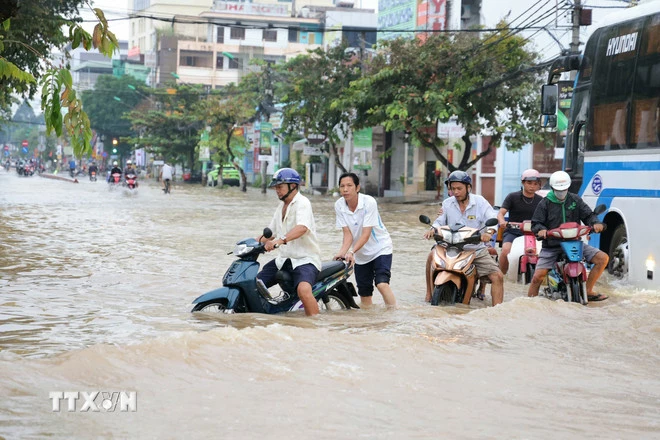 |
| High tides caused deep flooding on Cach Mang Thang Tam Street, Cai Khe Ward (Can Tho), making it very difficult for people to move around. (Photo: VNA) |
Weather in regions day and night 11/7
In the Northwest, there will be rain in some places; in the afternoon and at night, there will be scattered showers and thunderstorms in some places. In the morning and at night, it will be cold, and in some places it will be freezing. Light wind. Lowest temperature 20-23 degrees Celsius, in some places below 19 degrees Celsius. Highest temperature 24-27 degrees Celsius, in some places above 27 degrees Celsius.
In the Northeast, there will be rain in some places; in the afternoon and at night, there will be scattered showers and thunderstorms; in the plains, there will be rain, moderate rain and thunderstorms, locally heavy rain, cold in the morning and at night, and cold in the mountainous areas. Wind from the North to the Northwest, level 2-3. Lowest temperature 20-23 degrees Celsius, in the mountainous areas, some places below 20 degrees Celsius. Highest temperature 23-26 degrees Celsius, some places above 26 degrees Celsius.
Hanoi has rain in some places; from afternoon and night there will be rain, showers and thunderstorms, cold in the morning and at night. North to Northwest wind level 2-3. Lowest temperature 21-23 degrees Celsius. Highest temperature 23-25 degrees Celsius.
Provinces and cities from Thanh Hoa to Hue, in the North there will be moderate rain, heavy rain, locally very heavy rain; in the South in the morning there will be moderate rain, heavy rain, locally very heavy rain, later there will be scattered showers and thunderstorms, in thunderstorms there is a possibility of tornadoes, lightning and strong gusts of wind. Wind from the North to the Northwest level 3. The lowest temperature in the North is 21-23 degrees Celsius, in the South is 23-25 degrees Celsius. The highest temperature in the North is 23-25 degrees Celsius, in the South is 25-28 degrees Celsius.
The South Central Coast has scattered showers and thunderstorms in some places, especially in the Da Nang area in the morning there will be moderate to heavy rain, and locally very heavy rain in some places. Southeast wind level 2-3. Lowest temperature 22-25 degrees Celsius. Highest temperature 27-30 degrees Celsius.
In the morning, the Central Highlands will have moderate to heavy rain, locally very heavy rain, then scattered showers and thunderstorms in some places. In the North, the wind will be Southeast to East, in the South, the wind will be Southwest level 2-3. Lowest temperature 19-22 degrees Celsius. Highest temperature 24-27 degrees Celsius.
The South has scattered showers and thunderstorms; in the afternoon and evening there are scattered showers and thunderstorms, locally heavy rain, with the possibility of tornadoes, lightning and strong gusts of wind in thunderstorms. Southwest wind level 3-4. Lowest temperature 23-26 degrees Celsius. Highest temperature 28-31 degrees Celsius, some places above 31 degrees Celsius.
Ho Chi Minh City has scattered showers and thunderstorms; in the afternoon and evening there will be scattered showers and thunderstorms, locally heavy rain, with the possibility of tornadoes, lightning and strong gusts of wind during thunderstorms. Southwest wind level 3-4. Lowest temperature 24-26 degrees Celsius. Highest temperature 28-30 degrees Celsius.
According to VNA/Vietnam+
Source: https://baoquangtri.vn/xa-hoi/202511/tin-cuoi-cung-ve-con-bao-so-13-mua-lon-tu-thanh-hoa-den-da-nang-3cd42bd/
![[Photo] Hanoi: Long Bien residents brave the rain to go to work and school amid traffic jams due to bridge closures from early morning](https://vphoto.vietnam.vn/thumb/1200x675/vietnam/resource/IMAGE/2025/11/07/1762485038077_dji-0206-1506-jpg.webp)


![[Photo] Prime Minister Pham Minh Chinh receives the delegation of the Semiconductor Manufacturing International (SEMI)](https://vphoto.vietnam.vn/thumb/1200x675/vietnam/resource/IMAGE/2025/11/06/1762434628831_dsc-0219-jpg.webp)


Comment (0)