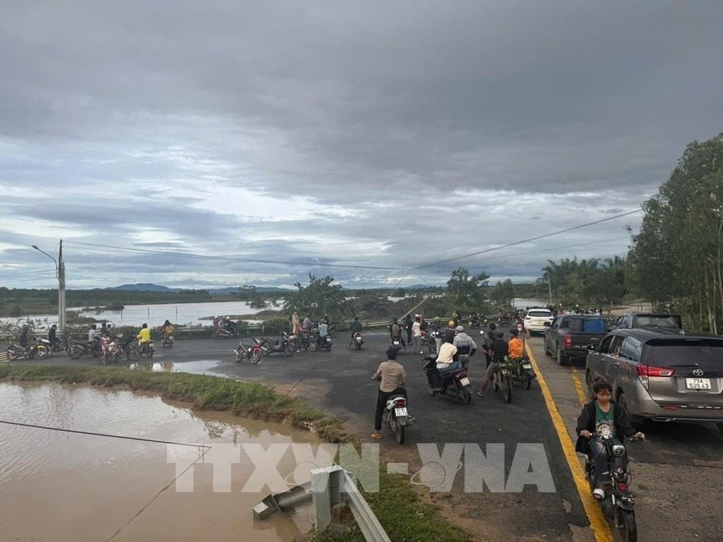
Immediately after the incident, authorities blocked off the collapsed road area to ensure safety for people and vehicles.
This is the route connecting Po To commune and Cho Long commune, with a large traffic volume. The landslide has seriously affected the travel of people in this area and vehicles traveling on National Highway 19.
Due to the influence of storm circulation No. 13 (storm Kalmaegi) combined with the strengthening cold air, since the afternoon of November 6, Gia Lai province has experienced prolonged heavy rain, causing the water level of Ba River and its tributaries to rise rapidly, causing flooding and landslides in many areas.
According to the Gia Lai Province Steering Committee for Natural Disaster Prevention and Search and Rescue, heavy rains have caused the water level of the Ba River at Ben Mong Bridge (Ia Trok Commune, Eastern Province) to exceed alert level 3 and continue to rise. The floodwaters rose rapidly during the night, causing many traffic routes and residential areas along the river to be deeply submerged and isolated.
In Ia Pa commune, rising floodwaters caused many areas to be deeply submerged. Mr. Vo Tan Cong, Vice Chairman of Ia Pa Commune People's Committee, said that the entire commune had about 300 houses flooded, and No Nang 2 village alone was completely cut off. On the night of November 6, the commune government, militia and police helped evacuate dozens of households to safety.
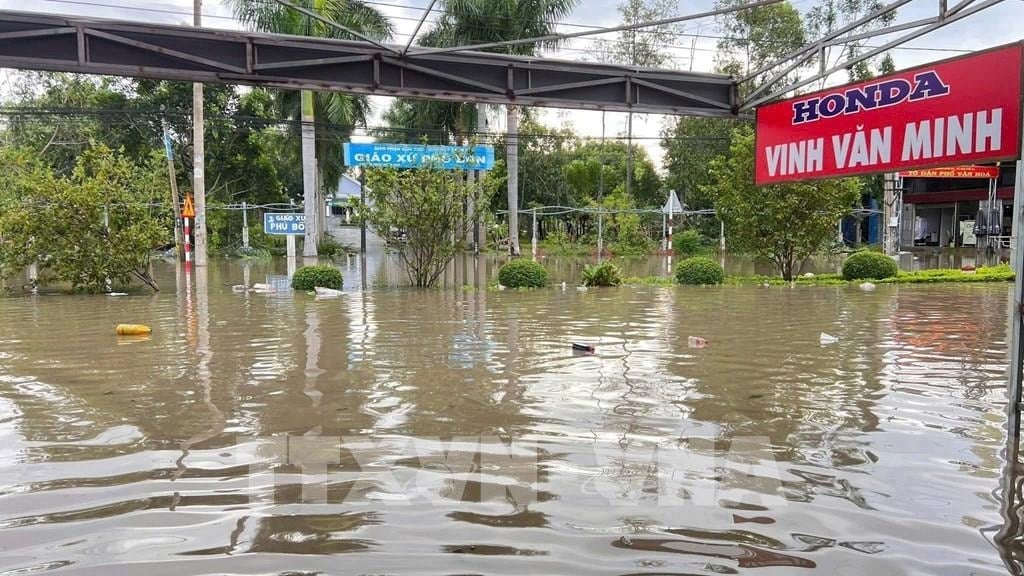
Mr. Do Van Trieu, a resident of Village 1, Ia Pa Commune, recounted: “The water rose very quickly, in less than an hour almost the entire house was flooded. My whole family had to unload their belongings and run to a relative’s house to avoid the flood.”
In Ia Hiao commune, heavy rain also caused localized flooding, with about 450 houses submerged. Mr. Pham Van Phuong, Secretary of the Ia Hiao Commune Party Committee, said that the locality has mobilized forces to support people in moving their belongings, clearing canals, and ensuring safety for people in low-lying areas.
On Highway 25, through Ayun Pa ward, rising floodwaters have cut off traffic, with many sections submerged 0.5 to 1 meter deep. Authorities have put up warning signs, instructing people not to go through flooded areas.
At To Na Pass (through Chu Rcam Commune), heavy rain caused landslides on the slope, causing rocks and soil to flow onto the road, causing traffic congestion. Authorities mobilized machinery and vehicles to quickly level the road and initially clear the route on the morning of November 7.
Gia Lai province is currently focusing on directing localities to closely monitor the development of floods and rains, proactively evacuate people in low-lying areas and along rivers and streams; at the same time, arrange forces to stand guard and ensure traffic safety at flooded and landslide areas.
The meteorological agency warned that on November 7 and 8, the Central and Southeastern regions of Gia Lai province will continue to experience heavy to very heavy rain, with a high risk of flash floods, landslides and localized flooding in low-lying areas.
According to VNASource: https://baohaiphong.vn/sat-lo-chia-cat-giao-thong-nhieu-khu-vuc-ngap-lut-o-gia-lai-525897.html


![[Photo] Da Nang: Hundreds of people join hands to clean up a vital tourist route after storm No. 13](https://vphoto.vietnam.vn/thumb/1200x675/vietnam/resource/IMAGE/2025/11/07/1762491638903_image-3-1353-jpg.webp)


































Comment (0)