
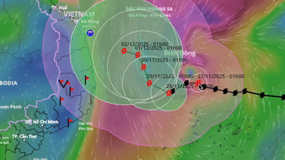
Accordingly, the sea area from Lam Dong to Ca Mau has northeast wind level 6, gusting to level 7-8, waves 2-4m high, rough sea; the Ca Mau - An Giang - Phu Quoc area has wind level 4-5, gusting to level 6-7, waves 1.5-2.5m high, slightly rough sea. Both sea areas have showers, thunderstorms, risk of tornadoes and strong gusts of wind.
 |
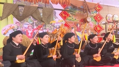
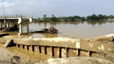
| Ho Chi Minh City is at risk of heavy rain due to a tropical depression that could strengthen into storm No. 15 - Photo: TQ |
To proactively respond to the tropical depression that could strengthen into a storm, threatening to affect Ho Chi Minh City, the Department of Agriculture and Environment recommends that departments, branches and localities closely monitor weather reports from the meteorological agency and the City Civil Defense Command.
Prepare a plan to prevent the low pressure from strengthening into a storm, ensure rescue forces and vehicles and be on duty 24/7.
Coastal localities, border guards, fisheries, fisheries surveillance forces, etc. deploy measures to ensure safety for people and boats; regularly report developments of strong winds and big waves; count and guide boats to move away from dangerous areas and anchor safely.
The Department of Fisheries and Fisheries Surveillance has a firm grasp of the location of fishing vessels operating far from shore and provides timely guidance on taking shelter. Irrigation and technical infrastructure units coordinate to operate reservoirs and tide control sluices, and prepare pumps to handle flooding caused by heavy rain.
Irrigation and hydropower enterprises coordinate to regulate reservoirs appropriately to ensure project safety and reduce flooding downstream. Relevant units proactively develop plans to prevent and quickly fix infrastructure problems.
Source: https://ttbc-hcm.gov.vn/tphcm-chu-dong-ung-pho-voi-ap-thap-nhiet-doi-co-the-manh-len-thanh-bao-so-15-1020063.html


![[Photo] Close-up of heavy damage at the school located on the banks of the Ban Thach River](/_next/image?url=https%3A%2F%2Fvphoto.vietnam.vn%2Fthumb%2F1200x675%2Fvietnam%2Fresource%2FIMAGE%2F2025%2F11%2F26%2F1764152130492_ndo_bl_img-8188-8805-jpg.webp&w=3840&q=75)

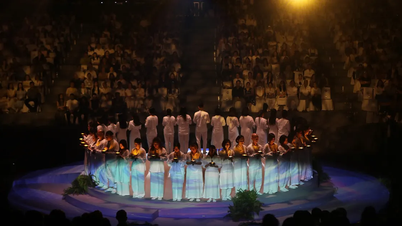
![[Photo] VinUni students' emotions are sublimated with "Homeland in the Heart: The Concert Film"](/_next/image?url=https%3A%2F%2Fvphoto.vietnam.vn%2Fthumb%2F1200x675%2Fvietnam%2Fresource%2FIMAGE%2F2025%2F11%2F26%2F1764174931822_10-3878-jpg.webp&w=3840&q=75)


Comment (0)