
On the afternoon of May 10, within the framework of the conference to implement Resolution 57-NQ/TW of the Politburo on science and technology development and digital transformation, the Ministry of Agriculture and Environment organized a thematic discussion session on environment, water resources and remote sensing.
At the discussion session, many delegates emphasized the role of remote sensing technology as an important tool in resource management, modern agricultural development and environmental protection in the digital transformation period.
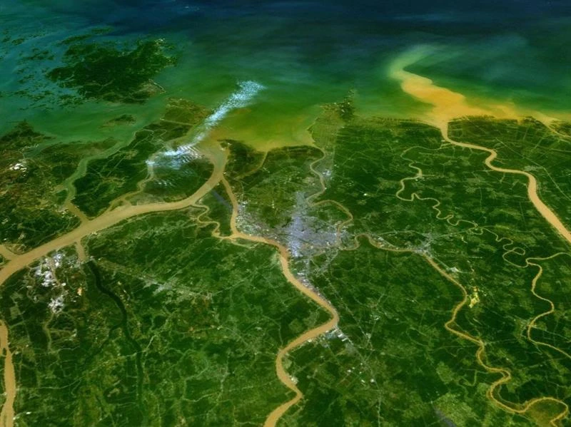
Associate Professor Dr. Pham Minh Hai, Deputy Director of the National Remote Sensing Department, said that Vietnam has now built a national remote sensing database with nearly 100,000 satellite images, collected from 16 different sources such as VNREDSat-1, SPOT6, Worldview, Landsat... The images have a resolution of 0.55m to 30m, a repetition time of 2.5 to 5 days, covering the entire territory and sea of Vietnam. This data volume has grown steadily by about 20% each year, serving many sectors from agriculture, environment to defense and security.

Currently, remote sensing technology has been effectively applied in Vietnam in many fields such as natural disaster warning, forest change monitoring, subsidence monitoring, land inventory and greenhouse gas emission monitoring. Typically, during Typhoon Yagi (September 2024), the Sentinel Asia system promptly provided data for rescue work and emergency response direction.
However, the remote sensing industry is still facing many challenges such as a shortage of high-quality human resources in the field of remote sensing image processing and artificial intelligence; the database has not met level 3 security standards; exploitation is still scattered and lacks synchronization; investment costs from satellite production to data processing remain high.
To overcome limitations and effectively exploit potential, the National Remote Sensing Department has submitted to the Ministry of Agriculture and Environment for approval the Project "Promoting the application of remote sensing and artificial intelligence in building a monitoring system for a number of agricultural and environmental fields, serving green growth and sustainable development".
Accordingly, from 2026, the monitoring system will be built in the direction of integrating modern technologies such as artificial intelligence, big data, internet of things and cloud computing. The goal is to improve decision-making capacity, direct and operate quickly and accurately, in line with the national digital transformation strategy.
Source: https://www.sggp.org.vn/viet-nam-day-manh-giam-sat-nong-nghiep-va-moi-truong-bang-vien-tham-tu-nam-2026-post794658.html
![[Photo] A delegation of 100 journalists from the Vietnam Journalists Association visits the soldiers and people of Truong Sa island district.](https://vphoto.vietnam.vn/thumb/1200x675/vietnam/resource/IMAGE/2025/5/30/0984a986227d4e988177f560d2e1563e)
![[Photo] National Conference "100 years of Vietnamese Revolutionary Press accompanying the glorious cause of the Party and the nation"](https://vphoto.vietnam.vn/thumb/1200x675/vietnam/resource/IMAGE/2025/5/30/1cf6cd5c8a934ebfa347028dcb08358c)

![[Photo] General Secretary To Lam receives Chief of the Central Office of the Lao People's Revolutionary Party](https://vphoto.vietnam.vn/thumb/1200x675/vietnam/resource/IMAGE/2025/5/30/140435f4b39d4599a3d17975dfb444c5)
![[Photo] Journalists moved to tears at the Memorial Service for the soldiers who died in Gac Ma](https://vphoto.vietnam.vn/thumb/1200x675/vietnam/resource/IMAGE/2025/5/30/9454613a55c54c16bf8c0efa51883456)


Comment (0)