

On the afternoon of June 12, Mr. Phung Tien Dung, Head of the Hydrological Forecasting Department , National Center for Hydro-Meteorological Forecasting (Department of Hydrometeorology, Ministry of Agriculture and Rural Development) said that the center of storm No. 1 (Wutip) is currently located in the west of Hoang Sa archipelago, reaching level 8-9. It is forecasted that in the next 24 hours, the storm will move northwest at a speed of about 10km/hour and has a tendency to strengthen.
In the next 2-3 days, the storm will move north, make landfall in Guangdong and Guangxi provinces (China) and then weaken.
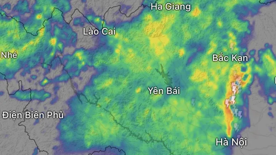
Before weakening, the storm still caused strong winds and heavy rain in the North East Sea and the Gulf of Tonkin; at the same time, it continued to cause heavy to very heavy rain on land in the Central region of our country.
Mr. Phung Tien Dung warned that many places in the Central region have had heavy to very heavy rain in the past hours, the rain will continue, the risk of flash floods and landslides is very high. Water levels in some rivers in the Central region have risen rapidly and reached high levels.
* According to information compiled by the Department of Dyke Management and Natural Disaster Prevention (Ministry of Agriculture and Environment), by noon today, June 12, the provinces from Quang Binh to Quang Ngai and Kon Tum had experienced heavy to very heavy rain, with common rainfall of 150-250mm.
Many places had extremely heavy rain with amounts from 300-500mm, Bach Ma peak ( Hue ) recorded 632mm (as of noon on June 12; accumulated to the afternoon of June 12 was 823mm), Thuong Lo 574mm, Giang Hai 378mm.
In Da Nang , Suoi Luong reached 421mm, Hoa Hai 380mm. Quang Nam had many places with rainfall exceeding 350mm such as Dai Hiep, Dai Son, Cau Ha Tan. Quang Binh and Quang Tri recorded some stations exceeding 200mm.
Heavy rains caused floods in some rivers, the water level exceeded the alarm level 1. Specifically, at Kien Giang River (Quang Binh), the water level reached 8.59m - 0.59m higher than alarm level 1. In Hue, Thuong Nhat station (Ta Trach) measured 60.34m - 1.34m higher than alarm level 1. Vu Gia River at Ai Nghia (Quang Nam) reached 7.23m; Cai River at Thanh My reached 16.27m - both exceeded alarm level 1 by 0.7m.
Damage was concentrated in Quang Binh, Quang Tri, Hue, Da Nang and Quang Nam. Dai Loc district (Quang Nam) alone had 300 houses flooded. Regarding boats, 3 boats sank, including 2 fishing boats from Quang Binh (QB-93451-TS, QB-92756-TS) while operating at sea and 1 boat at Da Nang while anchored. All 8 crew members were safely rescued by other fishing boats.
Floods have damaged 22,500 hectares of rice and crops, of which 12,758 hectares are in Hue, 8,246 hectares in Quang Tri, and 1,497 hectares in Da Nang. Da Nang also suffered damage to 33 hectares of aquaculture.
Regarding traffic, Quang Tri has 7 flooded underground spillways in Dak Rong district. Hue has landslides on the slopes of Highway 14C, La Son - Tuy Loan route, and Ho Chi Minh Highway through A Luoi district. Da Nang has many inner-city roads flooded (receded), and landslides on 2 rural roads. Quang Nam has 3 provincial roads (603B, 609, 615B) partially flooded.
As of noon on June 12, no human casualties have been recorded, said a representative of the Department of Dyke Management and Disaster Prevention.
Source: https://www.sggp.org.vn/bao-so-1-gay-mua-vuot-800mm-tai-trung-bo-post799195.html


![[Photo] Overcoming the heat, practicing to prepare for the parade](https://vphoto.vietnam.vn/thumb/1200x675/vietnam/resource/IMAGE/2025/6/21/b93392e8da8243b8a32040d19590e048)


![[Maritime News] Wan Hai Lines invests $150 million to buy 48,000 containers](https://vphoto.vietnam.vn/thumb/402x226/vietnam/resource/IMAGE/2025/6/20/c945a62aff624b4bb5c25e67e9bcc1cb)


Comment (0)