

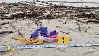
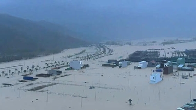
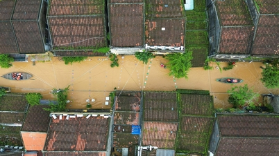
Many houses of people in Dak Lak are flooded.
The National Center for Hydro-Meteorological Forecasting said that as of 7 a.m. on November 19, water levels on many rivers from Hue to Khanh Hoa and the Central Highlands region were at very high levels and continued to develop complicatedly.
Currently, floods on Ba River, Kon River and Krong Ana River are rising rapidly. Some stations have recorded particularly noteworthy water levels:
Ba River at Cung Son reached 35.92 m, 1.42 m higher than alarm level 3; at Phu Lam reached 3.94 m, 0.24 m higher than alarm level 3.
The Kon River at Thach Hoa has reached alert level 3.
Thu Bon River at Cau Lau exceeded alarm level 2 by 0.22 m.
Tra Khuc River is only 0.04 m below alarm level 2 and continues to rise.
Krong Ana River at Giang Son exceeded alert level 2 by 0.02 m.
Many other rivers from Hue, Da Nang, Quang Nam , Quang Ngai, Gia Lai to Khanh Hoa are also fluctuating at alert levels 1-3, including Dinh River (Khanh Hoa) which is above alert level 3.
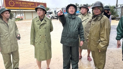
Faced with these dangerous developments, the National Center for Hydro-Meteorological Forecasting has issued a level 4 disaster risk warning for the eastern region of Dak Lak province.
Mr. Hoang Van Dai, Deputy Director of the National Center for Hydro-Meteorological Forecasting, said: "This is an especially serious warning level, issued when the area encounters a dangerous combination of large floods, flash floods and landslides, which can cause great damage to life, property and infrastructure."
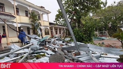
The risk of flash floods is very high.
In the next 12 hours, flood on Ba River at Phu Lam station will continue to rise and stay above alert level 3 (at the historical flood level in 1993 of 5.21 m) and Kon River will continue to rise and stay above alert level 3; flood on Krong Ana River will continue to increase; flood on Thu Bon River and Tra Khuc River will remain at alert level 1-2.
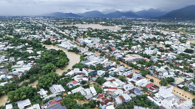
In the next 24 hours, flood levels on major rivers are likely to remain at a very high level, while widespread flooding will occur in provinces from Hue to Khanh Hoa.
Currently, the risk of flash floods on small rivers and streams and landslides on steep slopes in the Central and Central Highlands regions is very high. Many residential areas, especially low-lying areas, downstream areas of reservoirs and riverside areas, are likely to be deeply flooded in the coming hours.
The National Center for Hydro-Meteorological Forecasting recommends that people limit their movement through deep flooded areas, overflow areas, and landslide-prone slopes; proactively evacuate dangerous areas as requested by local authorities. Subsequent bulletins will be updated continuously, especially when there are changes in the operation and regulation of upstream reservoirs.
Thu Cuc
Source: https://baochinhphu.vn/canh-bao-cap-do-rui-ro-thien-tai-dac-biet-nghiem-trong-tai-phia-dong-tinh-dak-lak-10225111912151197.htm


![[Photo] Prime Minister Pham Minh Chinh and his wife meet the Vietnamese community in Algeria](https://vphoto.vietnam.vn/thumb/1200x675/vietnam/resource/IMAGE/2025/11/19/1763510299099_1763510015166-jpg.webp)
![[Photo] General Secretary To Lam receives Slovakian Deputy Prime Minister and Minister of Defense Robert Kalinak](https://vphoto.vietnam.vn/thumb/1200x675/vietnam/resource/IMAGE/2025/11/18/1763467091441_a1-bnd-8261-6981-jpg.webp)


Comment (0)