
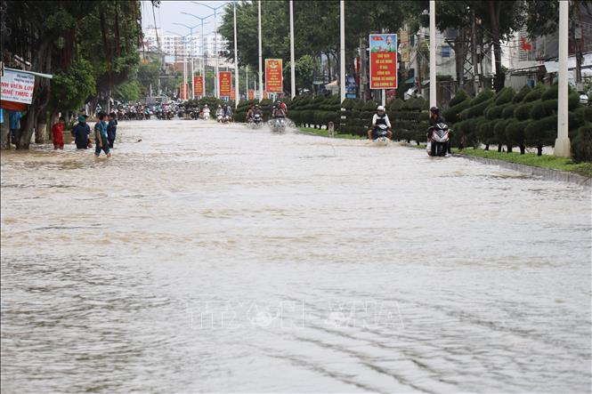
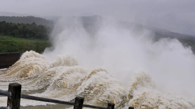
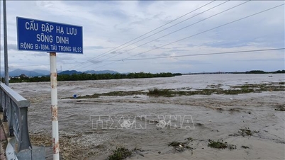
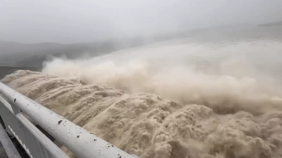
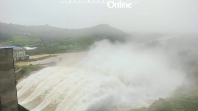
Accordingly, from 10:30 p.m. on November 18 to 9:30 a.m. on November 19, flood on Kon River (Gia Lai) continued to rise and was below alert level 3; downstream Ba River (Dak Lak) continued to rise and was above alert level 3; Vu Gia - Thu Bon River ( Da Nang city), Tra Khuc River (Quang Ngai) gradually decreased and was above alert level 2.
In the next 12 - 24 hours, floods on Kon and Ba rivers will gradually recede and reach alert levels 2 and 3; Vu Gia and Tra Khuc rivers will fluctuate at alert level 2; and Thu Bon river will fluctuate below alert level 3.
Warning: In the next 24 hours, floods on Huong River (Hue City), Bo River (Hue City), Dakbla River (Quang Ngai), Srepok River ( Dak Lak ) will fluctuate at alert level 1, alert level 2; floods on Krong Ana River (Dak Lak) will continue to rise and at alert level 2, Ky Lo River (Dak Lak), rivers in Khanh Hoa province will fluctuate at alert level 2, alert level 3 and above alert level 3.
Floods on rivers in the Central region are likely to last for many days. Flood risk level 3.
"The forecast and warning information is calculated based on the expected operating level of upstream reservoirs. The hydrometeorological agency will update the bulletins when there are changes in the discharge flow of the reservoirs," noted Head of Hydrological Forecasting Department Phung Tien Dung.
Real-time flash flood and landslide risk warning information is provided online on the website of the Department of Hydrometeorology at: https://luquetsatlo.nchmf.gov.vn and in flash flood and landslide warning bulletins.
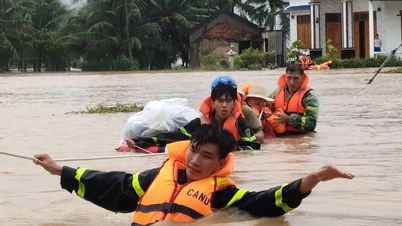
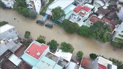
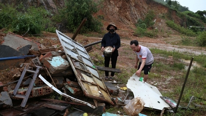
Floods on rivers and inundation in low-lying areas affect activities such as waterway transport, aquaculture, agricultural production, people's lives and socio-economic activities. Flash floods and landslides can have very negative impacts on the environment and threaten people's lives....
The hydrometeorological agency reminds people to regularly monitor forecast and warning information on the website of the National Center for Hydrometeorological Forecasting at nchmf.gov.vn, provincial, municipal and regional hydrometeorological stations; regularly update the latest hydrometeorological forecast information on the official mass media of the Central and local levels to proactively respond, and at the same time recommend that the authorities in the affected localities pay attention to reviewing the flow bottlenecks and vulnerable locations in the area to take preventive measures.
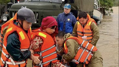
According to the guidance of the Department of Dyke Management and Natural Disaster Prevention and Control (Ministry of Agriculture and Environment), in the face of the above situation, affected areas should closely monitor developments of heavy rain, floods, flash floods, landslides, and promptly and fully inform authorities and people at all levels to proactively prevent, respond, and minimize damage.
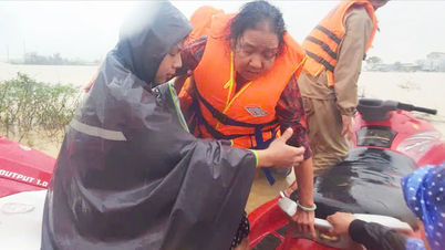
Localities deploy shock forces to inspect and review residential areas along rivers, streams, and low-lying areas to proactively organize the relocation and evacuation of people in areas at high risk of deep flooding, flash floods, and landslides; organize forces ready to control and guide traffic, and put up warning signs, especially through culverts, spillways, and areas with deep flooding and fast-flowing water; proactively arrange forces, materials, and means to overcome incidents, ensuring smooth traffic on main traffic routes when heavy rain occurs...
Source: https://baotintuc.vn/xa-hoi/canh-bao-nguy-co-ngap-lut-dien-rong-lu-quet-va-sat-lo-dat-tu-thanh-pho-hue-den-khanh-hoa-20251118223844541.htm


![[Photo] The Standing Committee of the Organizing Subcommittee serving the 14th National Party Congress meets on information and propaganda work for the Congress.](https://vphoto.vietnam.vn/thumb/1200x675/vietnam/resource/IMAGE/2025/11/19/1763531906775_tieu-ban-phuc-vu-dh-19-11-9302-614-jpg.webp)


![[Photo] General Secretary To Lam receives Slovakian Deputy Prime Minister and Minister of Defense Robert Kalinak](https://vphoto.vietnam.vn/thumb/1200x675/vietnam/resource/IMAGE/2025/11/18/1763467091441_a1-bnd-8261-6981-jpg.webp)
![[Photo] Prime Minister Pham Minh Chinh and his wife meet the Vietnamese community in Algeria](https://vphoto.vietnam.vn/thumb/1200x675/vietnam/resource/IMAGE/2025/11/19/1763510299099_1763510015166-jpg.webp)


Comment (0)