
Soil and rocks from the positive slope collapsed onto the road surface, the negative slope collapsed deeply, many sections of the roadbed were deformed... increasing the risk of unsafety.
However, with the continuous presence of functional forces, initial handling work was still promptly deployed, helping National Highway 27C maintain traffic flow, avoiding prolonged congestion.

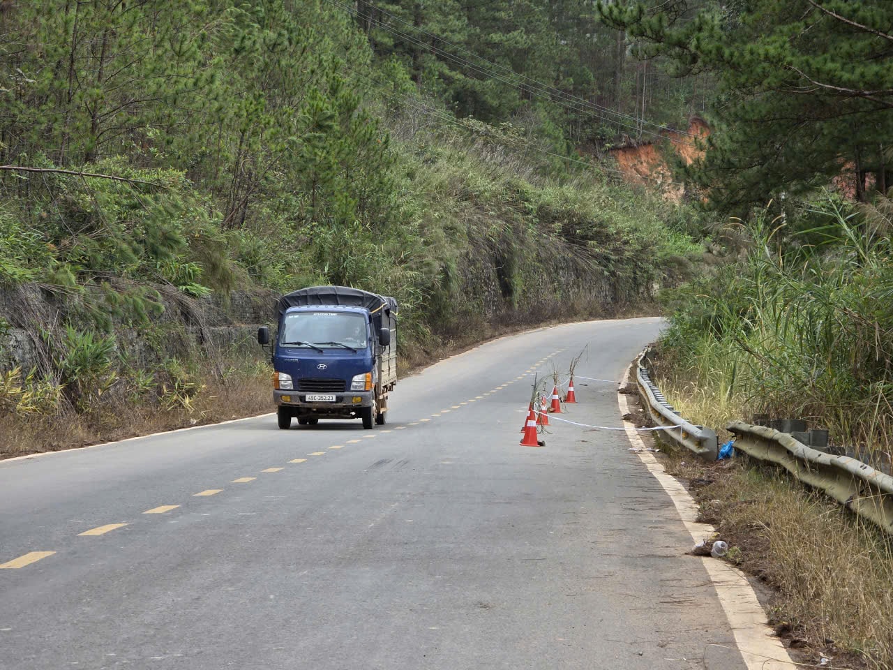
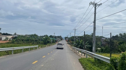
Reporters' observations on National Highway 27C, from Km65+800 to Km117+450 through Lac Duong commune and Lam Vien ward - Da Lat, showed many locations where rocks and trees had fallen from the slope onto the road surface at many sections; in which, there were locations where rocks and soil had spilled onto the road, directly threatening the safety of road users.
Specifically, the entire route recorded 36 large and small landslides. Authorities continuously sawed trees and cleared rocks and soil. At some dangerous landslide spots, the road surface appeared fractured, and large areas of soil were still at risk of sliding down at any time.

At Km65+800, considered the “hottest spot”, the positive slope collapsed onto the entire road surface, creating a layer of rock and soil several meters thick. The landslide was 100 meters long, 40 meters wide, 6 meters high, with an estimated volume of about 12,000 cubic meters. Machinery was constantly operating, but mud and soil continued to flow down with the rainwater.
Not far away, at Km84+200, the negative slope collapsed strongly, creating a 40m long crack right at the edge of the road, causing serious damage to the soft guardrail. At Km85+050, the negative slope slid down, damaging more than 15m of the guardrail wall.
At Km117+450, the embankment made of rubble stone was completely broken, and rocks and soil poured down onto the road. The landslide was 6 m high, 23 m long, and 6 m wide, creating a "barrier" that obstructed traffic; the amount of rocks and soil that needed to be cleared was about 414 m³.
Particularly from Km66+700 to Km117+400, there were 32 positive slope landslides, the amount of rock and soil spilled onto the road was up to 10,158 m³.
Mr. Do Dai Duong, Head of the Economic Department of Lac Duong Commune, said that the commune has coordinated with the Lam Dong Provincial Road Maintenance Board to cut down fallen trees and handle mud and soil. Currently, vehicles are still circulating, but people need to follow the instructions because the risk of landslides recurring is very high.
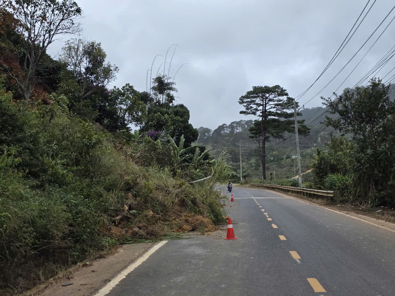
The Provincial Road Maintenance Board also arranges machinery on standby in risky areas to promptly clear away rocks and soil when incidents occur, to ensure traffic is not interrupted.
In addition, the units have also installed warning signs and stretched ropes to limit vehicles passing through dangerous locations; advised people to limit movement during heavy rain, pay attention to signs, and drive slowly at dangerous warning sections...
According to experts, prolonged heavy rains cause the ground to become saturated with water, increasing the risk of landslides – especially on mountain passes with complex terrain such as National Highway 27C. The current treatment is only a temporary solution, the road needs to be upgraded synchronously to ensure long-term safety.
Faced with serious damage on Route 27C and many other important routes managed by the Department of Construction, the unit has proposed that the Lam Dong Provincial People's Committee allocate about 361 billion VND to reinforce positive and negative slopes, improve the foundation and surface of the collapsed road, upgrade the drainage system and build sustainable landslide prevention items.
Source: https://baolamdong.vn/canh-bao-tinh-trang-sat-lo-nghiem-trong-tren-tuyen-quoc-lo-27c-405186.html
![[Photo] Prime Minister Pham Minh Chinh receives Governor of Gunma Prefecture (Japan) and Special Advisor to the Japan-Vietnam Friendship Parliamentary Alliance](/_next/image?url=https%3A%2F%2Fvphoto.vietnam.vn%2Fthumb%2F1200x675%2Fvietnam%2Fresource%2FIMAGE%2F2025%2F11%2F25%2F1764066321008_dsc-1312-jpg.webp&w=3840&q=75)


![[Photo] Close-up of Ba Ha River Hydropower Plant operating to regulate water to downstream](/_next/image?url=https%3A%2F%2Fvphoto.vietnam.vn%2Fthumb%2F1200x675%2Fvietnam%2Fresource%2FIMAGE%2F2025%2F11%2F25%2F1764059721084_image-6486-jpg.webp&w=3840&q=75)


![[Answer] Should I install an elevator for an old renovated house?](https://vphoto.vietnam.vn/thumb/402x226/vietnam/resource/IMAGE/2025/11/25/1764039191595_co-nen-lap-thang-may-cho-nha-cai-tao-cu-khong-04.jpeg)


Comment (0)