
 |
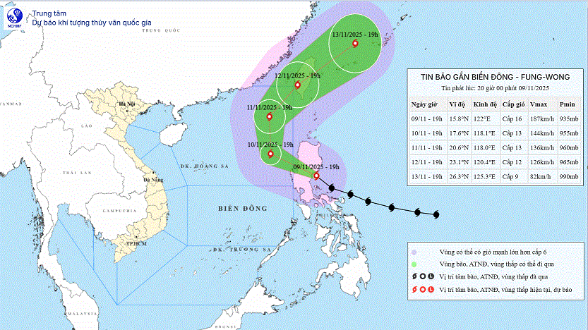
| Storm movement direction. (Source: National Center for Hydro-Meteorological Forecasting) |
According to the National Center for Hydro-Meteorological Forecasting, storm Fung-Wong is still moving in the same direction. It is forecasted that on November 10, the storm will decrease in intensity and enter the North East Sea.
At 7:00 p.m. on November 9, the center of the storm was at about 15.8 degrees North latitude; 122.0 degrees East longitude, on the eastern coastal area of Luzon Island (Philippines). The strongest wind near the center of the storm was level 15-16 (167-201 km/h), gusting to level 17. Moving in the West Northwest direction, speed about 25 km/h.
Forecast until 7:00 p.m. on November 10, the storm is in the eastern sea of the North East Sea with wind speed of level 13, gusting to level 16 and gradually weakening. The storm is moving in the West Northwest direction, speed of about 20km/h. The affected area is the eastern sea of the North East Sea, natural disaster risk level 3.
At 7:00 p.m. on November 11, the storm was in the eastern sea of the North East Sea with a level 13 intensity, gusting to level 16. The storm moved north at a speed of 10-15 km/h. The affected area was the eastern sea of the North East Sea, with a level 3 natural disaster risk.
Then, at 7:00 p.m. on November 12, the storm in the Taiwan island area had a level 11-12 intensity, gusting to level 15 and further weakened. The storm moved in a North-Northeast direction, at a speed of 10-15 km/h. The affected area was the sea area east of the North East Sea, with a level 3 natural disaster risk level.
From the next 72 to 96 hours, the storm will move to the Northeast, about 25km per hour and continue to weaken.
Due to the influence of the storm, the eastern sea area of the North East Sea has strong winds of level 6-7, later increasing to level 8-10; the area near the eye of the storm has strong winds of level 11-13, gusting to level 16, waves 4-6m high, later increasing to 6-8m, the area near the eye of the storm is 8-10m, the sea is very rough.
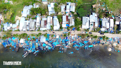
All boats operating in the above mentioned danger zones are susceptible to storms, whirlwinds, strong winds and large waves.
Previously, at 1:00 p.m. on November 9, in the sea east of Luzon Island (Philippines). The strongest wind near the storm center was level 15-16 (167-201 km/h), gusting to level 17. Moving in the West Northwest direction, speed about 25 km/h.
According to VNA/Vietnam+
Source: https://baoquangtri.vn/xa-hoi/202511/du-bao-bao-fung-wong-giam-cuong-do-di-vao-khu-vuc-bac-bien-dong-1b44235/


Comment (0)