
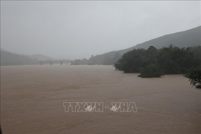
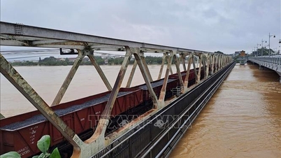
Currently, the water level on Vu Gia - Thu Bon River and Tam Ky River is rising. The water level at 7:00 p.m. on October 29 on the rivers is as follows: Vu Gia River at Hoi Khach is at: 18.38 m, 1.88 m above alert level 3; at Ai Nghia is at: 10.6 m, 1.6 m above alert level 3. Thu Bon River at Nong Son is at: 18.68 m, 3.68 m above alert level 3; at Giao Thuy is at: 9.94 m, 1.14 m above alert level 3; at Cau Lau is at: 5.36 m, 1.36 m above alert level 3; at Hoi An is at: 3.14 m, 1.14 m above alert level 3. Han River at Cam Le is at: 2.96 m, 0.46 m above alert level 3. Tam Ky River at Tam Ky is at: 2.65 m, below alarm level 3: 0.05 m.
It is forecasted that in the next 6-12 hours, the flood on Vu Gia - Thu Bon River will continue to rise and peak. The flood peak on Vu Gia River at Ai Nghia is likely to reach 10.6 m, above alert level 3: 1.6 m at a level approximately equal to the historical flood (Hmaxls 10.77 m in 2009); Thu Bon River at Cau Lau will reach 5.65-5.8 m, above alert level 3: 1.65-1.80 m, at a level higher than the historical flood (Hmaxls 5.48 m in 1964), at Hoi An it will reach 3.5 m, above alert level 3: 1.4 m, at a level 0.1 m higher than the historical flood (Hmaxls 3.40 m in 1964). Han River will reach 3.3-3.4 m, above alert level 3: 0.8-0.9 m; on Tam Ky River it will fluctuate at a level above alert level 3.
In the next 12-24 hours, flood on Vu Gia Thu Bon river will slowly recede, but will remain at a high level; Tam Ky river will fluctuate at alert level 2 - alert level 3.
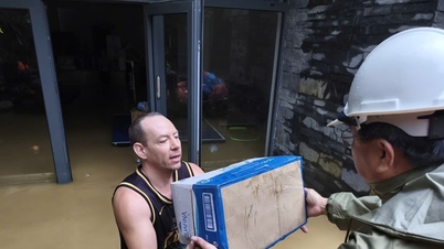
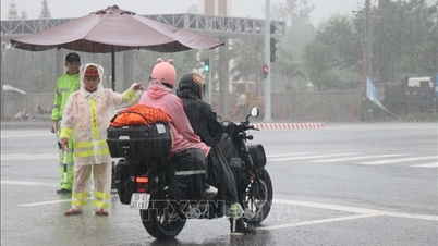
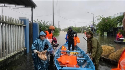
Severe widespread flooding continues to occur in low-lying areas along rivers and inundation in urban areas. Especially in the communes of Que Phuoc, Nong Son, Que Son, Tam Xuan, Lanh Ngoc, Duy Xuyen, Thu Bon, Xuan Phu, Thanh My, Thuong Duc, Ha Nha, Phu Thuan, Vu Gia, Dai Loc, Go Noi, Dien Ban Tay, Dien Ban Bac, Hoa Tien, Hoi An, Hoi An Tay, Hoi An Dong, Nam Phuoc, Duy Nghia, An Thang, Ban Thach ward, Huong Tra ward, Quang Phu ward, Tay Ho commune, Thang Dien, Thang Truong, Que Xuan, Hoa Xuan, Ngu Hanh Son, Cam Le, Ba Na, Thang An, Thu Bon, Hoa Vang, Hai Van, Dien Ban, Hai Chau...
There is a very high risk of flash floods and landslides on the slopes of mountainous areas of Da Nang city. Flood risk warning level 3.
Source: https://baotintuc.vn/xa-hoi/du-bao-lu-tren-song-thu-bon-tai-cau-lau-va-hoi-an-se-vuot-moc-lich-su-nam-1964-20251029230228096.htm
![[Photo] Prime Minister Pham Minh Chinh chaired a meeting to evaluate the operation of the two-level local government model.](https://vphoto.vietnam.vn/thumb/1200x675/vietnam/resource/IMAGE/2025/10/29/1761751710674_dsc-7999-jpg.webp)

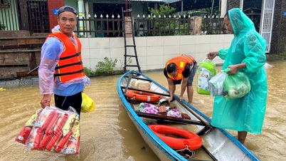
![[Photo] Hue: Inside the kitchen that donates thousands of meals a day to people in flooded areas](https://vphoto.vietnam.vn/thumb/1200x675/vietnam/resource/IMAGE/2025/10/29/1761738508516_bepcomhue-jpg.webp)
![[Photo] Prime Minister Pham Minh Chinh chaired a meeting to discuss solutions to overcome the consequences of floods in the central provinces.](https://vphoto.vietnam.vn/thumb/1200x675/vietnam/resource/IMAGE/2025/10/29/1761716305524_dsc-7735-jpg.webp)
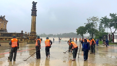
![[Photo] Human love in the flood in Hue](https://vphoto.vietnam.vn/thumb/1200x675/vietnam/resource/IMAGE/2025/10/29/1761740905727_4125427122470875256-2-jpg.webp)


![[Live] Concert Ha Long 2025: "Heritage Spirit - Brightening the Future"](https://vphoto.vietnam.vn/thumb/402x226/vietnam/resource/IMAGE/2025/10/29/1761743605124_g-anh-sang-am-thanh-hoanh-trang-cua-chuong-trinh-mang-den-trai-nghiem-dang-nho-cho-du-khach-22450328-17617424836781829598445-93-0-733-1024-crop-1761742492749383512980.jpeg)


Comment (0)