
On May 20, Hai Phong City People's Committee held a conference to announce the Adjustment of Hai Phong City Master Plan to 2040, with a vision to 2050 according to Decision No. 323/QD-TTg dated March 30, 2023 of the Prime Minister.
According to the People's Committee of Hai Phong City, the adjustment of the Master Plan for Hai Phong City construction to 2040, with a vision to 2050, aims to provide comprehensive orientation, from the structure and direction of urban space development, determining the population and land size, economic - social - technical - environmental infrastructure system... of the city. At the same time, creating a macro-management tool and legal basis for Hai Phong City to successfully implement Resolution 45-NQ/TW of the Politburo .
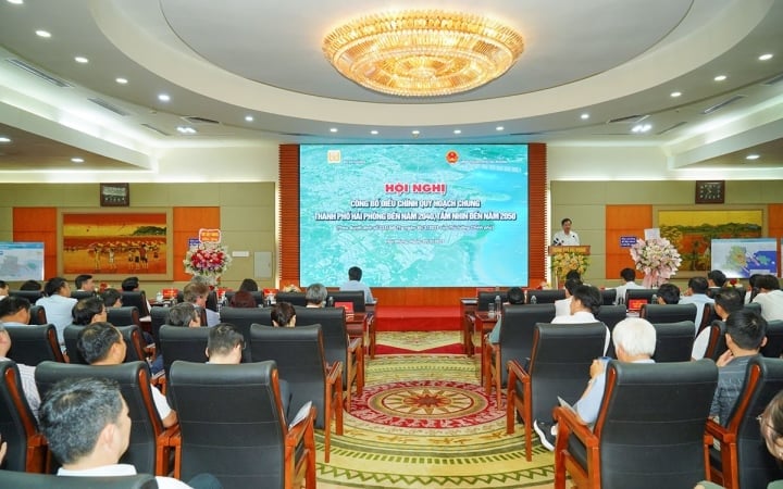
Conference on adjusting the master plan of Hai Phong city.
According to the Adjusted Master Plan of Hai Phong City to 2040, with a vision to 2050, Hai Phong City is an important growth pole of the country, a gateway to the East Sea on the Gulf of Tonkin, with a high level of development among the leading cities in Asia and the world .
Hai Phong City will develop according to the model of "Multi-center urban area and satellite cities", with the spatial structure: Two belts - Three corridors - Three centers and satellite cities.
In which: Two economic belts include: Coastal economic belt developing services - tourism - urban areas towards the sea; Industrial service economic belt from Lach Huyen port to the North (Thuy Nguyen district), the West (along Highway 10), the South (along Van Uc river) connecting with the network of industrial zones and clusters in the Red River Delta and the Hai Phong seaport system. Three landscape corridors include: Cam river corridor, Lach Tray river and Van Uc river.
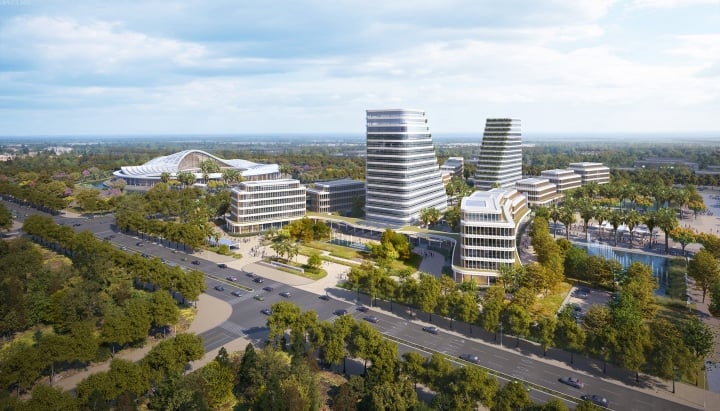
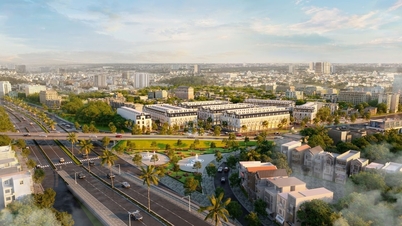
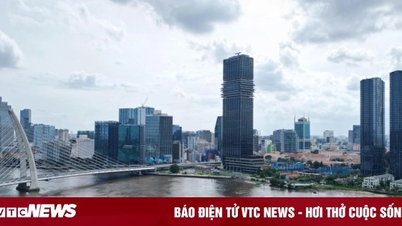
Perspective of Hai Phong City Political - Administrative Center in the North Cam River Urban Area.
Three urban centers and satellite towns include: Historical urban center and new administrative urban area North of Cam River; International commercial and financial center (CBD) in Hai An district and Duong Kinh district; Tien Lang airport urban area. Satellite towns include urban areas in marine, agricultural and rural ecological regions.
At the same time, Hai Phong City orients the development of the urban system, including: Central urban area: Area A: Historical inner-city urban area (belonging to Hong Bang, Le Chan, and Ngo Quyen districts).
Neighborhoods with historical and architectural values are oriented to preserve and embellish spaces and valuable architectural works, improve the landscape, and upgrade infrastructure to create the identity of an urban area with a long history of existence and development.
The city will rebuild old, degraded residential areas and apartments, gradually moving them to new, modern, and convenient apartment buildings; rebuild the area on the southern bank of the Cam River into a strip of modern, cultural urban landscape.
Area B: Northern expanded urban area (belonging to Thuy Nguyen district), building Thuy Nguyen district into a city under the city by 2025.
Develop a new administrative, political and cultural center of Hai Phong City associated with the new urban area North of Cam River. Encourage the development of high-rise buildings and buildings with unique modern architecture.
Restoring the ecosystem of Gia River, Bach Dang River, Cam River, and the northern mountainous area of Thuy Nguyen District. Exploiting the natural landscape elements of Thuy Nguyen to develop ecological urban areas and tourism. Building a regional logistics center, vocational training services, medical services, and a fishing center. Preserving, embellishing, and promoting the value of the Bach Dang Giang Victory historical relic site.
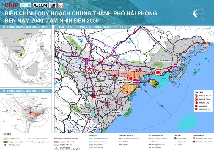
Map of adjusted master plan of Hai Phong city to 2040 - 2050.
Area C: The expanded urban area in the South and Southeast (districts: Hai An, Duong Kinh, Kien An, Do Son, Kien Thuy district), forming a new city and regional center with a focus on the commercial and financial area (CBD) connected to the new Hanoi - Hai Phong railway line.
Area D: Western urban expansion area (An Duong district), gradually building An Duong district to basically meet the criteria for establishing a district by 2025; adding urban functions and infrastructure to reduce the load on the historical urban center. Developing logistics and industrial service centers on National Highway 10 and National Highway 5.
Area E: Eastern development area (Cat Hai district), including: Area E1 - Cat Hai Island - Cai Trap: Developing Cat Hai urban services, industry, seaports and international maritime services. Expanding space to the South to develop Lach Huyen international port, industry, logistics services, tourism services, high-class cruise wharf.
Area E2 - Cat Ba Island - Long Chau: Developing Cat Ba national tourist area into an international-class tourist area, an environmentally friendly green tourist area.
Cat Ba National Park area (core zone): Strictly protect ecological landscape areas, especially Lan Ha Bay area; conserve rare endemic species.
Area F: East of Tien Lang district and Van Uc river mouth, build Hung Thang new urban area in accordance with the construction process of Tien Lang airport. Develop Van Uc river port system, industry, logistics and develop Nam Do Son port.
In addition, other urban areas: Forecast to 2040 include: Vinh Bao, Tam Cuong, Tien Lang, Hung Thang, An Lao, Truong Son, Quang Thanh, Luu Kiem, Minh Duc, Cat Hai, Cat Ba, Xuan Dam, Phu Long urban areas.
These urban areas will complete the national target program for new rural areas in the 2021-2025 period at the district level. Building new rural areas is close to urban criteria, creating conditions for rural areas to participate in the urbanization process.
Bach Long Vi island district forms a center for fisheries logistics and search and rescue services, develops tourism and maritime services associated with national security and defense.
Building Hai Phong City with synchronous, modern, high-quality, sustainable infrastructure, completing a type I urban area and meeting the criteria of a special urban area by 2030.
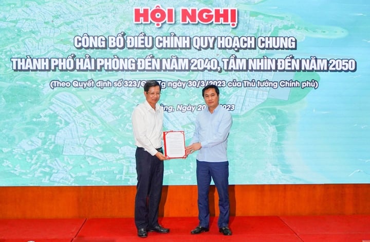
Deputy Minister of Construction Nguyen Tuong Van presented the Prime Minister's Decision approving the adjustment of the master plan of Hai Phong City.
According to the People's Committee of Hai Phong City, on the basis of the approved Master Plan (GP), the City will assign the sectors to complete the legal tool system to implement the approved GP, including: Regulations on management of urban and rural architecture; Urban development program; Adjustment of zoning plans of inner-city districts; General planning of urban areas, towns, district planning and specialized planning of urban technical infrastructure...
Hai Phong City hopes that with the orientations in the Master Plan for Hai Phong City construction to 2040, with a vision to 2050 approved by the Prime Minister, by 2025 it will basically complete the industrialization and modernization; meet the criteria of a type I urban area; and by 2030 become a modern, smart, and sustainable industrial city of the Southeast Asian region.
And by 2045, Hai Phong will become a highly developed city among the leading cities in Asia and the world.
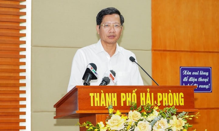
Mr. Le Anh Quan - Permanent Vice Chairman of Hai Phong City People's Committee
Speaking at the conference announcing the planning adjustment, Mr. Le Anh Quan - Permanent Vice Chairman of Hai Phong City People's Committee requested that all levels, sectors, agencies and units of the city need to focus on promoting propaganda and widely disseminating the core contents of the planning to all levels, sectors, business community and people of all walks of life, to understand the city's development aspirations in the coming period, in order to create unity in awareness, thereby having high determination, great efforts, drastic and effective actions in implementing the planning.
Based on the planning content, the Department of Construction and related units, according to their assigned functions and tasks, need to coordinate in organizing and implementing the planning to ensure consistency, synchronization, and science, especially in urban management and development, architectural space, urban landscape, land use management, management of infrastructure construction and urban underground space.
At the same time, request all levels, sectors and localities of the city to urgently review, adjust and establish new urban development programs and construction plans such as: general planning (district, town, new urban, functional areas), zoning plans, detailed plans to specify the approved adjustment project of the city's general planning; review and adjust the city's land use plan to ensure consistency with the adjustment of the general planning...
Continue to innovate urban planning and development to meet the rapid development needs of society and people, especially in the current context of international integration.
Pay attention to new trends in urban development such as: green cities, smart cities, sustainable urban development. Strengthen the application of information technology and digital transformation in planning work, helping to improve accuracy, efficiency, transparency and better forecasting of urban development trends; strengthen cooperation, learn from experiences of leading domestic and international experts, absorb community contributions to plan and develop urban areas in accordance with local realities, ensuring feasibility;
At the same time, the city's levels and sectors continue to focus on prioritizing resources for investment in urban technical infrastructure associated with social infrastructure; have solutions to economically and effectively use state budget capital for development investment; mobilize maximum and effectively use resources from enterprises and economic sectors for investment and comprehensive development of Hai Phong city.
MINH KHANG
Useful
Emotion
Creative
Unique
Source

![[Photo] Prime Minister Pham Minh Chinh chairs the 15th meeting of the Central Emulation and Reward Council](/_next/image?url=https%3A%2F%2Fvphoto.vietnam.vn%2Fthumb%2F1200x675%2Fvietnam%2Fresource%2FIMAGE%2F2025%2F11%2F27%2F1764245150205_dsc-1922-jpg.webp&w=3840&q=75)


![[Photo] President Luong Cuong attends the 50th Anniversary of Laos National Day](/_next/image?url=https%3A%2F%2Fvphoto.vietnam.vn%2Fthumb%2F1200x675%2Fvietnam%2Fresource%2FIMAGE%2F2025%2F11%2F27%2F1764225638930_ndo_br_1-jpg.webp&w=3840&q=75)


![[Online forum] Effective implementation of ethnic policies in Thai Nguyen province](https://vphoto.vietnam.vn/thumb/402x226/vietnam/resource/IMAGE/2025/11/28/1764296450164_30729563efc1639f3ad0_20251128090933.jpeg)


Comment (0)