
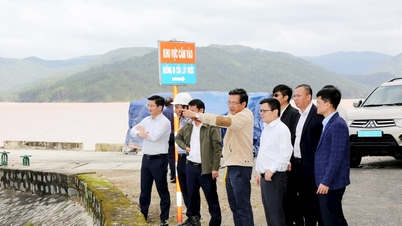
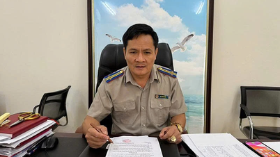
Dr. Ha Ngoc Tuan, Representative of Kyushu - Weatherplus Joint Venture, said that the forecasting model is based on real-time data from a system of more than 700 stations measuring rainfall, flow and water level. Information from the stations is continuously transmitted to the processing center, then combined with flow simulation to form reservoir operation scenarios when heavy rain occurs.
According to the development team representative, the goal of the technology is to convert rainfall information into forecasts of the amount of water that will enter the lake, the rate of rise and the risk of impact on downstream areas.

Dr. Ha Ngoc Tuan, Representative of Kyushu - Weatherplus Joint Venture. Photo: Bao Thang.
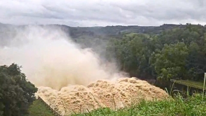
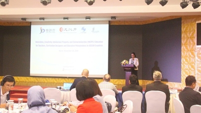
In recent extreme rainfall events, these simulations have been used to calculate when flood peaks may occur. An example given at the Forum “Application of science and technology in forecasting and early warning of natural disasters” on the afternoon of November 25, was the flood in the Ba Ha river basin.
The river basin of more than 11,000 km² recorded an average rainfall of 250 - 300 mm in a few days, equivalent to about 2.85 - 2.87 billion m³ of water. This figure is nearly double the total amount of water that large lakes such as Thac Ba (about 1.25 billion m³) or Ban Ve (1.4 billion m³) received during strong floods due to the impact of storms Yagi (2024) or Wipha (2025).
When water levels increase rapidly on such a large scale, real-time simulation can help operators know how the reservoir will increase its water level and when to open the sluice gates, according to Dr. Tuan.
The operating principle is modeled based on the natural delay between upstream rainfall and downstream water levels. Observations at the Ba Ha River show that the time between rainfall and water level rise at residential areas is usually around 9-10 hours. Even under adverse conditions, the minimum time is still around 5 hours.
The developer believes that if the forecast can “foresee” the water level rise in that time frame, the disaster response agency will have a basis to make earlier evacuation decisions and avoid being passive.

HNT's real-time reservoir monitoring dashboard. Photo: Weatherplus.
However, the group also noted that forecast errors are unavoidable. In the recent flood in the Ba Ha River, some international models predicted higher rainfall in the first period, while the second period gave lower rainfall results. The domestic operating model used by Weatherplus had an error of over 15% in the second heavy rain. However, the group said that identifying rainfall of hundreds of millimeters over a basin of tens of thousands of square kilometers is still "reliable enough" to determine risks and prepare safety plans.
"The prerequisite for the system to operate accurately is data quality. Rain gauge stations are constantly checked, erroneous data must be removed and all input information must be standardized before being put into simulation," Dr. Tuan shared, adding that if the data is incomplete or noisy, any model will have difficulty giving reliable results.
Some examples of operations at reservoirs were mentioned, such as forecasting a strong increase in flow during typhoon Wipha, helping the Hua Na hydropower plant prepare a regulation plan more than 1 day in advance, or simulation during typhoon Kajiki showed that the water level at Bai Thuong hydropower plant would not exceed the safety threshold if operating according to the calculated scenario.
Although it has only just been announced by the company, the evidence shows the ability of science and technology to convert rainfall data into practical operational decisions.

Hua Na Hydropower Plant safely responded to storm Wipha. Photo: TL.
In particular, Dr. Tuan's team also revealed the possibility of setting up a warning system based on water levels at a reference station. Specifically, when the water level reaches a certain level, the authorities can prepare to evacuate vulnerable groups. Or when it exceeds another threshold, all people in the danger zone must leave. This approach, according to Weatherplus, is more intuitive than the notification according to alarm levels I, II or III, which are more or less difficult for people to imagine.
The group representative expressed the hope that HNT technology, once completed, could be applied more widely, including in designing simple warning tools for local authorities.
They believe that about 5-10 hours before the flood peak, if determined early, is the decisive time to minimize casualties and limit damage to downstream areas. After 3 years of testing on large lakes, Dr. Tuan and his colleagues reaffirmed the importance of reliable monitoring data and forecast information. "The problem is whether we dare to invest in data, people and science and technology or not?", he concluded,
Source: https://nongnghiepmoitruong.vn/he-mo-cong-nghe-nhin-truoc-dinh-lu-10-tieng-d786517.html


![[Photo] VinUni students' emotions are sublimated with "Homeland in the Heart: The Concert Film"](/_next/image?url=https%3A%2F%2Fvphoto.vietnam.vn%2Fthumb%2F1200x675%2Fvietnam%2Fresource%2FIMAGE%2F2025%2F11%2F26%2F1764174931822_10-3878-jpg.webp&w=3840&q=75)


![[Photo] Close-up of heavy damage at the school located on the banks of the Ban Thach River](/_next/image?url=https%3A%2F%2Fvphoto.vietnam.vn%2Fthumb%2F1200x675%2Fvietnam%2Fresource%2FIMAGE%2F2025%2F11%2F26%2F1764152130492_ndo_bl_img-8188-8805-jpg.webp&w=3840&q=75)


![[Photo] Opening of the 28th Session of the Hanoi People's Council](https://vphoto.vietnam.vn/thumb/402x226/vietnam/resource/IMAGE/2025/11/26/1764155991133_image.jpeg)


Comment (0)